
Pee Wee Dam Reservoir Report
Nearby: Tommeheton Lake Birchin Lake
Last Updated: December 26, 2025
Pee Wee Dam, also known as Lake Mildred and Lucky Lake, is a private recreational facility located in Blackstone, Virginia.
°F
°F
mph
Wind
%
Humidity
Summary
The dam, primarily used for recreation, is owned and regulated by the Virginia Department of Conservation and Recreation. Standing at 23 feet high and stretching 1600 feet in length, Pee Wee Dam has a storage capacity of 50.7 acre-feet and covers a surface area of 3.96 acres.
Despite being categorized as having a low hazard potential, Pee Wee Dam has a moderate risk assessment due to its location and design. The dam features an uncontrolled spillway with a width of 10 feet and a maximum discharge of 1138 cubic feet per second. Although the dam's condition is currently not rated, it undergoes regular inspections every year to ensure its safety and reliability.
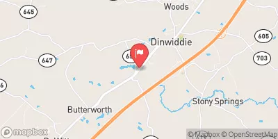
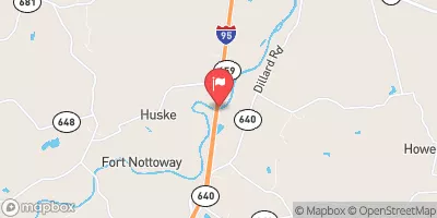
Water resource and climate enthusiasts interested in Pee Wee Dam can appreciate its role in providing recreational opportunities while recognizing the importance of proper maintenance and risk management measures to safeguard the surrounding community and environment. With its serene location along an unnamed tributary of the Nottoway River, Pee Wee Dam serves as a valuable asset for outdoor enthusiasts in Dinwiddie County, Virginia.
Dam Length |
1600 |
Dam Height |
23 |
River Or Stream |
Unnamed tributary Nottoway River - VAHU6 CU11 Nottoway River - Beaverpond Creek |
Primary Dam Type |
Earth |
Surface Area |
3.96 |
Drainage Area |
0.12 |
Nid Storage |
50.7 |
Outlet Gates |
Uncontrolled - 0 |
Hazard Potential |
Low |
Nid Height |
23 |
Seasonal Comparison
Weather Forecast
Nearby Streamflow Levels
 Nottoway River Near Rawlings
|
91cfs |
 Stony Creek Near Dinwiddie
|
0cfs |
 Deep Creek Near Mannboro
|
56cfs |
 Meherrin River Near Lawrenceville
|
169cfs |
 Appomattox River At Matoaca
|
399cfs |
 Nottoway River Near Stony Creek
|
223cfs |
Dam Data Reference
Condition Assessment
SatisfactoryNo existing or potential dam safety deficiencies are recognized. Acceptable performance is expected under all loading conditions (static, hydrologic, seismic) in accordance with the minimum applicable state or federal regulatory criteria or tolerable risk guidelines.
Fair
No existing dam safety deficiencies are recognized for normal operating conditions. Rare or extreme hydrologic and/or seismic events may result in a dam safety deficiency. Risk may be in the range to take further action. Note: Rare or extreme event is defined by the regulatory agency based on their minimum
Poor A dam safety deficiency is recognized for normal operating conditions which may realistically occur. Remedial action is necessary. POOR may also be used when uncertainties exist as to critical analysis parameters which identify a potential dam safety deficiency. Investigations and studies are necessary.
Unsatisfactory
A dam safety deficiency is recognized that requires immediate or emergency remedial action for problem resolution.
Not Rated
The dam has not been inspected, is not under state or federal jurisdiction, or has been inspected but, for whatever reason, has not been rated.
Not Available
Dams for which the condition assessment is restricted to approved government users.
Hazard Potential Classification
HighDams assigned the high hazard potential classification are those where failure or mis-operation will probably cause loss of human life.
Significant
Dams assigned the significant hazard potential classification are those dams where failure or mis-operation results in no probable loss of human life but can cause economic loss, environment damage, disruption of lifeline facilities, or impact other concerns. Significant hazard potential classification dams are often located in predominantly rural or agricultural areas but could be in areas with population and significant infrastructure.
Low
Dams assigned the low hazard potential classification are those where failure or mis-operation results in no probable loss of human life and low economic and/or environmental losses. Losses are principally limited to the owner's property.
Undetermined
Dams for which a downstream hazard potential has not been designated or is not provided.
Not Available
Dams for which the downstream hazard potential is restricted to approved government users.
 Pee Wee Dam