Lower Valley Reservoir Report
Last Updated: February 25, 2026
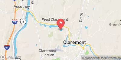
Lower Valley is a private concrete gravity dam located in Claremont, New Hampshire, on the Sugar River.
Summary
Completed in 1921, this hydroelectric facility serves multiple purposes, including water supply and hydroelectric power generation. With a dam height of 32.5 feet and a length of 145 feet, Lower Valley has a storage capacity of 24 acre-feet and a drainage area of 252 square miles.
Managed by the NHDES Dam Bureau and regulated by the Federal Energy Regulatory Commission, Lower Valley poses a significant hazard potential due to its uncontrolled spillway and moderate risk assessment. The dam has one other controlled outlet gate and a spillway width of 91 feet. While its condition assessment is not available, inspections are conducted every two years to ensure its structural integrity and safety.
For water resource and climate enthusiasts, Lower Valley represents a vital infrastructure for sustainable energy production and water management in the region. Its historical significance, combined with its modern regulatory oversight and risk management measures, make it an important asset for the community and a focal point for ongoing environmental stewardship efforts in New Hampshire's Sullivan County.
°F
°F
mph
Wind
%
Humidity
15-Day Weather Outlook
Year Completed |
1921 |
Dam Length |
145 |
Dam Height |
32.5 |
River Or Stream |
Sugar River |
Primary Dam Type |
Concrete |
Surface Area |
2 |
Drainage Area |
252 |
Nid Storage |
24 |
Outlet Gates |
Other Controlled - 1 |
Hazard Potential |
Significant |
Nid Height |
33 |
Seasonal Comparison
5-Day Hourly Forecast Detail
Nearby Streamflow Levels
Dam Data Reference
Condition Assessment
SatisfactoryNo existing or potential dam safety deficiencies are recognized. Acceptable performance is expected under all loading conditions (static, hydrologic, seismic) in accordance with the minimum applicable state or federal regulatory criteria or tolerable risk guidelines.
Fair
No existing dam safety deficiencies are recognized for normal operating conditions. Rare or extreme hydrologic and/or seismic events may result in a dam safety deficiency. Risk may be in the range to take further action. Note: Rare or extreme event is defined by the regulatory agency based on their minimum
Poor A dam safety deficiency is recognized for normal operating conditions which may realistically occur. Remedial action is necessary. POOR may also be used when uncertainties exist as to critical analysis parameters which identify a potential dam safety deficiency. Investigations and studies are necessary.
Unsatisfactory
A dam safety deficiency is recognized that requires immediate or emergency remedial action for problem resolution.
Not Rated
The dam has not been inspected, is not under state or federal jurisdiction, or has been inspected but, for whatever reason, has not been rated.
Not Available
Dams for which the condition assessment is restricted to approved government users.
Hazard Potential Classification
HighDams assigned the high hazard potential classification are those where failure or mis-operation will probably cause loss of human life.
Significant
Dams assigned the significant hazard potential classification are those dams where failure or mis-operation results in no probable loss of human life but can cause economic loss, environment damage, disruption of lifeline facilities, or impact other concerns. Significant hazard potential classification dams are often located in predominantly rural or agricultural areas but could be in areas with population and significant infrastructure.
Low
Dams assigned the low hazard potential classification are those where failure or mis-operation results in no probable loss of human life and low economic and/or environmental losses. Losses are principally limited to the owner's property.
Undetermined
Dams for which a downstream hazard potential has not been designated or is not provided.
Not Available
Dams for which the downstream hazard potential is restricted to approved government users.
Area Campgrounds
| Location | Reservations | Toilets |
|---|---|---|
 Mt. Ascutney State Park
|
||
 Ascutney Mt Stone Hut
|
||
 Tree Farm Campground
|
||
 NorthStar Campground
|

 Lower Valley