


Tyler Tree Farm Dam Reservoir Report
Last Updated: April 28, 2026
Nearby: East Barnet Comerford
°F
°F
mph
Wind
%
Humidity
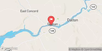
Tyler Tree Farm Dam, located in Monroe, New Hampshire, is a privately owned structure that serves primarily for recreational purposes.
Summary
Completed in 1969, this earth dam stands at a height of 25 feet and spans a length of 254 feet along Roaring Brook. With a storage capacity of 109 acre-feet and a surface area of 3.3 acres, this dam plays a significant role in managing water resources in the area.
Managed by the NHDES Dam Bureau, Tyler Tree Farm Dam has a spillway type of "Uncontrolled" with a spillway width of 5 feet. Despite its satisfactory condition assessment, the dam has been assigned a significant hazard potential rating, indicating the importance of regular inspections and maintenance. With a moderate risk assessment level, it is crucial for stakeholders to implement effective risk management measures to ensure the safety and integrity of the structure for both recreational and environmental purposes.
Overall, Tyler Tree Farm Dam stands as a vital component in the water resource management infrastructure of Grafton County, New Hampshire. With its picturesque location and significant storage capacity, this dam serves as a testament to the importance of proper dam regulation and maintenance in the face of climate variability and changing water resource demands.
Regional Streamflow Levels

15-Day Long Term Forecast
Year Completed |
1969 |
Dam Length |
254 |
Dam Height |
25 |
River Or Stream |
ROARING BROOK |
Primary Dam Type |
Earth |
Surface Area |
3.3 |
Drainage Area |
2.68 |
Nid Storage |
109 |
Hazard Potential |
Significant |
Foundations |
Unlisted/Unknown |
Nid Height |
25 |
Seasonal Comparison
5-Day Hourly Forecast Detail
Dam Data Reference
Condition Assessment
SatisfactoryNo existing or potential dam safety deficiencies are recognized. Acceptable performance is expected under all loading conditions (static, hydrologic, seismic) in accordance with the minimum applicable state or federal regulatory criteria or tolerable risk guidelines.
Fair
No existing dam safety deficiencies are recognized for normal operating conditions. Rare or extreme hydrologic and/or seismic events may result in a dam safety deficiency. Risk may be in the range to take further action. Note: Rare or extreme event is defined by the regulatory agency based on their minimum
Poor A dam safety deficiency is recognized for normal operating conditions which may realistically occur. Remedial action is necessary. POOR may also be used when uncertainties exist as to critical analysis parameters which identify a potential dam safety deficiency. Investigations and studies are necessary.
Unsatisfactory
A dam safety deficiency is recognized that requires immediate or emergency remedial action for problem resolution.
Not Rated
The dam has not been inspected, is not under state or federal jurisdiction, or has been inspected but, for whatever reason, has not been rated.
Not Available
Dams for which the condition assessment is restricted to approved government users.
Hazard Potential Classification
HighDams assigned the high hazard potential classification are those where failure or mis-operation will probably cause loss of human life.
Significant
Dams assigned the significant hazard potential classification are those dams where failure or mis-operation results in no probable loss of human life but can cause economic loss, environment damage, disruption of lifeline facilities, or impact other concerns. Significant hazard potential classification dams are often located in predominantly rural or agricultural areas but could be in areas with population and significant infrastructure.
Low
Dams assigned the low hazard potential classification are those where failure or mis-operation results in no probable loss of human life and low economic and/or environmental losses. Losses are principally limited to the owner's property.
Undetermined
Dams for which a downstream hazard potential has not been designated or is not provided.
Not Available
Dams for which the downstream hazard potential is restricted to approved government users.
Area Campgrounds
| Location | Reservations | Toilets |
|---|---|---|
 Crazy Horse Family Campground
|
||
 Sugar Ridge RV Resort
|
||
 Ricker Pond State Park
|
||
 Big Deer State Park
|
||
 Stillwater State Park
|
 Lyman Road Lyman