
Anawalt Lake Dam Reservoir Report
Last Updated: March 14, 2026
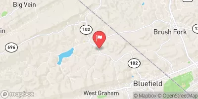
Anawalt Lake Dam in West Virginia, located in McDowell County, is a state-owned structure regulated by the Department of Environmental Protection's Division of Water and Waste Management.
Summary
The dam, with a height of 34 feet and a primary purpose of recreation, impounds Millseat Branch, offering opportunities for outdoor activities and water-based recreation. The dam has a high hazard potential but is currently in satisfactory condition, with the last inspection in August 2017.
With a storage capacity of 116.78 acre-feet, Anawalt Lake Dam serves as a vital resource for the local community while also posing potential risks that require careful monitoring and management. The dam has not been modified in recent years, and its emergency action plan and risk assessment status are currently unclear. It is essential for stakeholders and enthusiasts in water resource and climate fields to stay informed about the dam's condition and regulatory oversight to ensure the safety and sustainability of Anawalt Lake and its surrounding area.
°F
°F
mph
Wind
%
Humidity
15-Day Weather Outlook
Dam Length |
1820 |
Dam Height |
34 |
River Or Stream |
MILLSEAT BRANCH |
Primary Dam Type |
Earth |
Hydraulic Height |
34 |
Nid Storage |
116.78 |
Hazard Potential |
High |
Nid Height |
34 |
Seasonal Comparison
5-Day Hourly Forecast Detail
Nearby Streamflow Levels
 Bluestone River At Falls Mills
|
81cfs |
 Tug Fork At Welch
|
340cfs |
 Dry Fork At Beartown
|
619cfs |
 Guyandotte River Near Baileysville
|
474cfs |
 Panther Creek Near Panther
|
95cfs |
 Clear Fork At Clear Fork
|
395cfs |
Dam Data Reference
Condition Assessment
SatisfactoryNo existing or potential dam safety deficiencies are recognized. Acceptable performance is expected under all loading conditions (static, hydrologic, seismic) in accordance with the minimum applicable state or federal regulatory criteria or tolerable risk guidelines.
Fair
No existing dam safety deficiencies are recognized for normal operating conditions. Rare or extreme hydrologic and/or seismic events may result in a dam safety deficiency. Risk may be in the range to take further action. Note: Rare or extreme event is defined by the regulatory agency based on their minimum
Poor A dam safety deficiency is recognized for normal operating conditions which may realistically occur. Remedial action is necessary. POOR may also be used when uncertainties exist as to critical analysis parameters which identify a potential dam safety deficiency. Investigations and studies are necessary.
Unsatisfactory
A dam safety deficiency is recognized that requires immediate or emergency remedial action for problem resolution.
Not Rated
The dam has not been inspected, is not under state or federal jurisdiction, or has been inspected but, for whatever reason, has not been rated.
Not Available
Dams for which the condition assessment is restricted to approved government users.
Hazard Potential Classification
HighDams assigned the high hazard potential classification are those where failure or mis-operation will probably cause loss of human life.
Significant
Dams assigned the significant hazard potential classification are those dams where failure or mis-operation results in no probable loss of human life but can cause economic loss, environment damage, disruption of lifeline facilities, or impact other concerns. Significant hazard potential classification dams are often located in predominantly rural or agricultural areas but could be in areas with population and significant infrastructure.
Low
Dams assigned the low hazard potential classification are those where failure or mis-operation results in no probable loss of human life and low economic and/or environmental losses. Losses are principally limited to the owner's property.
Undetermined
Dams for which a downstream hazard potential has not been designated or is not provided.
Not Available
Dams for which the downstream hazard potential is restricted to approved government users.
 Anawalt Lake Dam