
Mcnary Lock And Dam - Pasco Levee 12-2 Reservoir Report
Last Updated: April 1, 2026
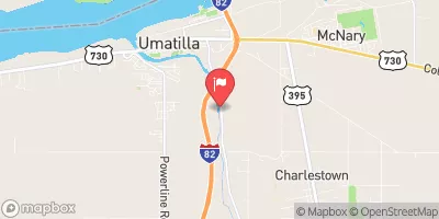
Mcnary Lock and Dam, also known as Pasco Levee 12-2, is a federal project located in Oregon, along the Columbia River.
Summary
Completed in 1952, the dam serves as a key flood risk reduction measure in the region. Owned, funded, designed, and operated by the US Army Corps of Engineers, the dam is an earth-type structure with a height of 30 feet.
With a high hazard potential, the dam does not eliminate all flood risks but works to manage water levels and relieve pressure during severe weather events. The US Army Corps of Engineers employs various risk management measures, including regular monitoring, maintenance, and engagement with local emergency managers and the public. While more detailed information about the dam's specific operations and risk assessments is forthcoming, ongoing efforts ensure the structural integrity and functionality of Mcnary Lock and Dam for the benefit of water resource and climate enthusiasts alike.
°F
°F
mph
Wind
%
Humidity
15-Day Weather Outlook
Year Completed |
1952 |
Dam Height |
30 |
River Or Stream |
COLUMBIA |
Primary Dam Type |
Earth |
Hazard Potential |
High |
Nid Height |
30 |
Seasonal Comparison
5-Day Hourly Forecast Detail
Nearby Streamflow Levels
 Yakima River At Kiona
|
8980cfs |
 Umatilla River Near Umatilla
|
210cfs |
 Walla Walla River Near Touchet
|
953cfs |
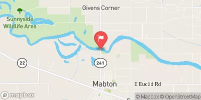 Yakima River At Mabton
|
4700cfs |
 Columbia River Below Priest Rapids Dam
|
160000cfs |
 Umatilla R At W Reservation Bndy Nr Pendleton
|
508cfs |
Dam Data Reference
Condition Assessment
SatisfactoryNo existing or potential dam safety deficiencies are recognized. Acceptable performance is expected under all loading conditions (static, hydrologic, seismic) in accordance with the minimum applicable state or federal regulatory criteria or tolerable risk guidelines.
Fair
No existing dam safety deficiencies are recognized for normal operating conditions. Rare or extreme hydrologic and/or seismic events may result in a dam safety deficiency. Risk may be in the range to take further action. Note: Rare or extreme event is defined by the regulatory agency based on their minimum
Poor A dam safety deficiency is recognized for normal operating conditions which may realistically occur. Remedial action is necessary. POOR may also be used when uncertainties exist as to critical analysis parameters which identify a potential dam safety deficiency. Investigations and studies are necessary.
Unsatisfactory
A dam safety deficiency is recognized that requires immediate or emergency remedial action for problem resolution.
Not Rated
The dam has not been inspected, is not under state or federal jurisdiction, or has been inspected but, for whatever reason, has not been rated.
Not Available
Dams for which the condition assessment is restricted to approved government users.
Hazard Potential Classification
HighDams assigned the high hazard potential classification are those where failure or mis-operation will probably cause loss of human life.
Significant
Dams assigned the significant hazard potential classification are those dams where failure or mis-operation results in no probable loss of human life but can cause economic loss, environment damage, disruption of lifeline facilities, or impact other concerns. Significant hazard potential classification dams are often located in predominantly rural or agricultural areas but could be in areas with population and significant infrastructure.
Low
Dams assigned the low hazard potential classification are those where failure or mis-operation results in no probable loss of human life and low economic and/or environmental losses. Losses are principally limited to the owner's property.
Undetermined
Dams for which a downstream hazard potential has not been designated or is not provided.
Not Available
Dams for which the downstream hazard potential is restricted to approved government users.
 Mcnary Lock And Dam - Pasco Levee 12-2
 Road 54 605, Pasco