
Upper Clinch Valley Dam #1b Reservoir Report
Last Updated: March 14, 2026
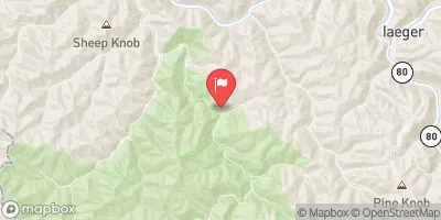
Upper Clinch Valley Dam #1b, also known as Cavitts Creek Dam, is a critical infrastructure owned by the local government in Tazewell, Virginia.
Summary
This earth dam, standing at a height of 75.5 feet, serves primarily for flood risk reduction, with additional purposes including recreation and water supply. The dam has a storage capacity of 2,320 acre-feet, providing essential protection to the surrounding area from potential flooding events.
Located on Cavitts Creek, this dam plays a vital role in maintaining water levels and ensuring the safety of the community. With a high hazard potential but a satisfactory condition assessment as of October 2020, the dam is regularly inspected and regulated by the Department of Conservation and Recreation in Virginia. Despite being completed at an unknown year, Upper Clinch Valley Dam #1b continues to serve its purpose effectively, showcasing the importance of proper maintenance and management of water resources in the face of climate challenges.
The dam's strategic position and design allow for effective flood control measures, contributing to the overall water resource management in the region. With a significant drainage area of 2.57 square miles and a normal storage capacity of 931 acre-feet, the dam provides vital protection to the community. As a key element in the area's flood risk reduction infrastructure, Upper Clinch Valley Dam #1b stands as a testament to the importance of sustainable water resource management in the face of changing climate conditions.
°F
°F
mph
Wind
%
Humidity
15-Day Weather Outlook
Dam Length |
460 |
Dam Height |
75.5 |
River Or Stream |
CAVITTS CREEK |
Primary Dam Type |
Earth |
Surface Area |
61.8 |
Hydraulic Height |
75.5 |
Drainage Area |
2.57 |
Nid Storage |
2320 |
Structural Height |
75.5 |
Hazard Potential |
High |
Nid Height |
76 |
Seasonal Comparison
5-Day Hourly Forecast Detail
Nearby Streamflow Levels
 Bluestone River At Falls Mills
|
81cfs |
 Tug Fork At Welch
|
340cfs |
 Dry Fork At Beartown
|
619cfs |
 N F Holston River Near Saltville
|
491cfs |
 M F Holston River At Seven Mile Ford
|
330cfs |
 Panther Creek Near Panther
|
95cfs |
Dam Data Reference
Condition Assessment
SatisfactoryNo existing or potential dam safety deficiencies are recognized. Acceptable performance is expected under all loading conditions (static, hydrologic, seismic) in accordance with the minimum applicable state or federal regulatory criteria or tolerable risk guidelines.
Fair
No existing dam safety deficiencies are recognized for normal operating conditions. Rare or extreme hydrologic and/or seismic events may result in a dam safety deficiency. Risk may be in the range to take further action. Note: Rare or extreme event is defined by the regulatory agency based on their minimum
Poor A dam safety deficiency is recognized for normal operating conditions which may realistically occur. Remedial action is necessary. POOR may also be used when uncertainties exist as to critical analysis parameters which identify a potential dam safety deficiency. Investigations and studies are necessary.
Unsatisfactory
A dam safety deficiency is recognized that requires immediate or emergency remedial action for problem resolution.
Not Rated
The dam has not been inspected, is not under state or federal jurisdiction, or has been inspected but, for whatever reason, has not been rated.
Not Available
Dams for which the condition assessment is restricted to approved government users.
Hazard Potential Classification
HighDams assigned the high hazard potential classification are those where failure or mis-operation will probably cause loss of human life.
Significant
Dams assigned the significant hazard potential classification are those dams where failure or mis-operation results in no probable loss of human life but can cause economic loss, environment damage, disruption of lifeline facilities, or impact other concerns. Significant hazard potential classification dams are often located in predominantly rural or agricultural areas but could be in areas with population and significant infrastructure.
Low
Dams assigned the low hazard potential classification are those where failure or mis-operation results in no probable loss of human life and low economic and/or environmental losses. Losses are principally limited to the owner's property.
Undetermined
Dams for which a downstream hazard potential has not been designated or is not provided.
Not Available
Dams for which the downstream hazard potential is restricted to approved government users.
 Upper Clinch Valley Dam #1b