
G-3 Pond Reservoir Report
Nearby: Taplin Dam Clausen Dam
Last Updated: January 11, 2026
G-3 Pond, located in Clinton, Iowa, is a privately owned earth dam structure designed by the USDA NRCS in 1971.
°F
°F
mph
Wind
%
Humidity
Summary
This small pond serves multiple purposes, including fire protection and stock or small fish pond. With a dam height of 27 feet and a storage capacity of 34 acre-feet, G-3 Pond covers a surface area of 3 acres and drains a 0.07 square mile watershed.
Despite being rated as having a low hazard potential and a moderate risk level, G-3 Pond has not been inspected or assessed for its condition. The dam features an uncontrolled spillway and is regulated by the Iowa DNR. It is situated near the Wapsipinicon River and Tr-Brophy Creek, making it an important water resource for the surrounding area. The pond's location and design make it a valuable asset for both water conservation and climate management efforts in the region.
Overall, G-3 Pond stands as a testament to the importance of small-scale water infrastructure in supporting various ecological and human needs. As climate change continues to impact water resources, structures like G-3 Pond play a crucial role in mitigating risks and ensuring sustainable water management practices. With its strategic location, diverse purposes, and regulatory oversight, G-3 Pond exemplifies the intersection of water resource management and climate resilience in the heart of Iowa.
Year Completed |
1971 |
Dam Length |
375 |
Dam Height |
27 |
River Or Stream |
TR-BROPHY CREEK |
Primary Dam Type |
Earth |
Surface Area |
3 |
Drainage Area |
0.07 |
Nid Storage |
34 |
Hazard Potential |
Low |
Foundations |
Soil |
Nid Height |
27 |
Seasonal Comparison
Weather Forecast
Nearby Streamflow Levels
 Mississippi River At Clinton
|
45600cfs |
 Wapsipinicon River Near De Witt
|
559cfs |
 Maquoketa River Near Maquoketa
|
569cfs |
 Apple River Near Hanover
|
110cfs |
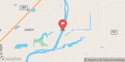 Rock River Near Joslin
|
5590cfs |
 Crow Creek At Bettendorf
|
5cfs |
Dam Data Reference
Condition Assessment
SatisfactoryNo existing or potential dam safety deficiencies are recognized. Acceptable performance is expected under all loading conditions (static, hydrologic, seismic) in accordance with the minimum applicable state or federal regulatory criteria or tolerable risk guidelines.
Fair
No existing dam safety deficiencies are recognized for normal operating conditions. Rare or extreme hydrologic and/or seismic events may result in a dam safety deficiency. Risk may be in the range to take further action. Note: Rare or extreme event is defined by the regulatory agency based on their minimum
Poor A dam safety deficiency is recognized for normal operating conditions which may realistically occur. Remedial action is necessary. POOR may also be used when uncertainties exist as to critical analysis parameters which identify a potential dam safety deficiency. Investigations and studies are necessary.
Unsatisfactory
A dam safety deficiency is recognized that requires immediate or emergency remedial action for problem resolution.
Not Rated
The dam has not been inspected, is not under state or federal jurisdiction, or has been inspected but, for whatever reason, has not been rated.
Not Available
Dams for which the condition assessment is restricted to approved government users.
Hazard Potential Classification
HighDams assigned the high hazard potential classification are those where failure or mis-operation will probably cause loss of human life.
Significant
Dams assigned the significant hazard potential classification are those dams where failure or mis-operation results in no probable loss of human life but can cause economic loss, environment damage, disruption of lifeline facilities, or impact other concerns. Significant hazard potential classification dams are often located in predominantly rural or agricultural areas but could be in areas with population and significant infrastructure.
Low
Dams assigned the low hazard potential classification are those where failure or mis-operation results in no probable loss of human life and low economic and/or environmental losses. Losses are principally limited to the owner's property.
Undetermined
Dams for which a downstream hazard potential has not been designated or is not provided.
Not Available
Dams for which the downstream hazard potential is restricted to approved government users.
Area Campgrounds
| Location | Reservations | Toilets |
|---|---|---|
 Army Corps of Engineers' Causeway
|
||
 South Sabula Lakes County Park
|
||
 Rock Creek County Campground
|
 G-3 Pond
 30th Avenue North Clinton