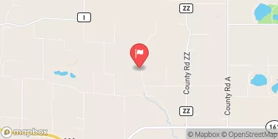
Mcdill Reservoir Report
Nearby: Whiting Mill Dam Whiting Plover
Last Updated: February 23, 2026
Mcdill, a local government-owned dam located in Portage, Wisconsin, serves as a vital structure on the Plover River.
Summary
Built in 1855, this Earth-type dam stands at a height of 20.6 feet and has a significant hazard potential. With a storage capacity of 2160 acre-feet and a drainage area of 163 square miles, Mcdill plays a crucial role in regulating water flow and providing flood control measures for the surrounding area.
Despite its age, Mcdill has undergone modifications in 1962 and 2000 to enhance its efficiency and safety. Regular inspections are conducted, with the most recent one in September 2019, revealing a satisfactory condition assessment. The dam is regulated by the Wisconsin Department of Natural Resources (WIDNR) and meets state permitting, inspection, and enforcement requirements. In case of emergencies, however, there is no detailed Emergency Action Plan (EAP) in place, raising concerns about the dam's preparedness for unforeseen events.
Overall, Mcdill presents a blend of historical significance and practical utility in managing water resources in the region. Its location on the Plover River, along with its storage capacity and hazard potential, underscores the importance of continued monitoring and maintenance to ensure the safety and efficiency of this essential water infrastructure.
°F
°F
mph
Wind
%
Humidity
15-Day Weather Outlook
Years Modified |
1962 - Other, 2000 - Other |
Year Completed |
1855 |
Dam Length |
450 |
Dam Height |
20.6 |
River Or Stream |
PLOVER |
Primary Dam Type |
Earth |
Surface Area |
261 |
Hydraulic Height |
14.9 |
Drainage Area |
163 |
Nid Storage |
2160 |
Structural Height |
20.6 |
Hazard Potential |
Significant |
Nid Height |
21 |
Seasonal Comparison
5-Day Hourly Forecast Detail
Nearby Streamflow Levels
 Tomorrow River Near Nelsonville
|
31cfs |
 Wisconsin River At Wisconsin Rapids
|
4150cfs |
 Tenmile Creek Near Nekoosa
|
524cfs |
 Wisconsin River At Rothschild
|
2840cfs |
 Eau Claire River At Kelly
|
280cfs |
 Waupaca River Near Waupaca
|
431cfs |
Dam Data Reference
Condition Assessment
SatisfactoryNo existing or potential dam safety deficiencies are recognized. Acceptable performance is expected under all loading conditions (static, hydrologic, seismic) in accordance with the minimum applicable state or federal regulatory criteria or tolerable risk guidelines.
Fair
No existing dam safety deficiencies are recognized for normal operating conditions. Rare or extreme hydrologic and/or seismic events may result in a dam safety deficiency. Risk may be in the range to take further action. Note: Rare or extreme event is defined by the regulatory agency based on their minimum
Poor A dam safety deficiency is recognized for normal operating conditions which may realistically occur. Remedial action is necessary. POOR may also be used when uncertainties exist as to critical analysis parameters which identify a potential dam safety deficiency. Investigations and studies are necessary.
Unsatisfactory
A dam safety deficiency is recognized that requires immediate or emergency remedial action for problem resolution.
Not Rated
The dam has not been inspected, is not under state or federal jurisdiction, or has been inspected but, for whatever reason, has not been rated.
Not Available
Dams for which the condition assessment is restricted to approved government users.
Hazard Potential Classification
HighDams assigned the high hazard potential classification are those where failure or mis-operation will probably cause loss of human life.
Significant
Dams assigned the significant hazard potential classification are those dams where failure or mis-operation results in no probable loss of human life but can cause economic loss, environment damage, disruption of lifeline facilities, or impact other concerns. Significant hazard potential classification dams are often located in predominantly rural or agricultural areas but could be in areas with population and significant infrastructure.
Low
Dams assigned the low hazard potential classification are those where failure or mis-operation results in no probable loss of human life and low economic and/or environmental losses. Losses are principally limited to the owner's property.
Undetermined
Dams for which a downstream hazard potential has not been designated or is not provided.
Not Available
Dams for which the downstream hazard potential is restricted to approved government users.

 Boy Scouts of America: Camp Fletcher
 Jordan Park Campground
 Jordan County Park Canoe Walk-In Campsites
 Lake Emily Park North Campground
 Lake Emily South Campground
 Vista Royalle Campground
 Mcdill
 Plover River -- Access