Coon Creek 21 Reservoir Report
Nearby: Coon Creek 23 Coon Creek 41
Last Updated: February 24, 2026
Coon Creek 21, also known as Tucker/Luckasson/Rulland, is a local government-owned earth dam located in Monroe, Wisconsin.
Summary
Built in 1963 by the USDA NRCS, this dam serves the primary purpose of flood risk reduction along the Un Trib Rullands Coulee Creek. With a height of 46 feet and a storage capacity of 271 acre-feet, Coon Creek 21 plays a crucial role in managing water resources and protecting the surrounding area from potential flooding.
Despite its low hazard potential, Coon Creek 21 has been assessed as unsatisfactory in terms of condition, with the last inspection conducted in August 2016. The dam is regulated by the Wisconsin Department of Natural Resources and undergoes regular state inspections, enforcement, and permitting to ensure its structural integrity and functionality. With a moderate risk assessment rating, there is a need for continued monitoring and potential risk management measures to maintain the effectiveness of Coon Creek 21 in mitigating flood risks and safeguarding the local community.
As climate change continues to impact water resources and weather patterns, the significance of infrastructure like Coon Creek 21 in flood risk reduction becomes increasingly crucial. With a focus on debris control and flood risk reduction, this dam serves as a vital component of water resource management in the area. Going forward, ongoing maintenance, inspections, and potential upgrades will be essential to ensure the continued effectiveness of Coon Creek 21 in safeguarding the community and surrounding environment from the impacts of extreme weather events.
°F
°F
mph
Wind
%
Humidity
15-Day Weather Outlook
Year Completed |
1963 |
Dam Length |
315 |
Dam Height |
46 |
River Or Stream |
Un Trib Rullands Coulee Creek |
Primary Dam Type |
Earth |
Surface Area |
2 |
Hydraulic Height |
13 |
Drainage Area |
3.2 |
Nid Storage |
271 |
Structural Height |
46 |
Hazard Potential |
Low |
Nid Height |
46 |
Seasonal Comparison
5-Day Hourly Forecast Detail
Nearby Streamflow Levels
 Kickapoo River At State Highway 33 At Ontario
|
149cfs |
 La Crosse River At Sparta
|
155cfs |
 Kickapoo River At La Farge
|
272cfs |
 La Crosse River Near La Crosse
|
358cfs |
 Black River Near Galesville
|
862cfs |
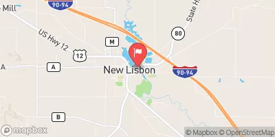 Lemonweir River At New Lisbon
|
261cfs |
Dam Data Reference
Condition Assessment
SatisfactoryNo existing or potential dam safety deficiencies are recognized. Acceptable performance is expected under all loading conditions (static, hydrologic, seismic) in accordance with the minimum applicable state or federal regulatory criteria or tolerable risk guidelines.
Fair
No existing dam safety deficiencies are recognized for normal operating conditions. Rare or extreme hydrologic and/or seismic events may result in a dam safety deficiency. Risk may be in the range to take further action. Note: Rare or extreme event is defined by the regulatory agency based on their minimum
Poor A dam safety deficiency is recognized for normal operating conditions which may realistically occur. Remedial action is necessary. POOR may also be used when uncertainties exist as to critical analysis parameters which identify a potential dam safety deficiency. Investigations and studies are necessary.
Unsatisfactory
A dam safety deficiency is recognized that requires immediate or emergency remedial action for problem resolution.
Not Rated
The dam has not been inspected, is not under state or federal jurisdiction, or has been inspected but, for whatever reason, has not been rated.
Not Available
Dams for which the condition assessment is restricted to approved government users.
Hazard Potential Classification
HighDams assigned the high hazard potential classification are those where failure or mis-operation will probably cause loss of human life.
Significant
Dams assigned the significant hazard potential classification are those dams where failure or mis-operation results in no probable loss of human life but can cause economic loss, environment damage, disruption of lifeline facilities, or impact other concerns. Significant hazard potential classification dams are often located in predominantly rural or agricultural areas but could be in areas with population and significant infrastructure.
Low
Dams assigned the low hazard potential classification are those where failure or mis-operation results in no probable loss of human life and low economic and/or environmental losses. Losses are principally limited to the owner's property.
Undetermined
Dams for which a downstream hazard potential has not been designated or is not provided.
Not Available
Dams for which the downstream hazard potential is restricted to approved government users.
Area Campgrounds
| Location | Reservations | Toilets |
|---|---|---|
 Esofea - Rentz Memorial Park
|
||
 Esofea/Rentz Memorial Park Campground
|
||
 Leon Valley Campground
|

 Coon Creek 21