Bad Axe 16 Reservoir Report
Nearby: Bad Axe 17 Bad Axe 24
Last Updated: February 11, 2026
Bad Axe 16, also known as Thompson, is a vital flood risk reduction structure located in Vernon, Wisconsin along the Hornby Hollow Creek.
Summary
Built in 1965 by the USDA NRCS, this earth dam stands at 44 feet tall and stretches 510 feet in length. With a storage capacity of 577 acre-feet, it plays a crucial role in managing water levels and mitigating potential flooding in the area. The dam is under the regulatory authority of the Wisconsin Department of Natural Resources, ensuring that it meets all necessary safety and inspection requirements.
Despite its age, Bad Axe 16 remains in satisfactory condition with a low hazard potential. Its last inspection in May 2016 deemed it structurally sound, with a moderate risk assessment rating of 3. The dam has a spillway type of "Uncontrolled" and a maximum discharge capacity of 402 cubic feet per second. In the event of an emergency, the structure is equipped to handle potential risks, although specific emergency action plans may need updating. With its strategic location and design, Bad Axe 16 continues to serve its primary purpose of flood risk reduction effectively, safeguarding the surrounding community from potential water-related hazards.
°F
°F
mph
Wind
%
Humidity
15-Day Weather Outlook
Year Completed |
1965 |
Dam Length |
510 |
Dam Height |
44 |
River Or Stream |
HORNBY HOLLOW CREEK |
Primary Dam Type |
Earth |
Hydraulic Height |
18 |
Drainage Area |
6 |
Nid Storage |
577 |
Structural Height |
44 |
Hazard Potential |
Low |
Nid Height |
44 |
Seasonal Comparison
5-Day Hourly Forecast Detail
Nearby Streamflow Levels
 Kickapoo River At La Farge
|
272cfs |
 Kickapoo River At Steuben
|
437cfs |
 Kickapoo River At State Highway 33 At Ontario
|
149cfs |
 Upper Iowa River Near Dorchester
|
885cfs |
 La Crosse River Near La Crosse
|
348cfs |
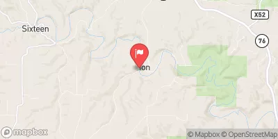 Yellow River At Ion
|
62cfs |
Dam Data Reference
Condition Assessment
SatisfactoryNo existing or potential dam safety deficiencies are recognized. Acceptable performance is expected under all loading conditions (static, hydrologic, seismic) in accordance with the minimum applicable state or federal regulatory criteria or tolerable risk guidelines.
Fair
No existing dam safety deficiencies are recognized for normal operating conditions. Rare or extreme hydrologic and/or seismic events may result in a dam safety deficiency. Risk may be in the range to take further action. Note: Rare or extreme event is defined by the regulatory agency based on their minimum
Poor A dam safety deficiency is recognized for normal operating conditions which may realistically occur. Remedial action is necessary. POOR may also be used when uncertainties exist as to critical analysis parameters which identify a potential dam safety deficiency. Investigations and studies are necessary.
Unsatisfactory
A dam safety deficiency is recognized that requires immediate or emergency remedial action for problem resolution.
Not Rated
The dam has not been inspected, is not under state or federal jurisdiction, or has been inspected but, for whatever reason, has not been rated.
Not Available
Dams for which the condition assessment is restricted to approved government users.
Hazard Potential Classification
HighDams assigned the high hazard potential classification are those where failure or mis-operation will probably cause loss of human life.
Significant
Dams assigned the significant hazard potential classification are those dams where failure or mis-operation results in no probable loss of human life but can cause economic loss, environment damage, disruption of lifeline facilities, or impact other concerns. Significant hazard potential classification dams are often located in predominantly rural or agricultural areas but could be in areas with population and significant infrastructure.
Low
Dams assigned the low hazard potential classification are those where failure or mis-operation results in no probable loss of human life and low economic and/or environmental losses. Losses are principally limited to the owner's property.
Undetermined
Dams for which a downstream hazard potential has not been designated or is not provided.
Not Available
Dams for which the downstream hazard potential is restricted to approved government users.

 Sidie Hollow County Park Boat Landing Campground
 Boat Landing - Sidie Hollow Park
 Ridge - Sidie Hollow Park
 Sidie Hollow County Park Ridge Campground
 Main - Sidie Hollow Park
 Sidie Hollow County Park Main Campground
 Bad Axe 16