Clam Lake Reservoir Report
Nearby: Amsterdam Slough Dahl-Merkley
Last Updated: February 22, 2026
Clam Lake, located in Burnett, Wisconsin, is a gravity dam completed in 1936 primarily for recreation purposes.
Summary
With a structural height of 10 feet and a length of 110 feet, this dam on the Clam River has a storage capacity of 9600 acre-feet and a surface area of 1207 acres. Despite being classified as low hazard potential, the risk assessment for Clam Lake is rated very high, indicating the importance of proper risk management measures.
Managed by the Wisconsin Department of Natural Resources (WIDNR), Clam Lake is regulated, permitted, inspected, and enforced by the state agency. The dam features a controlled spillway and a maximum discharge capacity of 6160 cubic feet per second. The last inspection in November 2019 deemed the dam to be in a not-rated condition, emphasizing the need for a more comprehensive assessment to ensure its safety and integrity for the future.
With its picturesque location and recreational significance, Clam Lake serves as a vital water resource for the surrounding area. Enthusiasts of water resources and climate will appreciate the unique features and risks associated with this dam, highlighting the importance of proper maintenance and management to safeguard both the environment and public safety.
°F
°F
mph
Wind
%
Humidity
15-Day Weather Outlook
Year Completed |
1936 |
Dam Length |
110 |
Dam Height |
10 |
River Or Stream |
CLAM |
Primary Dam Type |
Gravity |
Surface Area |
1207 |
Hydraulic Height |
10 |
Drainage Area |
325 |
Nid Storage |
9600 |
Structural Height |
10 |
Hazard Potential |
Low |
Nid Height |
10 |
Seasonal Comparison
5-Day Hourly Forecast Detail
Nearby Streamflow Levels
 St. Croix River Near Danbury
|
1650cfs |
 Snake River Near Pine City
|
172cfs |
 Kettle River Below Sandstone
|
170cfs |
 St. Croix River At St. Croix Falls
|
2520cfs |
 Namekagon River At Leonards
|
66cfs |
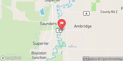 Nemadji River Near South Superior
|
93cfs |
Dam Data Reference
Condition Assessment
SatisfactoryNo existing or potential dam safety deficiencies are recognized. Acceptable performance is expected under all loading conditions (static, hydrologic, seismic) in accordance with the minimum applicable state or federal regulatory criteria or tolerable risk guidelines.
Fair
No existing dam safety deficiencies are recognized for normal operating conditions. Rare or extreme hydrologic and/or seismic events may result in a dam safety deficiency. Risk may be in the range to take further action. Note: Rare or extreme event is defined by the regulatory agency based on their minimum
Poor A dam safety deficiency is recognized for normal operating conditions which may realistically occur. Remedial action is necessary. POOR may also be used when uncertainties exist as to critical analysis parameters which identify a potential dam safety deficiency. Investigations and studies are necessary.
Unsatisfactory
A dam safety deficiency is recognized that requires immediate or emergency remedial action for problem resolution.
Not Rated
The dam has not been inspected, is not under state or federal jurisdiction, or has been inspected but, for whatever reason, has not been rated.
Not Available
Dams for which the condition assessment is restricted to approved government users.
Hazard Potential Classification
HighDams assigned the high hazard potential classification are those where failure or mis-operation will probably cause loss of human life.
Significant
Dams assigned the significant hazard potential classification are those dams where failure or mis-operation results in no probable loss of human life but can cause economic loss, environment damage, disruption of lifeline facilities, or impact other concerns. Significant hazard potential classification dams are often located in predominantly rural or agricultural areas but could be in areas with population and significant infrastructure.
Low
Dams assigned the low hazard potential classification are those where failure or mis-operation results in no probable loss of human life and low economic and/or environmental losses. Losses are principally limited to the owner's property.
Undetermined
Dams for which a downstream hazard potential has not been designated or is not provided.
Not Available
Dams for which the downstream hazard potential is restricted to approved government users.

 Clam Lake
 Lower Clam Lake -- Clam Lake (Lower) Access