Hemlock Reservoir Report
Nearby: La Valle Dutch Hollow Lake
Last Updated: February 23, 2026
Hemlock is a local government-owned earth dam located in Sauk, Wisconsin, specifically in the city of La Valle.
Summary
Built in 1964, this structure serves primarily for recreation purposes, offering visitors a serene environment to enjoy outdoor activities. Situated on the Hemlock Slough of Baraboo River, the dam has a height of 11 feet and a length of 1800 feet, with a maximum storage capacity of 85 acre-feet and a normal storage of 50 acre-feet.
Despite its low hazard potential and fair condition assessment, Hemlock poses a very high risk due to its location and potential impact on the surrounding area. The dam has a controlled spillway type and a hydraulic height of 6 feet, with a maximum discharge capacity of 45 cubic feet per second. Regular inspections are conducted to ensure its safety, with the last assessment completed in June 2016. With its beautiful surroundings and recreational opportunities, Hemlock is a valuable water resource in the region, contributing to the overall enjoyment and conservation of water in Wisconsin.
As climate change continues to impact water resources and infrastructure, the management and maintenance of dams like Hemlock become increasingly vital. With the state regulatory agency WIDNR overseeing its permitting, inspection, and enforcement processes, Hemlock is part of a comprehensive system designed to protect both the dam structure and the environment it serves. As enthusiasts of water resources and climate resilience, understanding the importance of structures like Hemlock is essential in safeguarding our natural resources for future generations.
°F
°F
mph
Wind
%
Humidity
15-Day Weather Outlook
Year Completed |
1964 |
Dam Length |
1800 |
Dam Height |
11 |
River Or Stream |
HEMLOCK SLOUGH OF BARABOO R. |
Primary Dam Type |
Earth |
Surface Area |
12 |
Hydraulic Height |
6 |
Drainage Area |
0.4 |
Nid Storage |
85 |
Structural Height |
11 |
Hazard Potential |
Low |
Nid Height |
11 |
Seasonal Comparison
5-Day Hourly Forecast Detail
Nearby Streamflow Levels
 Wisconsin River Near Wisconsin Dells
|
6300cfs |
 Lemonweir River At New Lisbon
|
261cfs |
 Kickapoo River At State Highway 33 At Ontario
|
149cfs |
 Kickapoo River At La Farge
|
272cfs |
 Baraboo River Near Baraboo
|
304cfs |
 Yellow River At Necedah
|
127cfs |
Dam Data Reference
Condition Assessment
SatisfactoryNo existing or potential dam safety deficiencies are recognized. Acceptable performance is expected under all loading conditions (static, hydrologic, seismic) in accordance with the minimum applicable state or federal regulatory criteria or tolerable risk guidelines.
Fair
No existing dam safety deficiencies are recognized for normal operating conditions. Rare or extreme hydrologic and/or seismic events may result in a dam safety deficiency. Risk may be in the range to take further action. Note: Rare or extreme event is defined by the regulatory agency based on their minimum
Poor A dam safety deficiency is recognized for normal operating conditions which may realistically occur. Remedial action is necessary. POOR may also be used when uncertainties exist as to critical analysis parameters which identify a potential dam safety deficiency. Investigations and studies are necessary.
Unsatisfactory
A dam safety deficiency is recognized that requires immediate or emergency remedial action for problem resolution.
Not Rated
The dam has not been inspected, is not under state or federal jurisdiction, or has been inspected but, for whatever reason, has not been rated.
Not Available
Dams for which the condition assessment is restricted to approved government users.
Hazard Potential Classification
HighDams assigned the high hazard potential classification are those where failure or mis-operation will probably cause loss of human life.
Significant
Dams assigned the significant hazard potential classification are those dams where failure or mis-operation results in no probable loss of human life but can cause economic loss, environment damage, disruption of lifeline facilities, or impact other concerns. Significant hazard potential classification dams are often located in predominantly rural or agricultural areas but could be in areas with population and significant infrastructure.
Low
Dams assigned the low hazard potential classification are those where failure or mis-operation results in no probable loss of human life and low economic and/or environmental losses. Losses are principally limited to the owner's property.
Undetermined
Dams for which a downstream hazard potential has not been designated or is not provided.
Not Available
Dams for which the downstream hazard potential is restricted to approved government users.
Area Campgrounds
| Location | Reservations | Toilets |
|---|---|---|
 Legion Park Camp Sites
|
||
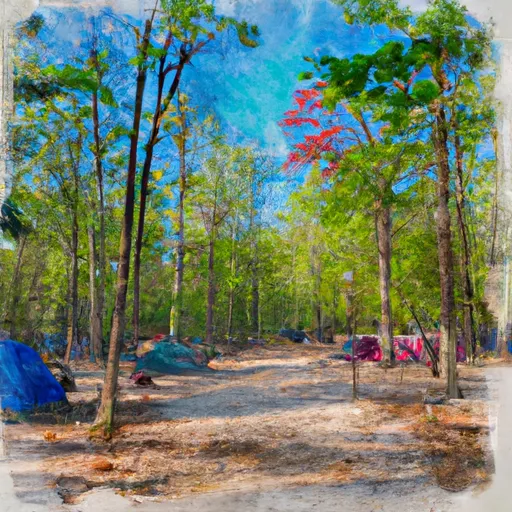 Wonewoc Legion Park
|
||
 Baker's Field
|
||
 Schultz City Park
|

 Hemlock
 Hemlock Slough -- Access