


Mccargar Reservoir Report
Last Updated: April 14, 2026
Nearby: Hahns Peak Willow Creek
°F
°F
mph
Wind
%
Humidity
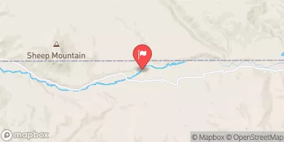
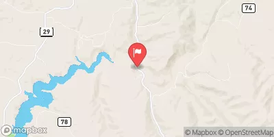
Mccargar, located in Slater, Colorado, is a private dam with a primary purpose of serving as a fire protection, stock, or small fish pond.
Summary
Completed in 1974, this earth dam stands at a height of 22 feet and has a storage capacity of 113 acre-feet. Despite its low hazard potential and fair condition assessment, the dam is state-regulated and subject to regular inspections, permitting, and enforcement by the Colorado Division of Water Resources.
Sitting on Independence Creek, Mccargar plays a crucial role in providing water for fish and wildlife while also serving as a vital resource for fire protection in the area. With a spillway width of 20 feet and a maximum discharge of 323 cubic feet per second, the dam is equipped to handle moderate risk situations. The surrounding area benefits from the dam's presence, with a surface area of 9 acres and a drainage area of 0 acres.
Overall, Mccargar's strategic location in Routt County, Colorado, highlights its importance in water resource management and climate resilience efforts. As a key component of the local ecosystem, this dam represents a valuable asset for maintaining water security, supporting wildlife habitats, and safeguarding against potential fire emergencies in the region.
Regional Streamflow Levels
 Little Snake River Near Slater
|
329cfs |
 Encampment River Ab Hog Park Cr
|
186cfs |
 Slater Fork Near Slater
|
65cfs |
 Elk River Near Milner
|
584cfs |
 Elkhead Creek Above Long Gulch
|
119cfs |
 Yampa River At Steamboat Springs
|
420cfs |
15-Day Long Term Forecast
Year Completed |
1974 |
Dam Length |
330 |
Dam Height |
22 |
River Or Stream |
INDEPENDENCE CR-TR |
Primary Dam Type |
Earth |
Surface Area |
9 |
Hydraulic Height |
18 |
Nid Storage |
113 |
Structural Height |
23 |
Hazard Potential |
Low |
Nid Height |
23 |
Seasonal Comparison
5-Day Hourly Forecast Detail
Dam Data Reference
Condition Assessment
SatisfactoryNo existing or potential dam safety deficiencies are recognized. Acceptable performance is expected under all loading conditions (static, hydrologic, seismic) in accordance with the minimum applicable state or federal regulatory criteria or tolerable risk guidelines.
Fair
No existing dam safety deficiencies are recognized for normal operating conditions. Rare or extreme hydrologic and/or seismic events may result in a dam safety deficiency. Risk may be in the range to take further action. Note: Rare or extreme event is defined by the regulatory agency based on their minimum
Poor A dam safety deficiency is recognized for normal operating conditions which may realistically occur. Remedial action is necessary. POOR may also be used when uncertainties exist as to critical analysis parameters which identify a potential dam safety deficiency. Investigations and studies are necessary.
Unsatisfactory
A dam safety deficiency is recognized that requires immediate or emergency remedial action for problem resolution.
Not Rated
The dam has not been inspected, is not under state or federal jurisdiction, or has been inspected but, for whatever reason, has not been rated.
Not Available
Dams for which the condition assessment is restricted to approved government users.
Hazard Potential Classification
HighDams assigned the high hazard potential classification are those where failure or mis-operation will probably cause loss of human life.
Significant
Dams assigned the significant hazard potential classification are those dams where failure or mis-operation results in no probable loss of human life but can cause economic loss, environment damage, disruption of lifeline facilities, or impact other concerns. Significant hazard potential classification dams are often located in predominantly rural or agricultural areas but could be in areas with population and significant infrastructure.
Low
Dams assigned the low hazard potential classification are those where failure or mis-operation results in no probable loss of human life and low economic and/or environmental losses. Losses are principally limited to the owner's property.
Undetermined
Dams for which a downstream hazard potential has not been designated or is not provided.
Not Available
Dams for which the downstream hazard potential is restricted to approved government users.
Area Campgrounds
| Location | Reservations | Toilets |
|---|---|---|
 Hahns Peak Lake
|
||
 Hahns Peak Lake Campground
|
||
 Steamboat Lake State Park
|
||
 Hans peak
|
||
 Pearl Lake State Park
|
||
 CDT crossing campsite
|
 Wy-Co State Line To Encampment River Wilderness Boundary
 Headwaters (Continental Divide) And Its West Fork (From West Fork Lake) To North Section Line, Sec 21, T12N, R84W
 Encampment River Wilderness Boundary To Medicine Bow Nf Boundary