Higel Marine Park Boat Launch
Community Reviews
Been here? Share the conditions.
Reviews, ratings & photos are added in the free Snoflo iOS app — rate a spot, tag the conditions, and your visit is verified by location. Add or manage your reviews from the app.
Higel Marine Park
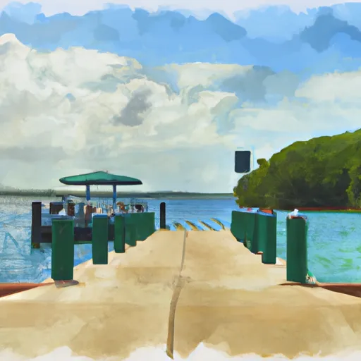
According to the latest information available, Higel Marine Park provides boaters with access to some of the best fishing and water sports opportunities in the area. The park is open from sunrise to sunset, and there is no fee to use the boat ramp. However, boaters should note that there are strict regulations in place to protect the natural resources in the park, including speed limits, no-wake zones, and restrictions on fishing and hunting. Additionally, boaters should be aware of the weather conditions and local hazards, including strong currents, shallow shoals, and wildlife.
In summary, Higel Marine Park is a popular boat ramp in Florida that provides boaters with access to the Gulf of Mexico, intracoastal waterway, and Venice Inlet. It is a concrete double-wide ramp that is approximately 50 feet wide and can accommodate all kinds of boats up to 40 feet in length. Boaters should be aware of the regulations and local hazards in the area to ensure a safe and enjoyable experience on the water.
Plan your launch down to the hour
Same weather feed Snoflo's iOS app uses -- updated continuously from NOAA / yr.no.
Next 5 days, hour by hour
Temperature line with weather symbols on top, snow + rain accumulation as columns, humidity as a dotted line.
5-day forecast table
Every 3 hours, broken out across temperature, snow, rain, humidity, and wind.
| Time | Condition | Temp (°F) | Snow (in) | Rain (in) | Humidity (%) | Wind (mps) | Wind dir |
|---|---|---|---|---|---|---|---|
| Loading detailed forecast… | |||||||
15-day temperature & precipitation
Daily temperatures, snow, and rain projected over the next two weeks.
Area streamflow levels
USGS streamgauges around Higel Marine Park -- the same readings that determine whether your launch is safe and your boat is the right craft.
| Streamgauge | Discharge | View |
|---|---|---|
| Myakka River At Control Near Laurel Fl | 102 cfs | → |
| Myakka River Near Sarasota Fl | 167 cfs | → |
| Howard Creek Near Sarasota Fl | 86 cfs | → |
| Cocoplum Waterway At North Port Fl | 80 cfs | → |
| Big Slough At West Price Blvd Near North Port Fl | 40 cfs | → |
| Big Slough At Tropicaire Blvd Near North Port Fl | 13 cfs | → |
Plan a longer trip
The closest paddle runs, fishing spots, and other boat launches so you can extend a day on the water.
River runs
- Approximately At River Mile 23 Where Riverfront Residential Development Begins To The Vicinity Of Snook Haven Fish Camp At Approximately River Mile 18
- Approximately River Mile 18 To A Point Just Upriver Of The Us 41 Highway Crossing
- The Southern Boundary Of The Myakka River State Park To Ends Approximately At River Mile 23 Where Riverfront Residential Development Begins
- A Point Just Upriver Of The Us 41 Highway Crossing To The Sarasota/Charlotte County Line
- Begins Downstream Of The State Road 72 Bridge To The Southern Boundary Of Myakka River State Park
- County Road 780 Bridge To State Road 72 Bridge
Boating safety & etiquette
- Check the conditions before you launch
- Use the streamflow numbers, weather, and wind forecast on this page. High-cfs whitewater requires whitewater-specific craft and skill.
- Wear your life jacket
- Statistically the single biggest survival factor in a boating incident. State law often requires one per passenger.
- File a float plan
- Tell someone on shore your put-in, take-out, and expected return time. Especially for multi-day or remote trips.
- Yield at the ramp
- Prep gear in the parking lot, not on the ramp. Launch and clear quickly so others can use the lane.
- Clean, drain, dry
- Inspect, clean, drain and dry your boat between waters to prevent the spread of aquatic invasive species.
Set push alerts in the Snoflo app
Save Higel Marine Park as a favorite, set a discharge threshold or a wind/precipitation alert, and the iOS app will push the moment conditions cross.
About Higel Marine Park
Can I launch a motorboat here?
Most Snoflo-tracked launches support motorboats; check the operator for any horsepower restrictions, paddle-only zones, or seasonal closures.
How fresh is the streamflow data?
USGS streamgauges report continuously (every 15 minutes); the table on this page pulls the latest reading at page load.
Is there a fee?
Many federal and state boat launches charge a day-use fee. Check the operator's site before driving out.
What boat is right for these conditions?
Use the nearby streamflow numbers and river-run panel on this page to gauge current conditions. Wider, slower water is friendly for casual paddling and powerboats; high-cfs whitewater requires whitewater-specific craft and skill.
Can I get alerts when conditions change?
Yes -- alerts are managed in the Snoflo iOS app. Favorite this launch, set a threshold (discharge, wind), and you'll get a push the moment it crosses.
Other launches near here
Snoflo-tracked boat launches within driving distance of Higel Marine Park.