Lakeview Trail Jackson County Boat Launch
Community Reviews
Been here? Share the conditions.
Reviews, ratings & photos are added in the free Snoflo iOS app — rate a spot, tag the conditions, and your visit is verified by location. Add or manage your reviews from the app.
Lakeview Trail Jackson County
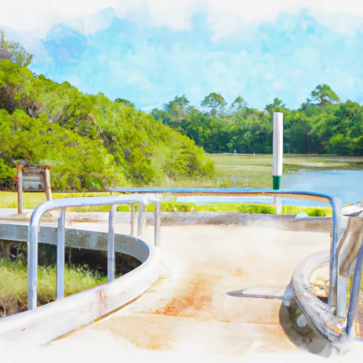
The Lakeview Trail boat ramp services Merritt's Mill Pond, a 202-acre freshwater lake located in Jackson County, Florida. This lake is known for its clear waters, fishing opportunities, and scenic views. The lake also has several springs and underwater caves that attract divers and snorkelers.
In terms of permitted watercraft, the Lakeview Trail boat ramp allows small to medium sized boats with a maximum length of 20 feet. Motorized boats are allowed on the lake, but there is a speed limit of 20mph. Additionally, kayaks, canoes, and paddleboards are also permitted on the lake.
In conclusion, the Lakeview Trail boat ramp in Jackson County, Florida is a suitable launching point for small to medium-sized watercraft such as kayaks, canoes, and motorized boats with a maximum length of 20 feet. It services Merritt's Mill Pond, a freshwater lake that offers various recreational activities.
Plan your launch down to the hour
Same weather feed Snoflo's iOS app uses -- updated continuously from NOAA / yr.no.
Next 5 days, hour by hour
Temperature line with weather symbols on top, snow + rain accumulation as columns, humidity as a dotted line.
5-day forecast table
Every 3 hours, broken out across temperature, snow, rain, humidity, and wind.
| Time | Condition | Temp (°F) | Snow (in) | Rain (in) | Humidity (%) | Wind (mps) | Wind dir |
|---|---|---|---|---|---|---|---|
| Loading detailed forecast… | |||||||
15-day temperature & precipitation
Daily temperatures, snow, and rain projected over the next two weeks.
Area streamflow levels
USGS streamgauges around Lakeview Trail Jackson County -- the same readings that determine whether your launch is safe and your boat is the right craft.
| Streamgauge | Discharge | View |
|---|---|---|
| Apalachicola River At Chattahoochee Fla | 11,400 cfs | → |
| Spring Creek Near Reynoldsville | 414 cfs | → |
| Chipola River At Marianna Fl | 495 cfs | → |
| Chipola River Nr Altha | 1,250 cfs | → |
| Telogia Creek Nr Bristol | 85 cfs | → |
| Apalachicola River Nr Blountstown | 12,800 cfs | → |
Plan a longer trip
The closest paddle runs, fishing spots, and other boat launches so you can extend a day on the water.
Nearby fishing
Boating safety & etiquette
- Check the conditions before you launch
- Use the streamflow numbers, weather, and wind forecast on this page. High-cfs whitewater requires whitewater-specific craft and skill.
- Wear your life jacket
- Statistically the single biggest survival factor in a boating incident. State law often requires one per passenger.
- File a float plan
- Tell someone on shore your put-in, take-out, and expected return time. Especially for multi-day or remote trips.
- Yield at the ramp
- Prep gear in the parking lot, not on the ramp. Launch and clear quickly so others can use the lane.
- Clean, drain, dry
- Inspect, clean, drain and dry your boat between waters to prevent the spread of aquatic invasive species.
Set push alerts in the Snoflo app
Save Lakeview Trail Jackson County as a favorite, set a discharge threshold or a wind/precipitation alert, and the iOS app will push the moment conditions cross.
About Lakeview Trail Jackson County
Can I launch a motorboat here?
Most Snoflo-tracked launches support motorboats; check the operator for any horsepower restrictions, paddle-only zones, or seasonal closures.
How fresh is the streamflow data?
USGS streamgauges report continuously (every 15 minutes); the table on this page pulls the latest reading at page load.
Is there a fee?
Many federal and state boat launches charge a day-use fee. Check the operator's site before driving out.
What boat is right for these conditions?
Use the nearby streamflow numbers and river-run panel on this page to gauge current conditions. Wider, slower water is friendly for casual paddling and powerboats; high-cfs whitewater requires whitewater-specific craft and skill.
Can I get alerts when conditions change?
Yes -- alerts are managed in the Snoflo iOS app. Favorite this launch, set a threshold (discharge, wind), and you'll get a push the moment it crosses.
Other launches near here
Snoflo-tracked boat launches within driving distance of Lakeview Trail Jackson County.