Manatee County Boat Launch
Community Reviews
Been here? Share the conditions.
Reviews, ratings & photos are added in the free Snoflo iOS app — rate a spot, tag the conditions, and your visit is verified by location. Add or manage your reviews from the app.
Manatee County
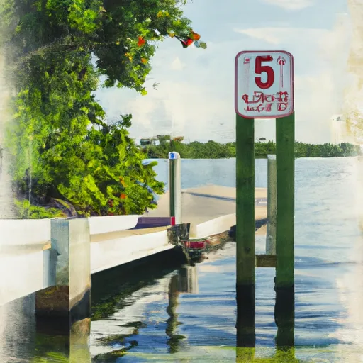
The Manatee County boat ramp is a public boat ramp that serves as a launching point for boats and other watercraft. It is a concrete boat ramp suitable for small to medium-sized boats. It has a width of approximately 25 feet, which can accommodate multiple boats at once.
The Manatee County boat ramp services the Manatee River, which is a popular destination for boaters and fishermen. The river stretches over 50 miles and offers ample opportunities for recreational activities such as boating, fishing, and sightseeing.
A variety of watercraft are permitted on the Manatee River, including motorboats, sailboats, canoes, kayaks, and other non-motorized watercraft. However, it is important to note that certain areas of the river may be restricted for specific types of watercraft or activities, so it is best to check with local authorities before launching.
In conclusion, the Manatee County boat ramp is a public boat ramp located in Florida that services the Manatee River. It is suitable for small to medium-sized boats and can accommodate multiple boats at once. A variety of watercraft are permitted on the river, including motorized and non-motorized watercraft.
Plan your launch down to the hour
Same weather feed Snoflo's iOS app uses -- updated continuously from NOAA / yr.no.
Next 5 days, hour by hour
Temperature line with weather symbols on top, snow + rain accumulation as columns, humidity as a dotted line.
5-day forecast table
Every 3 hours, broken out across temperature, snow, rain, humidity, and wind.
| Time | Condition | Temp (°F) | Snow (in) | Rain (in) | Humidity (%) | Wind (mps) | Wind dir |
|---|---|---|---|---|---|---|---|
| Loading detailed forecast… | |||||||
15-day temperature & precipitation
Daily temperatures, snow, and rain projected over the next two weeks.
Area streamflow levels
USGS streamgauges around Manatee County -- the same readings that determine whether your launch is safe and your boat is the right craft.
| Streamgauge | Discharge | View |
|---|---|---|
| Gamble Creek Near Parrish Fl | 26 cfs | → |
| Braden Riv At Lakewood Ranch Nr Lorraine Fl | 1 cfs | → |
| Gamble Creek At County Road 675 Near Parrish Fl | 3 cfs | → |
| Manatee River Near Myakka Head Fl | 50 cfs | → |
| Ogleby Ck Dnstr From Boggy Ck Near Myakka City Fl | 37 cfs | → |
| Coker Creek Near Myakka City Fl | 44 cfs | → |
Plan a longer trip
The closest paddle runs, fishing spots, and other boat launches so you can extend a day on the water.
River runs
- County Road 780 Bridge To State Road 72 Bridge
- Begins Downstream Of The State Road 72 Bridge To The Southern Boundary Of Myakka River State Park
- The Southern Boundary Of The Myakka River State Park To Ends Approximately At River Mile 23 Where Riverfront Residential Development Begins
- Approximately At River Mile 23 Where Riverfront Residential Development Begins To The Vicinity Of Snook Haven Fish Camp At Approximately River Mile 18
- Approximately River Mile 18 To A Point Just Upriver Of The Us 41 Highway Crossing
- A Point Just Upriver Of The Us 41 Highway Crossing To The Sarasota/Charlotte County Line
Nearby fishing
Boating safety & etiquette
- Check the conditions before you launch
- Use the streamflow numbers, weather, and wind forecast on this page. High-cfs whitewater requires whitewater-specific craft and skill.
- Wear your life jacket
- Statistically the single biggest survival factor in a boating incident. State law often requires one per passenger.
- File a float plan
- Tell someone on shore your put-in, take-out, and expected return time. Especially for multi-day or remote trips.
- Yield at the ramp
- Prep gear in the parking lot, not on the ramp. Launch and clear quickly so others can use the lane.
- Clean, drain, dry
- Inspect, clean, drain and dry your boat between waters to prevent the spread of aquatic invasive species.
Set push alerts in the Snoflo app
Save Manatee County as a favorite, set a discharge threshold or a wind/precipitation alert, and the iOS app will push the moment conditions cross.
About Manatee County
Can I launch a motorboat here?
Most Snoflo-tracked launches support motorboats; check the operator for any horsepower restrictions, paddle-only zones, or seasonal closures.
How fresh is the streamflow data?
USGS streamgauges report continuously (every 15 minutes); the table on this page pulls the latest reading at page load.
Is there a fee?
Many federal and state boat launches charge a day-use fee. Check the operator's site before driving out.
What boat is right for these conditions?
Use the nearby streamflow numbers and river-run panel on this page to gauge current conditions. Wider, slower water is friendly for casual paddling and powerboats; high-cfs whitewater requires whitewater-specific craft and skill.
Can I get alerts when conditions change?
Yes -- alerts are managed in the Snoflo iOS app. Favorite this launch, set a threshold (discharge, wind), and you'll get a push the moment it crosses.
Other launches near here
Snoflo-tracked boat launches within driving distance of Manatee County.