Northwest 8th Street 4281, Coconut Creek Boat Launch
Community Reviews
Been here? Share the conditions.
Reviews, ratings & photos are added in the free Snoflo iOS app — rate a spot, tag the conditions, and your visit is verified by location. Add or manage your reviews from the app.
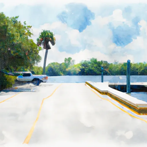
Northwest 8th Street 4281, Coconut Creek
However, there are several boat ramps in the surrounding areas with varying specifications. For example, the Pompano Beach Boat Ramp, located approximately 5 miles southeast of Coconut Creek, is a public boat ramp that services the Intracoastal Waterway and Atlantic Ocean. It has four launching lanes and is 20 feet wide. The ramp is suitable for boats up to 40 feet in length and has a maximum weight capacity of 20,000 pounds.
Additionally, the Quiet Waters Park Boat Ramp in Deerfield Beach, located approximately 6 miles northeast of Coconut Creek, is a public boat ramp that services the Quiet Waters Park lake. It has two launching lanes and is 18 feet wide. The ramp is suitable for boats up to 22 feet in length and has a maximum weight capacity of 6,000 pounds.
It is important to note that regulations and specifications for boat ramps can vary, depending on location and governing authority. It is always recommended to check with local authorities or visit the facility in person to verify accuracy.
Plan your launch down to the hour
Same weather feed Snoflo's iOS app uses -- updated continuously from NOAA / yr.no.
Next 5 days, hour by hour
Temperature line with weather symbols on top, snow + rain accumulation as columns, humidity as a dotted line.
5-day forecast table
Every 3 hours, broken out across temperature, snow, rain, humidity, and wind.
| Time | Condition | Temp (°F) | Snow (in) | Rain (in) | Humidity (%) | Wind (mps) | Wind dir |
|---|---|---|---|---|---|---|---|
| Loading detailed forecast… | |||||||
15-day temperature & precipitation
Daily temperatures, snow, and rain projected over the next two weeks.
Area streamflow levels
USGS streamgauges around Northwest 8th Street 4281, Coconut Creek -- the same readings that determine whether your launch is safe and your boat is the right craft.
| Streamgauge | Discharge | View |
|---|---|---|
| Hillsboro Canal At S-6 Near Shawano | 119 cfs | → |
| N.W. Wellfield Canal Nr Dade Broward Levee Nr Penn | 1 cfs | → |
| Miami Canal At Nw36 St | 24 cfs | → |
Plan a longer trip
The closest paddle runs, fishing spots, and other boat launches so you can extend a day on the water.
Boating safety & etiquette
- Check the conditions before you launch
- Use the streamflow numbers, weather, and wind forecast on this page. High-cfs whitewater requires whitewater-specific craft and skill.
- Wear your life jacket
- Statistically the single biggest survival factor in a boating incident. State law often requires one per passenger.
- File a float plan
- Tell someone on shore your put-in, take-out, and expected return time. Especially for multi-day or remote trips.
- Yield at the ramp
- Prep gear in the parking lot, not on the ramp. Launch and clear quickly so others can use the lane.
- Clean, drain, dry
- Inspect, clean, drain and dry your boat between waters to prevent the spread of aquatic invasive species.
Set push alerts in the Snoflo app
Save Northwest 8th Street 4281, Coconut Creek as a favorite, set a discharge threshold or a wind/precipitation alert, and the iOS app will push the moment conditions cross.
About Northwest 8th Street 4281, Coconut Creek
Can I launch a motorboat here?
Most Snoflo-tracked launches support motorboats; check the operator for any horsepower restrictions, paddle-only zones, or seasonal closures.
How fresh is the streamflow data?
USGS streamgauges report continuously (every 15 minutes); the table on this page pulls the latest reading at page load.
Is there a fee?
Many federal and state boat launches charge a day-use fee. Check the operator's site before driving out.
What boat is right for these conditions?
Use the nearby streamflow numbers and river-run panel on this page to gauge current conditions. Wider, slower water is friendly for casual paddling and powerboats; high-cfs whitewater requires whitewater-specific craft and skill.
Can I get alerts when conditions change?
Yes -- alerts are managed in the Snoflo iOS app. Favorite this launch, set a threshold (discharge, wind), and you'll get a push the moment it crosses.
Other launches near here
Snoflo-tracked boat launches within driving distance of Northwest 8th Street 4281, Coconut Creek.