Ochlockonee Bay Boat Ramp Boat Launch
Community Reviews
Been here? Share the conditions.
Reviews, ratings & photos are added in the free Snoflo iOS app — rate a spot, tag the conditions, and your visit is verified by location. Add or manage your reviews from the app.
Ochlockonee Bay Boat Ramp
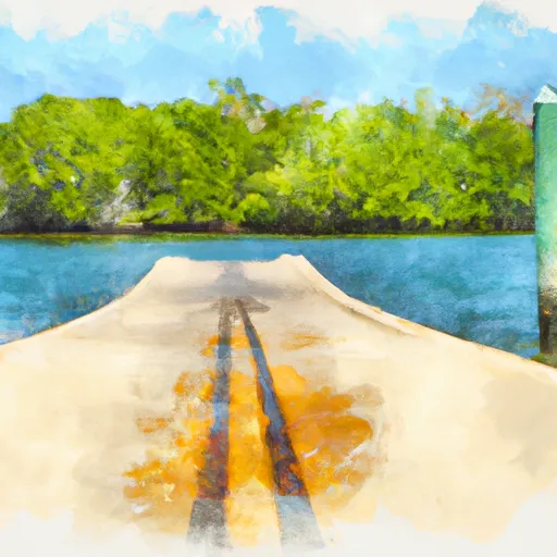
This boat ramp services the Ochlockonee Bay, which is a shallow, brackish body of water located in the eastern part of Apalachee Bay and stretches approximately 8 miles in length. The bay is surrounded by salt marshes and is connected to the Gulf of Mexico through a narrow channel.
According to the Florida Fish and Wildlife Conservation Commission, the Ochlockonee Bay is open for boating and fishing activities. All types of boats are permitted on the water, including canoes, kayaks, sailboats, and motorized vessels. However, boaters should be aware of the shallow waters and submerged oyster bars that can be hazardous to navigation.
Based on the latest information available, the Ochlockonee Bay Boat Ramp is open year-round and provides access to a popular recreational area for boating, fishing, and wildlife viewing. Visitors can enjoy the scenic beauty of the bay and its natural surroundings, as well as the abundant marine life that inhabits the area.
Plan your launch down to the hour
Same weather feed Snoflo's iOS app uses -- updated continuously from NOAA / yr.no.
Next 5 days, hour by hour
Temperature line with weather symbols on top, snow + rain accumulation as columns, humidity as a dotted line.
5-day forecast table
Every 3 hours, broken out across temperature, snow, rain, humidity, and wind.
| Time | Condition | Temp (°F) | Snow (in) | Rain (in) | Humidity (%) | Wind (mps) | Wind dir |
|---|---|---|---|---|---|---|---|
| Loading detailed forecast… | |||||||
15-day temperature & precipitation
Daily temperatures, snow, and rain projected over the next two weeks.
Area streamflow levels
USGS streamgauges around Ochlockonee Bay Boat Ramp -- the same readings that determine whether your launch is safe and your boat is the right craft.
| Streamgauge | Discharge | View |
|---|---|---|
| Sopchoppy River Nr Sopchoppy | 3 cfs | → |
| Lost Creek At Arran Fla | 1 cfs | → |
| Wakulla River Near Crawfordville | 276 cfs | → |
| Ochlockonee River Nr Smith Creek | 831 cfs | → |
| St. Marks River Near Newport | 490 cfs | → |
| New River Nr Sumatra Fla | 237 cfs | → |
Plan a longer trip
The closest paddle runs, fishing spots, and other boat launches so you can extend a day on the water.
River runs
- Forest Service Property Bounday To St. Marks Wildlife Refuge Boundary
- Tirce Creek Bridge (Monkey Creek) To Forest Service Property Boundary In Sec 13
- Bradwell Bay Wilderness (Northern Boundary) To Bradwell Bay Wilderness Boundary At Trice Bridge On Fr 329
- Segment D--Mud Swamp/New River Wilderness (Southern) Wilderness Boundary To Northern Boundary Of Town Of Carrabelle (Rm 4)
- Headwaters To Concrete Bridge (Burnt Bridge) On Fh 13 (Where River Enters Bradwell Ray Wilderness)
- Segment C--Mud Swamp/New River Wilderness Boundary To Mud Swamp/New River Wilderness (Southern) Boundary
Nearby fishing
Boating safety & etiquette
- Check the conditions before you launch
- Use the streamflow numbers, weather, and wind forecast on this page. High-cfs whitewater requires whitewater-specific craft and skill.
- Wear your life jacket
- Statistically the single biggest survival factor in a boating incident. State law often requires one per passenger.
- File a float plan
- Tell someone on shore your put-in, take-out, and expected return time. Especially for multi-day or remote trips.
- Yield at the ramp
- Prep gear in the parking lot, not on the ramp. Launch and clear quickly so others can use the lane.
- Clean, drain, dry
- Inspect, clean, drain and dry your boat between waters to prevent the spread of aquatic invasive species.
Set push alerts in the Snoflo app
Save Ochlockonee Bay Boat Ramp as a favorite, set a discharge threshold or a wind/precipitation alert, and the iOS app will push the moment conditions cross.
About Ochlockonee Bay Boat Ramp
Can I launch a motorboat here?
Most Snoflo-tracked launches support motorboats; check the operator for any horsepower restrictions, paddle-only zones, or seasonal closures.
How fresh is the streamflow data?
USGS streamgauges report continuously (every 15 minutes); the table on this page pulls the latest reading at page load.
Is there a fee?
Many federal and state boat launches charge a day-use fee. Check the operator's site before driving out.
What boat is right for these conditions?
Use the nearby streamflow numbers and river-run panel on this page to gauge current conditions. Wider, slower water is friendly for casual paddling and powerboats; high-cfs whitewater requires whitewater-specific craft and skill.
Can I get alerts when conditions change?
Yes -- alerts are managed in the Snoflo iOS app. Favorite this launch, set a threshold (discharge, wind), and you'll get a push the moment it crosses.
Other launches near here
Snoflo-tracked boat launches within driving distance of Ochlockonee Bay Boat Ramp.