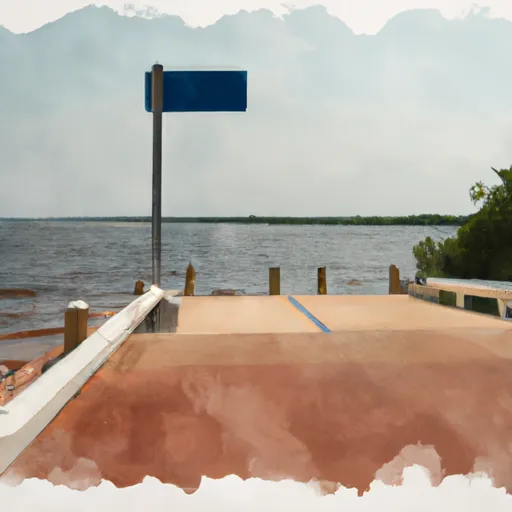
Volusia County Boat Launch
Community Reviews
Been here? Share the conditions.
Reviews, ratings & photos are added in the free Snoflo iOS app — rate a spot, tag the conditions, and your visit is verified by location. Add or manage your reviews from the app.
Volusia County
The ramp services the Indian River Lagoon, which is a large estuary system that stretches along the east coast of Florida. This body of water is known for its diverse marine life, including manatees, dolphins, and a variety of fish species.
The Volusia County boat ramp is open to a variety of watercraft, including boats, jet skis, and kayaks. However, there are some restrictions in place for certain types of craft. For example, there are specific rules regarding the use of personal watercraft, such as jet skis, and operators must follow safety guidelines to ensure the safety of themselves and others on the water.
In terms of the latest information available, the Volusia County government website provides details on the amenities available at the boat ramp, as well as information on fees and permits that may be required. Additionally, users should always check local weather and water conditions before launching their watercraft to ensure a safe and enjoyable experience.
Plan your launch down to the hour
Same weather feed Snoflo's iOS app uses -- updated continuously from NOAA / yr.no.
Next 5 days, hour by hour
Temperature line with weather symbols on top, snow + rain accumulation as columns, humidity as a dotted line.
5-day forecast table
Every 3 hours, broken out across temperature, snow, rain, humidity, and wind.
| Time | Condition | Temp (°F) | Snow (in) | Rain (in) | Humidity (%) | Wind (mps) | Wind dir |
|---|---|---|---|---|---|---|---|
| Loading detailed forecast… | |||||||
15-day temperature & precipitation
Daily temperatures, snow, and rain projected over the next two weeks.
Area streamflow levels
USGS streamgauges around Volusia County -- the same readings that determine whether your launch is safe and your boat is the right craft.
| Streamgauge | Discharge | View |
|---|---|---|
| Tomoka River Nr Holly Hill | 17 cfs | → |
| Spruce Creek Nr Samsula | 11 cfs | → |
| Halifax Canal Nr Harbor Oaks | 45 cfs | → |
| St. Johns River Nr Deland | 2,870 cfs | → |
| Haw Creek Ab Russells Landing Nr St Johns Park Fl | 113 cfs | → |
| St. Johns River At Astor | 1,850 cfs | → |
Plan a longer trip
The closest paddle runs, fishing spots, and other boat launches so you can extend a day on the water.
River runs
- Segment B--Alexander Springs Wilderness Boundary To Confluence With St. Johns River
- Segment A--Mouth Of Spring On Ocala Nf To Alexander Springs Wilderness Boundary
- Segment B--Bridge On Sh 19 To Confluence With Lake George
- Segment A--Mouth Of Spring On Ocala Nf (At Juniper Springs Wilderness) To Bridge On Sh 19 (At Wilderness Boundary)
Nearby fishing
Boating safety & etiquette
- Check the conditions before you launch
- Use the streamflow numbers, weather, and wind forecast on this page. High-cfs whitewater requires whitewater-specific craft and skill.
- Wear your life jacket
- Statistically the single biggest survival factor in a boating incident. State law often requires one per passenger.
- File a float plan
- Tell someone on shore your put-in, take-out, and expected return time. Especially for multi-day or remote trips.
- Yield at the ramp
- Prep gear in the parking lot, not on the ramp. Launch and clear quickly so others can use the lane.
- Clean, drain, dry
- Inspect, clean, drain and dry your boat between waters to prevent the spread of aquatic invasive species.
Set push alerts in the Snoflo app
Save Volusia County as a favorite, set a discharge threshold or a wind/precipitation alert, and the iOS app will push the moment conditions cross.
About Volusia County
Can I launch a motorboat here?
Most Snoflo-tracked launches support motorboats; check the operator for any horsepower restrictions, paddle-only zones, or seasonal closures.
How fresh is the streamflow data?
USGS streamgauges report continuously (every 15 minutes); the table on this page pulls the latest reading at page load.
Is there a fee?
Many federal and state boat launches charge a day-use fee. Check the operator's site before driving out.
What boat is right for these conditions?
Use the nearby streamflow numbers and river-run panel on this page to gauge current conditions. Wider, slower water is friendly for casual paddling and powerboats; high-cfs whitewater requires whitewater-specific craft and skill.
Can I get alerts when conditions change?
Yes -- alerts are managed in the Snoflo iOS app. Favorite this launch, set a threshold (discharge, wind), and you'll get a push the moment it crosses.
Other launches near here
Snoflo-tracked boat launches within driving distance of Volusia County.