College Hill Road Madison County Boat Launch
Community Reviews
Been here? Share the conditions.
Reviews, ratings & photos are added in the free Snoflo iOS app — rate a spot, tag the conditions, and your visit is verified by location. Add or manage your reviews from the app.
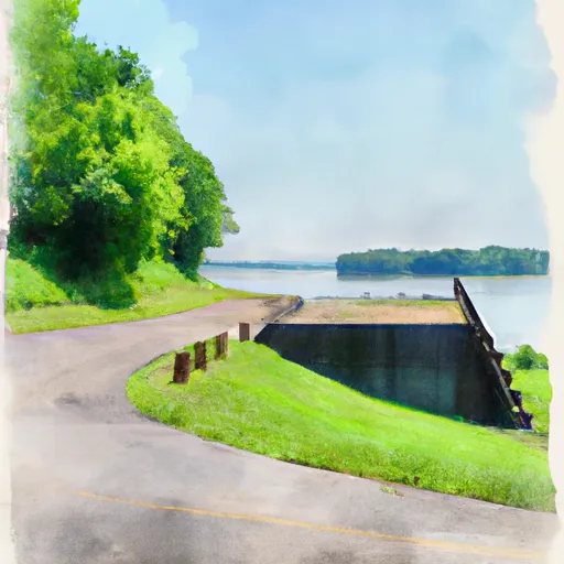
College Hill Road Madison County
One possible option is the boat ramp located at Fort Boonesborough State Park (latitude: 37.857758, longitude: -84.264007), which is just a few miles northwest of Madison County. This boat ramp provides access to the Kentucky River and is open to a variety of watercraft, including powerboats, kayaks, and canoes. The ramp is said to be "wide and easy to navigate" by visitors and can accommodate several boats at once.
Another potential option is the boat ramp at Valley View Ferry (latitude: 37.827919, longitude: -84.232000), which is situated on the Kentucky River just south of Madison County. This ramp is open to the public and allows access to the river for fishing, boating, and other recreational activities. It is also wide enough to accommodate multiple boats at once.
Overall, while I could not locate a specific boat ramp named "College Hill Road" in Madison County, there are several other options in the area that may offer similar access to local waterways. It is important to verify the latest information with local authorities before using any boat ramp to ensure accuracy and safety.
Plan your launch down to the hour
Same weather feed Snoflo's iOS app uses -- updated continuously from NOAA / yr.no.
Next 5 days, hour by hour
Temperature line with weather symbols on top, snow + rain accumulation as columns, humidity as a dotted line.
5-day forecast table
Every 3 hours, broken out across temperature, snow, rain, humidity, and wind.
| Time | Condition | Temp (°F) | Snow (in) | Rain (in) | Humidity (%) | Wind (mps) | Wind dir |
|---|---|---|---|---|---|---|---|
| Loading detailed forecast… | |||||||
15-day temperature & precipitation
Daily temperatures, snow, and rain projected over the next two weeks.
Area streamflow levels
USGS streamgauges around College Hill Road Madison County -- the same readings that determine whether your launch is safe and your boat is the right craft.
| Streamgauge | Discharge | View |
|---|---|---|
| Kentucky River At Lock 11 Near College Hill | 1,030 cfs | → |
| Red River At Clay City | 83 cfs | → |
| Kentucky River At Lock 10 Near Winchester | 1,200 cfs | → |
| Kentucky River At Lock 12 Near Irvine | · | → |
| Slate Creek At Highway 713 Nr Mt. Sterling | 18 cfs | → |
| Kentucky River At Lock 9 At Valley View | 1,390 cfs | → |
Plan a longer trip
The closest paddle runs, fishing spots, and other boat launches so you can extend a day on the water.
River runs
Boating safety & etiquette
- Check the conditions before you launch
- Use the streamflow numbers, weather, and wind forecast on this page. High-cfs whitewater requires whitewater-specific craft and skill.
- Wear your life jacket
- Statistically the single biggest survival factor in a boating incident. State law often requires one per passenger.
- File a float plan
- Tell someone on shore your put-in, take-out, and expected return time. Especially for multi-day or remote trips.
- Yield at the ramp
- Prep gear in the parking lot, not on the ramp. Launch and clear quickly so others can use the lane.
- Clean, drain, dry
- Inspect, clean, drain and dry your boat between waters to prevent the spread of aquatic invasive species.
Set push alerts in the Snoflo app
Save College Hill Road Madison County as a favorite, set a discharge threshold or a wind/precipitation alert, and the iOS app will push the moment conditions cross.
About College Hill Road Madison County
Can I launch a motorboat here?
Most Snoflo-tracked launches support motorboats; check the operator for any horsepower restrictions, paddle-only zones, or seasonal closures.
How fresh is the streamflow data?
USGS streamgauges report continuously (every 15 minutes); the table on this page pulls the latest reading at page load.
Is there a fee?
Many federal and state boat launches charge a day-use fee. Check the operator's site before driving out.
What boat is right for these conditions?
Use the nearby streamflow numbers and river-run panel on this page to gauge current conditions. Wider, slower water is friendly for casual paddling and powerboats; high-cfs whitewater requires whitewater-specific craft and skill.
Can I get alerts when conditions change?
Yes -- alerts are managed in the Snoflo iOS app. Favorite this launch, set a threshold (discharge, wind), and you'll get a push the moment it crosses.
Other launches near here
Snoflo-tracked boat launches within driving distance of College Hill Road Madison County.