Red Bridge Road 16, Wilbraham boat launch
Community Reviews
Been here? Share the conditions.
Reviews, ratings & photos are added in the free Snoflo iOS app — rate a spot, tag the conditions, and your visit is verified by location. Add or manage your reviews from the app.
Red Bridge Road 16, Wilbraham
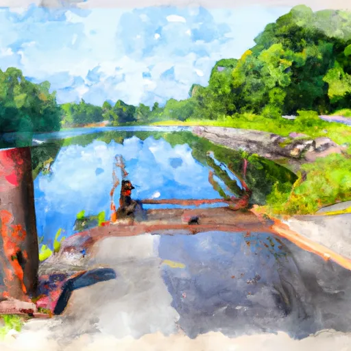
This boat ramp services the Chicopee River, which flows through several towns in Massachusetts. The river is a popular destination for recreational boating, fishing, and other water activities. The boat ramp is accessible from Red Bridge Road and provides easy access to the river for boaters.
The type of craft permitted on the water depends on the size and horsepower of the boat. Generally, small boats and watercraft, including canoes, kayaks, and rowboats, are allowed on the Chicopee River. Motorized boats must comply with Massachusetts Department of Environmental Protection regulations regarding horsepower and emissions.
In summary, the Red Bridge Road 16 boat ramp in Wilbraham, Massachusetts is a concrete ramp that is approximately 40 feet wide and suitable for launching small boats and watercraft. It services the Chicopee River and is accessible from Red Bridge Road. Small boats and watercraft, including canoes, kayaks, and rowboats, are permitted on the water, while larger boats must comply with state regulations.
Plan your launch down to the hour
Same weather feed Snoflo's iOS app uses -- updated continuously from NOAA / yr.no.
Next 5 days, hour by hour
Temperature line with weather symbols on top, snow + rain accumulation as columns, humidity as a dotted line.
5-day forecast table
Every 3 hours, broken out across temperature, snow, rain, humidity, and wind.
| Time | Condition | Temp (°F) | Snow (in) | Rain (in) | Humidity (%) | Wind (mps) | Wind dir |
|---|---|---|---|---|---|---|---|
| Loading detailed forecast… | |||||||
15-day temperature & precipitation
Daily temperatures, snow, and rain projected over the next two weeks.
Area streamflow levels
USGS streamgauges around Red Bridge Road 16, Wilbraham -- the same readings that determine whether your launch is safe and your boat is the right craft.
| Streamgauge | Discharge | View |
|---|---|---|
| Chicopee River At Indian Orchard | 238 cfs | → |
| Swift River At West Ware | 49 cfs | → |
| Quaboag River At West Brimfield | 65 cfs | → |
| Ware River At Gibbs Crossing | 60 cfs | → |
| Connecticut R At Interstate 391 Bridge At Holyoke | 4,080 cfs | → |
| Quinebaug R Bl E Brimfield Dam At Fiskdale | 32 cfs | → |
Plan a longer trip
The closest paddle runs, fishing spots, and other boat launches so you can extend a day on the water.
River runs
- Begins Below The Tailrace Of The Rainbow Dam To The Confluence With The Connecticut River
- The Confluence Of The East And West Branches To The Confluence With The Farmington River In East Granby
- The Massachusetts-Connecticut State Line In Hartland To The Confluence With The Salmon Brook Main Stem
- The Hartland Headwaters To The Confluence With The Salmon Brook Main Stem
- New Hartford/Canton Town Line To The Confluence With The Nepaug River
- The Confluence With The Nepaug River To A Point 0.2 Miles Below The Lower Collinsville Dam Tailrace
Boating safety & etiquette
- Check the conditions before you launch
- Use the streamflow numbers, weather, and wind forecast on this page. High-cfs whitewater requires whitewater-specific craft and skill.
- Wear your life jacket
- Statistically the single biggest survival factor in a boating incident. State law often requires one per passenger.
- File a float plan
- Tell someone on shore your put-in, take-out, and expected return time. Especially for multi-day or remote trips.
- Yield at the ramp
- Prep gear in the parking lot, not on the ramp. Launch and clear quickly so others can use the lane.
- Clean, drain, dry
- Inspect, clean, drain and dry your boat between waters to prevent the spread of aquatic invasive species.
Set push alerts in the Snoflo app
Save Red Bridge Road 16, Wilbraham as a favorite, set a discharge threshold or a wind/precipitation alert, and the iOS app will push the moment conditions cross.
About Red Bridge Road 16, Wilbraham
Can I launch a motorboat here?
Most Snoflo-tracked launches support motorboats; check the operator for any horsepower restrictions, paddle-only zones, or seasonal closures.
How fresh is the streamflow data?
USGS streamgauges report continuously (every 15 minutes); the table on this page pulls the latest reading at page load.
Is there a fee?
Many federal and state boat launches charge a day-use fee. Check the operator's site before driving out.
What boat is right for these conditions?
Use the nearby streamflow numbers and river-run panel on this page to gauge current conditions. Wider, slower water is friendly for casual paddling and powerboats; high-cfs whitewater requires whitewater-specific craft and skill.
Can I get alerts when conditions change?
Yes -- alerts are managed in the Snoflo iOS app. Favorite this launch, set a threshold (discharge, wind), and you'll get a push the moment it crosses.
Other launches near here
Snoflo-tracked boat launches within driving distance of Red Bridge Road 16, Wilbraham.