Quaboag Street 131-199, Brookfield Boat Launch
Community Reviews
Been here? Share the conditions.
Reviews, ratings & photos are added in the free Snoflo iOS app — rate a spot, tag the conditions, and your visit is verified by location. Add or manage your reviews from the app.
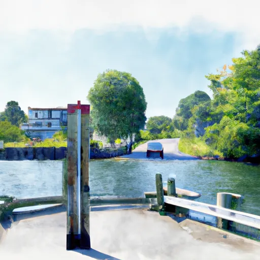
Quaboag Street 131-199, Brookfield
According to the latest information available, the Quaboag Street boat ramp is open to the public and can be used by anyone who has a valid boating license and registration. The pond itself is relatively small, covering an area of about 600 acres, and it is primarily used for fishing, swimming, and recreational boating. The pond is stocked with various species of fish, including bass, trout, and pickerel, which makes it popular among anglers.
In terms of the types of boats that are permitted on the water, the pond has a speed limit of 45 miles per hour, which means that high-speed motorboats are not allowed. However, boaters can use canoes, kayaks, rowboats, and small motorized boats, as long as they comply with the speed limit and other safety regulations.
Overall, the Quaboag Street boat ramp is a convenient and well-maintained facility that provides easy access to the Quaboag Pond for boaters and anglers alike. Its location in Brookfield, Massachusetts, makes it easily accessible from nearby towns and cities, and its ample parking space and wide ramp make it an ideal spot for launching and retrieving boats of various sizes.
Plan your launch down to the hour
Same weather feed Snoflo's iOS app uses -- updated continuously from NOAA / yr.no.
Next 5 days, hour by hour
Temperature line with weather symbols on top, snow + rain accumulation as columns, humidity as a dotted line.
5-day forecast table
Every 3 hours, broken out across temperature, snow, rain, humidity, and wind.
| Time | Condition | Temp (°F) | Snow (in) | Rain (in) | Humidity (%) | Wind (mps) | Wind dir |
|---|---|---|---|---|---|---|---|
| Loading detailed forecast… | |||||||
15-day temperature & precipitation
Daily temperatures, snow, and rain projected over the next two weeks.
Area streamflow levels
USGS streamgauges around Quaboag Street 131-199, Brookfield -- the same readings that determine whether your launch is safe and your boat is the right craft.
| Streamgauge | Discharge | View |
|---|---|---|
| Sevenmile River Near Spencer | 1 cfs | → |
| Quinebaug R Bl E Brimfield Dam At Fiskdale | 22 cfs | → |
| Quinebaug R Bl Westville Dam Nr Southbridge | 41 cfs | → |
| Quaboag River At West Brimfield | 56 cfs | → |
| Little River Near Oxford | 4 cfs | → |
| Ware River At Gibbs Crossing | 57 cfs | → |
Plan a longer trip
The closest paddle runs, fishing spots, and other boat launches so you can extend a day on the water.
Boating safety & etiquette
- Check the conditions before you launch
- Use the streamflow numbers, weather, and wind forecast on this page. High-cfs whitewater requires whitewater-specific craft and skill.
- Wear your life jacket
- Statistically the single biggest survival factor in a boating incident. State law often requires one per passenger.
- File a float plan
- Tell someone on shore your put-in, take-out, and expected return time. Especially for multi-day or remote trips.
- Yield at the ramp
- Prep gear in the parking lot, not on the ramp. Launch and clear quickly so others can use the lane.
- Clean, drain, dry
- Inspect, clean, drain and dry your boat between waters to prevent the spread of aquatic invasive species.
Set push alerts in the Snoflo app
Save Quaboag Street 131-199, Brookfield as a favorite, set a discharge threshold or a wind/precipitation alert, and the iOS app will push the moment conditions cross.
About Quaboag Street 131-199, Brookfield
Can I launch a motorboat here?
Most Snoflo-tracked launches support motorboats; check the operator for any horsepower restrictions, paddle-only zones, or seasonal closures.
How fresh is the streamflow data?
USGS streamgauges report continuously (every 15 minutes); the table on this page pulls the latest reading at page load.
Is there a fee?
Many federal and state boat launches charge a day-use fee. Check the operator's site before driving out.
What boat is right for these conditions?
Use the nearby streamflow numbers and river-run panel on this page to gauge current conditions. Wider, slower water is friendly for casual paddling and powerboats; high-cfs whitewater requires whitewater-specific craft and skill.
Can I get alerts when conditions change?
Yes -- alerts are managed in the Snoflo iOS app. Favorite this launch, set a threshold (discharge, wind), and you'll get a push the moment it crosses.
Other launches near here
Snoflo-tracked boat launches within driving distance of Quaboag Street 131-199, Brookfield.