Lake Michigan, Suttons Bay, Leelanau County Boat Launch
Community Reviews
Been here? Share the conditions.
Reviews, ratings & photos are added in the free Snoflo iOS app — rate a spot, tag the conditions, and your visit is verified by location. Add or manage your reviews from the app.
Lake Michigan, Suttons Bay, Leelanau County
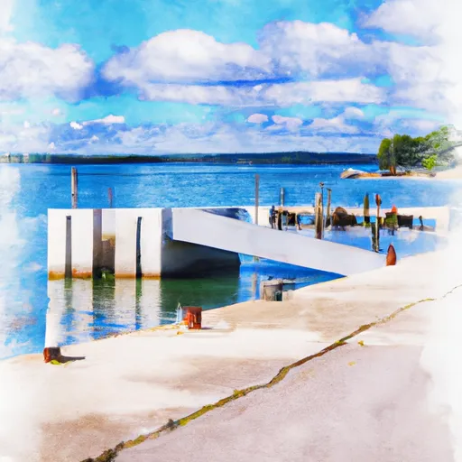
According to the Michigan Department of Natural Resources (DNR) website, the boat ramp named Lake Michigan is located in Suttons Bay, Leelanau County, Michigan. It is a concrete ramp that is 25 feet wide, with a maximum depth of 6 feet. The boat ramp provides access to Lake Michigan, which is a large body of freshwater in the Great Lakes system.
The DNR website states that the boat ramp is suitable for launching small to medium-sized watercraft, including boats, jet skis, and kayaks. However, the website notes that the ramp may not be suitable for larger vessels, and users should exercise caution when launching and retrieving their boats.
The latest information available suggests that the boat ramp is well-maintained and provides easy access to Lake Michigan. Users are encouraged to follow all safety guidelines and regulations, including wearing personal flotation devices, observing speed limits, and avoiding areas of high boat traffic.
Plan your launch down to the hour
Same weather feed Snoflo's iOS app uses -- updated continuously from NOAA / yr.no.
Next 5 days, hour by hour
Temperature line with weather symbols on top, snow + rain accumulation as columns, humidity as a dotted line.
5-day forecast table
Every 3 hours, broken out across temperature, snow, rain, humidity, and wind.
| Time | Condition | Temp (°F) | Snow (in) | Rain (in) | Humidity (%) | Wind (mps) | Wind dir |
|---|---|---|---|---|---|---|---|
| Loading detailed forecast… | |||||||
15-day temperature & precipitation
Daily temperatures, snow, and rain projected over the next two weeks.
Area streamflow levels
USGS streamgauges around Lake Michigan, Suttons Bay, Leelanau County -- the same readings that determine whether your launch is safe and your boat is the right craft.
| Streamgauge | Discharge | View |
|---|---|---|
| Boardman R Above Brown Bridge Road Nr Mayfield | 139 cfs | → |
| Jordan River Near East Jordan | 183 cfs | → |
| Platte River At Honor | 145 cfs | → |
Plan a longer trip
The closest paddle runs, fishing spots, and other boat launches so you can extend a day on the water.
River runs
- Southeastern Boundary Of Sleeping Bear Dunes National Lakeshore To Northwetern Boundary Of Sleeping Bear Dunes National Lakeshore
- Southern Boundary Of Sleeping Bear Dunes National Lakeshore To Mouth At Lake Michigan
Boating safety & etiquette
- Check the conditions before you launch
- Use the streamflow numbers, weather, and wind forecast on this page. High-cfs whitewater requires whitewater-specific craft and skill.
- Wear your life jacket
- Statistically the single biggest survival factor in a boating incident. State law often requires one per passenger.
- File a float plan
- Tell someone on shore your put-in, take-out, and expected return time. Especially for multi-day or remote trips.
- Yield at the ramp
- Prep gear in the parking lot, not on the ramp. Launch and clear quickly so others can use the lane.
- Clean, drain, dry
- Inspect, clean, drain and dry your boat between waters to prevent the spread of aquatic invasive species.
Set push alerts in the Snoflo app
Save Lake Michigan, Suttons Bay, Leelanau County as a favorite, set a discharge threshold or a wind/precipitation alert, and the iOS app will push the moment conditions cross.
About Lake Michigan, Suttons Bay, Leelanau County
Can I launch a motorboat here?
Most Snoflo-tracked launches support motorboats; check the operator for any horsepower restrictions, paddle-only zones, or seasonal closures.
How fresh is the streamflow data?
USGS streamgauges report continuously (every 15 minutes); the table on this page pulls the latest reading at page load.
Is there a fee?
Many federal and state boat launches charge a day-use fee. Check the operator's site before driving out.
What boat is right for these conditions?
Use the nearby streamflow numbers and river-run panel on this page to gauge current conditions. Wider, slower water is friendly for casual paddling and powerboats; high-cfs whitewater requires whitewater-specific craft and skill.
Can I get alerts when conditions change?
Yes -- alerts are managed in the Snoflo iOS app. Favorite this launch, set a threshold (discharge, wind), and you'll get a push the moment it crosses.
Other launches near here
Snoflo-tracked boat launches within driving distance of Lake Michigan, Suttons Bay, Leelanau County.