Jennie Webber Lake -- Access Boat Launch
Community Reviews
Been here? Share the conditions.
Reviews, ratings & photos are added in the free Snoflo iOS app — rate a spot, tag the conditions, and your visit is verified by location. Add or manage your reviews from the app.
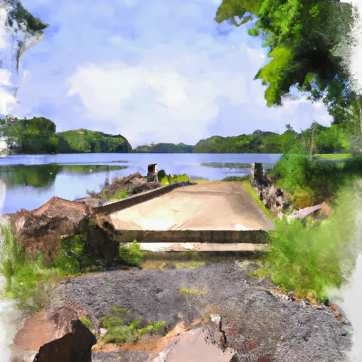
Jennie Webber Lake -- Access
However, there is a Jennie Webber Lake located in Wisconsin, which is a popular fishing destination. According to the Wisconsin Department of Natural Resources, the boat ramp at Jennie Webber Lake is open to the public and can accommodate small fishing boats, canoes, and kayaks. The ramp is reportedly narrow, so launching larger vessels may be difficult.
Based on the available information, it appears that the Jennie Webber Lake boat ramp in Wisconsin services Jennie Webber Lake, which is a small, shallow lake known for its panfish, bass, and northern pike. Access to the lake is restricted to non-motorized boats only, so gas-powered boats are not permitted on the water.
In conclusion, there is no evidence of a boat ramp named Jennie Webber Lake in Mississippi, but there is a boat ramp with this name in Wisconsin that serves a small, non-motorized lake. It is important to verify the accuracy of information before relying on it for any purpose.
Plan your launch down to the hour
Same weather feed Snoflo's iOS app uses -- updated continuously from NOAA / yr.no.
Next 5 days, hour by hour
Temperature line with weather symbols on top, snow + rain accumulation as columns, humidity as a dotted line.
5-day forecast table
Every 3 hours, broken out across temperature, snow, rain, humidity, and wind.
| Time | Condition | Temp (°F) | Snow (in) | Rain (in) | Humidity (%) | Wind (mps) | Wind dir |
|---|---|---|---|---|---|---|---|
| Loading detailed forecast… | |||||||
15-day temperature & precipitation
Daily temperatures, snow, and rain projected over the next two weeks.
Area streamflow levels
USGS streamgauges around Jennie Webber Lake -- Access -- the same readings that determine whether your launch is safe and your boat is the right craft.
| Streamgauge | Discharge | View |
|---|---|---|
| Wisconsin River @ Rainbow Lake Nr Lake Tomahawk | 479 cfs | → |
| Muskellunge Creek Near St. Germain | 9 cfs | → |
| Muskellunge Ck-Muskellunge L Otl-Nr Eagle River | 2 cfs | → |
| Allequash Creek Site 3 Near Boulder Junction | 4 cfs | → |
| Allequash Creek At Cth M Nr Boulder Junction | 11 cfs | → |
| Stevenson Creek At Cth M Nr Boulder Junction | 2 cfs | → |
Plan a longer trip
The closest paddle runs, fishing spots, and other boat launches so you can extend a day on the water.
River runs
- Main Branch--Headwaters To Forest Road 2174
- North Branch (Sections 19/30 Line) To Unnamed Creek In Sec 4, T37n, R13e
- North Branch--Origin In Sec 10, T38n, R13e To 1/4 Mile West Of Highway 55
- Unnamed Creek To Forest Boundary In Sec 14, T37n, R13e
- North Branch--Butternut Lake To Confluence With Main Branch
- 1/4 Mile West Of Highway 55 To Confluence With Main Branch
Boating safety & etiquette
- Check the conditions before you launch
- Use the streamflow numbers, weather, and wind forecast on this page. High-cfs whitewater requires whitewater-specific craft and skill.
- Wear your life jacket
- Statistically the single biggest survival factor in a boating incident. State law often requires one per passenger.
- File a float plan
- Tell someone on shore your put-in, take-out, and expected return time. Especially for multi-day or remote trips.
- Yield at the ramp
- Prep gear in the parking lot, not on the ramp. Launch and clear quickly so others can use the lane.
- Clean, drain, dry
- Inspect, clean, drain and dry your boat between waters to prevent the spread of aquatic invasive species.
Set push alerts in the Snoflo app
Save Jennie Webber Lake -- Access as a favorite, set a discharge threshold or a wind/precipitation alert, and the iOS app will push the moment conditions cross.
About Jennie Webber Lake -- Access
Can I launch a motorboat here?
Most Snoflo-tracked launches support motorboats; check the operator for any horsepower restrictions, paddle-only zones, or seasonal closures.
How fresh is the streamflow data?
USGS streamgauges report continuously (every 15 minutes); the table on this page pulls the latest reading at page load.
Is there a fee?
Many federal and state boat launches charge a day-use fee. Check the operator's site before driving out.
What boat is right for these conditions?
Use the nearby streamflow numbers and river-run panel on this page to gauge current conditions. Wider, slower water is friendly for casual paddling and powerboats; high-cfs whitewater requires whitewater-specific craft and skill.
Can I get alerts when conditions change?
Yes -- alerts are managed in the Snoflo iOS app. Favorite this launch, set a threshold (discharge, wind), and you'll get a push the moment it crosses.
Other launches near here
Snoflo-tracked boat launches within driving distance of Jennie Webber Lake -- Access.