Wisconsin River -- Mazo Town Boat Landing Boat Launch
Community Reviews
Been here? Share the conditions.
Reviews, ratings & photos are added in the free Snoflo iOS app — rate a spot, tag the conditions, and your visit is verified by location. Add or manage your reviews from the app.
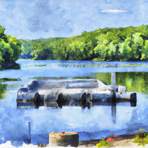
Wisconsin River -- Mazo Town Boat Landing
However, I can provide general information about boat ramps on the Wisconsin River. Boat ramps can vary in size and shape, but they are generally designed to allow boats and other watercraft to be launched into the water. The Wisconsin River is a popular destination for recreational boating, fishing, and other water-based activities.
The width of a boat ramp can also vary, but they are typically wide enough to accommodate a single vehicle and boat trailer. Some boat ramps may have multiple launch lanes to accommodate more traffic.
The Wisconsin River services a large area of central and northern Wisconsin, stretching approximately 430 miles from the northern part of the state to its confluence with the Mississippi River near Prairie du Chien. The river is a major tributary of the Mississippi River and is known for its scenic beauty and diverse wildlife.
A variety of watercraft are permitted on the Wisconsin River, including motorized boats, kayaks, canoes, and paddleboards. However, specific regulations may vary depending on the section of the river and local ordinances. It is important to check with local authorities before launching any watercraft on the Wisconsin River.
Plan your launch down to the hour
Same weather feed Snoflo's iOS app uses -- updated continuously from NOAA / yr.no.
Next 5 days, hour by hour
Temperature line with weather symbols on top, snow + rain accumulation as columns, humidity as a dotted line.
5-day forecast table
Every 3 hours, broken out across temperature, snow, rain, humidity, and wind.
| Time | Condition | Temp (°F) | Snow (in) | Rain (in) | Humidity (%) | Wind (mps) | Wind dir |
|---|---|---|---|---|---|---|---|
| Loading detailed forecast… | |||||||
15-day temperature & precipitation
Daily temperatures, snow, and rain projected over the next two weeks.
Area streamflow levels
USGS streamgauges around Wisconsin River -- Mazo Town Boat Landing -- the same readings that determine whether your launch is safe and your boat is the right craft.
| Streamgauge | Discharge | View |
|---|---|---|
| Black Earth Creek At Black Earth | 37 cfs | → |
| Brewery Creek-Upstream Site-At Cross Plains | 1 cfs | → |
| Pheasant Branch At Airport Road Nr Middleton | · | → |
| Pheasant Branch At Middleton | 2 cfs | → |
| Spring Creek Near Waunakee | 3 cfs | → |
| Baraboo River Near Baraboo | 264 cfs | → |
Plan a longer trip
The closest paddle runs, fishing spots, and other boat launches so you can extend a day on the water.
Boating safety & etiquette
- Check the conditions before you launch
- Use the streamflow numbers, weather, and wind forecast on this page. High-cfs whitewater requires whitewater-specific craft and skill.
- Wear your life jacket
- Statistically the single biggest survival factor in a boating incident. State law often requires one per passenger.
- File a float plan
- Tell someone on shore your put-in, take-out, and expected return time. Especially for multi-day or remote trips.
- Yield at the ramp
- Prep gear in the parking lot, not on the ramp. Launch and clear quickly so others can use the lane.
- Clean, drain, dry
- Inspect, clean, drain and dry your boat between waters to prevent the spread of aquatic invasive species.
Set push alerts in the Snoflo app
Save Wisconsin River -- Mazo Town Boat Landing as a favorite, set a discharge threshold or a wind/precipitation alert, and the iOS app will push the moment conditions cross.
About Wisconsin River -- Mazo Town Boat Landing
Can I launch a motorboat here?
Most Snoflo-tracked launches support motorboats; check the operator for any horsepower restrictions, paddle-only zones, or seasonal closures.
How fresh is the streamflow data?
USGS streamgauges report continuously (every 15 minutes); the table on this page pulls the latest reading at page load.
Is there a fee?
Many federal and state boat launches charge a day-use fee. Check the operator's site before driving out.
What boat is right for these conditions?
Use the nearby streamflow numbers and river-run panel on this page to gauge current conditions. Wider, slower water is friendly for casual paddling and powerboats; high-cfs whitewater requires whitewater-specific craft and skill.
Can I get alerts when conditions change?
Yes -- alerts are managed in the Snoflo iOS app. Favorite this launch, set a threshold (discharge, wind), and you'll get a push the moment it crosses.
Other launches near here
Snoflo-tracked boat launches within driving distance of Wisconsin River -- Mazo Town Boat Landing.