Highway 28, Fontana Dam Boat Launch
Community Reviews
Been here? Share the conditions.
Reviews, ratings & photos are added in the free Snoflo iOS app — rate a spot, tag the conditions, and your visit is verified by location. Add or manage your reviews from the app.
Highway 28, Fontana Dam
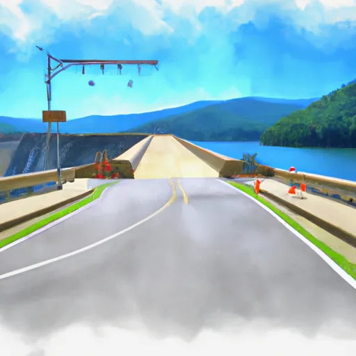
Fontana Lake is a large reservoir located in western North Carolina, which offers a variety of recreational activities such as boating, fishing, and swimming. The lake has a total area of approximately 10,230 acres and is surrounded by the Great Smoky Mountains National Park, making it a popular destination for outdoor enthusiasts.
Various kinds of watercraft are permitted on the Fontana Lake, including motorized boats, canoes, kayaks, and sailboats. However, personal watercraft such as jet skis are not allowed on the lake.
The information provided here is accurate as of the time of writing, but it is always recommended to verify the latest information before planning a visit to the Highway 28 boat ramp at Fontana Dam in North Carolina.
Plan your launch down to the hour
Same weather feed Snoflo's iOS app uses -- updated continuously from NOAA / yr.no.
Next 5 days, hour by hour
Temperature line with weather symbols on top, snow + rain accumulation as columns, humidity as a dotted line.
5-day forecast table
Every 3 hours, broken out across temperature, snow, rain, humidity, and wind.
| Time | Condition | Temp (°F) | Snow (in) | Rain (in) | Humidity (%) | Wind (mps) | Wind dir |
|---|---|---|---|---|---|---|---|
| Loading detailed forecast… | |||||||
15-day temperature & precipitation
Daily temperatures, snow, and rain projected over the next two weeks.
Area streamflow levels
USGS streamgauges around Highway 28, Fontana Dam -- the same readings that determine whether your launch is safe and your boat is the right craft.
| Streamgauge | Discharge | View |
|---|---|---|
| Cheoah River Nr Bearpen Gap Nr Tapoco | 122 cfs | → |
| Little River Above Townsend | 258 cfs | → |
| Little Tennessee River At Needmore | 548 cfs | → |
| Tuckasegee River At Bryson City | 947 cfs | → |
| Valley River At Tomotla | 212 cfs | → |
| Little River Near Maryville | 356 cfs | → |
Plan a longer trip
The closest paddle runs, fishing spots, and other boat launches so you can extend a day on the water.
River runs
- Polecat Branch To Snowbird Picnic Area
- Owlcamp Branch To Polecat Branch
- Headwaters Near Mitchell Lick To Owlcamp Branch
- Natahala Powerhouse To Lake Fontana (River Mile 4)
- Headwaters Near Graham County Line To Nc/Tn State Line
- Headwaters In Standing Indian Basin To Slackwater Of Natahala Lake
Boating safety & etiquette
- Check the conditions before you launch
- Use the streamflow numbers, weather, and wind forecast on this page. High-cfs whitewater requires whitewater-specific craft and skill.
- Wear your life jacket
- Statistically the single biggest survival factor in a boating incident. State law often requires one per passenger.
- File a float plan
- Tell someone on shore your put-in, take-out, and expected return time. Especially for multi-day or remote trips.
- Yield at the ramp
- Prep gear in the parking lot, not on the ramp. Launch and clear quickly so others can use the lane.
- Clean, drain, dry
- Inspect, clean, drain and dry your boat between waters to prevent the spread of aquatic invasive species.
Set push alerts in the Snoflo app
Save Highway 28, Fontana Dam as a favorite, set a discharge threshold or a wind/precipitation alert, and the iOS app will push the moment conditions cross.
About Highway 28, Fontana Dam
Can I launch a motorboat here?
Most Snoflo-tracked launches support motorboats; check the operator for any horsepower restrictions, paddle-only zones, or seasonal closures.
How fresh is the streamflow data?
USGS streamgauges report continuously (every 15 minutes); the table on this page pulls the latest reading at page load.
Is there a fee?
Many federal and state boat launches charge a day-use fee. Check the operator's site before driving out.
What boat is right for these conditions?
Use the nearby streamflow numbers and river-run panel on this page to gauge current conditions. Wider, slower water is friendly for casual paddling and powerboats; high-cfs whitewater requires whitewater-specific craft and skill.
Can I get alerts when conditions change?
Yes -- alerts are managed in the Snoflo iOS app. Favorite this launch, set a threshold (discharge, wind), and you'll get a push the moment it crosses.
Other launches near here
Snoflo-tracked boat launches within driving distance of Highway 28, Fontana Dam.