Spillway Recreation Area Boat Launch
Community Reviews
Been here? Share the conditions.
Reviews, ratings & photos are added in the free Snoflo iOS app — rate a spot, tag the conditions, and your visit is verified by location. Add or manage your reviews from the app.
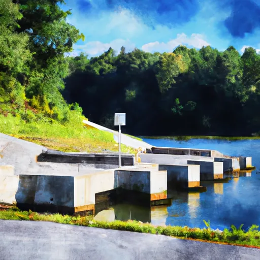
Spillway Recreation Area
According to the Pennsylvania Fish and Boat Commission, the Youghiogheny River is classified as a Class I and II waterway, which means that it is suitable for a wide range of watercraft, including canoes, kayaks, rowboats, and motorized boats. However, the commission notes that the river can be dangerous during periods of high water, and recommends that boaters use caution and wear appropriate safety gear at all times.
In addition to boating and fishing, the Spillway Recreation Area also offers a range of other recreational activities, including hiking, picnicking, and camping. The area is located near several other popular outdoor destinations, including Ohiopyle State Park and Laurel Ridge State Park, making it a popular destination for outdoor enthusiasts throughout the region.
Plan your launch down to the hour
Same weather feed Snoflo's iOS app uses -- updated continuously from NOAA / yr.no.
Next 5 days, hour by hour
Temperature line with weather symbols on top, snow + rain accumulation as columns, humidity as a dotted line.
5-day forecast table
Every 3 hours, broken out across temperature, snow, rain, humidity, and wind.
| Time | Condition | Temp (°F) | Snow (in) | Rain (in) | Humidity (%) | Wind (mps) | Wind dir |
|---|---|---|---|---|---|---|---|
| Loading detailed forecast… | |||||||
15-day temperature & precipitation
Daily temperatures, snow, and rain projected over the next two weeks.
Area streamflow levels
USGS streamgauges around Spillway Recreation Area -- the same readings that determine whether your launch is safe and your boat is the right craft.
| Streamgauge | Discharge | View |
|---|---|---|
| Youghiogheny River At Youghiogheny River Dam | 865 cfs | → |
| Youghiogheny River Below Confluence | 1,120 cfs | → |
| Laurel Hill Creek At Ursina | 45 cfs | → |
| Youghiogheny River At Ohiopyle | 1,150 cfs | → |
| Casselman River At Markleton | 149 cfs | → |
| Bear Creek At Friendsville | 29 cfs | → |
Plan a longer trip
The closest paddle runs, fishing spots, and other boat launches so you can extend a day on the water.
River runs
- Begins Below The Youghiogheny River Lake Dam In Confluence, Pennsylvania To Ends In South Connellsville, Pennsylvania
- Begins As River Passes Under The Herrington Manor Road Bridge At Oakland, Maryland To The Corporate Boundary Of Friendsville, Maryland
Boating safety & etiquette
- Check the conditions before you launch
- Use the streamflow numbers, weather, and wind forecast on this page. High-cfs whitewater requires whitewater-specific craft and skill.
- Wear your life jacket
- Statistically the single biggest survival factor in a boating incident. State law often requires one per passenger.
- File a float plan
- Tell someone on shore your put-in, take-out, and expected return time. Especially for multi-day or remote trips.
- Yield at the ramp
- Prep gear in the parking lot, not on the ramp. Launch and clear quickly so others can use the lane.
- Clean, drain, dry
- Inspect, clean, drain and dry your boat between waters to prevent the spread of aquatic invasive species.
Set push alerts in the Snoflo app
Save Spillway Recreation Area as a favorite, set a discharge threshold or a wind/precipitation alert, and the iOS app will push the moment conditions cross.
About Spillway Recreation Area
Can I launch a motorboat here?
Most Snoflo-tracked launches support motorboats; check the operator for any horsepower restrictions, paddle-only zones, or seasonal closures.
How fresh is the streamflow data?
USGS streamgauges report continuously (every 15 minutes); the table on this page pulls the latest reading at page load.
Is there a fee?
Many federal and state boat launches charge a day-use fee. Check the operator's site before driving out.
What boat is right for these conditions?
Use the nearby streamflow numbers and river-run panel on this page to gauge current conditions. Wider, slower water is friendly for casual paddling and powerboats; high-cfs whitewater requires whitewater-specific craft and skill.
Can I get alerts when conditions change?
Yes -- alerts are managed in the Snoflo iOS app. Favorite this launch, set a threshold (discharge, wind), and you'll get a push the moment it crosses.
Other launches near here
Snoflo-tracked boat launches within driving distance of Spillway Recreation Area.