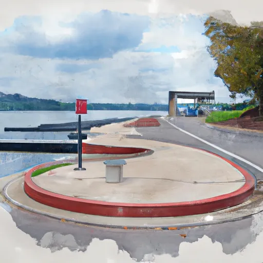
South Northshore Drive 10920-11098, Knoxville Boat Launch
Community Reviews
Been here? Share the conditions.
Reviews, ratings & photos are added in the free Snoflo iOS app — rate a spot, tag the conditions, and your visit is verified by location. Add or manage your reviews from the app.
South Northshore Drive 10920-11098, Knoxville
The South Northshore Drive boat ramp provides access to the Tennessee River, which flows through Knoxville and is a popular destination for boating, fishing, and other water-based activities. The Tennessee River is a large body of water, with a total length of 652 miles, and it is home to a wide variety of fish species, including bass, catfish, and crappie.
The TWRA allows a wide range of watercraft to be launched from the South Northshore Drive boat ramp, including motorized boats, jet skis, kayaks, and canoes. However, the agency does enforce certain rules and regulations to ensure the safety of all boaters and protect the natural environment. For example, all boats must have a valid registration, and operators must have a boating safety education certificate. Additionally, there are restrictions on the use of certain types of equipment, such as wakeboards and water skis, in certain areas of the river.
Overall, the South Northshore Drive boat ramp is a popular and well-maintained facility that provides convenient access to one of Knoxville's most beautiful natural resources. Boaters of all experience levels can enjoy the scenery, fish for a variety of species, or simply relax and take in the view.
Plan your launch down to the hour
Same weather feed Snoflo's iOS app uses -- updated continuously from NOAA / yr.no.
Next 5 days, hour by hour
Temperature line with weather symbols on top, snow + rain accumulation as columns, humidity as a dotted line.
5-day forecast table
Every 3 hours, broken out across temperature, snow, rain, humidity, and wind.
| Time | Condition | Temp (°F) | Snow (in) | Rain (in) | Humidity (%) | Wind (mps) | Wind dir |
|---|---|---|---|---|---|---|---|
| Loading detailed forecast… | |||||||
15-day temperature & precipitation
Daily temperatures, snow, and rain projected over the next two weeks.
Area streamflow levels
USGS streamgauges around South Northshore Drive 10920-11098, Knoxville -- the same readings that determine whether your launch is safe and your boat is the right craft.
| Streamgauge | Discharge | View |
|---|---|---|
| Beaver Creek At Solway | 49 cfs | → |
| Little River Near Alcoa | 298 cfs | → |
| Little River Near Maryville | 270 cfs | → |
| Bullrun Creek Near Halls Crossroads | 34 cfs | → |
| Emory River At Oakdale | 872 cfs | → |
| Little River Above Townsend | 191 cfs | → |
Plan a longer trip
The closest paddle runs, fishing spots, and other boat launches so you can extend a day on the water.
Nearby fishing
Boating safety & etiquette
- Check the conditions before you launch
- Use the streamflow numbers, weather, and wind forecast on this page. High-cfs whitewater requires whitewater-specific craft and skill.
- Wear your life jacket
- Statistically the single biggest survival factor in a boating incident. State law often requires one per passenger.
- File a float plan
- Tell someone on shore your put-in, take-out, and expected return time. Especially for multi-day or remote trips.
- Yield at the ramp
- Prep gear in the parking lot, not on the ramp. Launch and clear quickly so others can use the lane.
- Clean, drain, dry
- Inspect, clean, drain and dry your boat between waters to prevent the spread of aquatic invasive species.
Set push alerts in the Snoflo app
Save South Northshore Drive 10920-11098, Knoxville as a favorite, set a discharge threshold or a wind/precipitation alert, and the iOS app will push the moment conditions cross.
About South Northshore Drive 10920-11098, Knoxville
Can I launch a motorboat here?
Most Snoflo-tracked launches support motorboats; check the operator for any horsepower restrictions, paddle-only zones, or seasonal closures.
How fresh is the streamflow data?
USGS streamgauges report continuously (every 15 minutes); the table on this page pulls the latest reading at page load.
Is there a fee?
Many federal and state boat launches charge a day-use fee. Check the operator's site before driving out.
What boat is right for these conditions?
Use the nearby streamflow numbers and river-run panel on this page to gauge current conditions. Wider, slower water is friendly for casual paddling and powerboats; high-cfs whitewater requires whitewater-specific craft and skill.
Can I get alerts when conditions change?
Yes -- alerts are managed in the Snoflo iOS app. Favorite this launch, set a threshold (discharge, wind), and you'll get a push the moment it crosses.
Other launches near here
Snoflo-tracked boat launches within driving distance of South Northshore Drive 10920-11098, Knoxville.