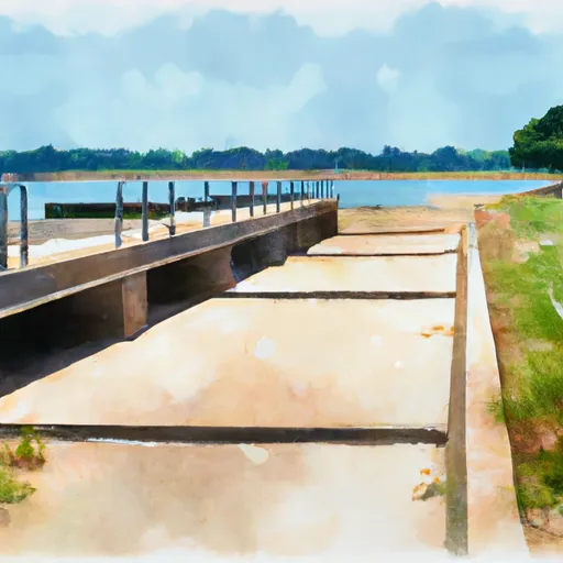
Tyler County boat launch
Community Reviews
Been here? Share the conditions.
Reviews, ratings & photos are added in the free Snoflo iOS app — rate a spot, tag the conditions, and your visit is verified by location. Add or manage your reviews from the app.
Tyler County
However, there are several other boat ramps in Tyler County, Texas that may be of interest to those looking for boating access to local bodies of water. For example, the Martin Dies Jr. State Park boat ramp provides access to the 1,200-acre Martin Dies Jr. State Park Lake, which is open to motorboats, kayaks, canoes, and other watercraft.
Another option is the Turkey Creek Boat Ramp, which provides access to the Neches River and is suitable for smaller boats and kayaks. This ramp is located in the Angelina National Forest and is approximately 15 miles south of the town of Jasper.
Overall, the availability and restrictions of boating access will vary depending on the specific boat ramp and body of water in question. It is always best to check with local authorities and follow posted regulations to ensure a safe and enjoyable boating experience.
Plan your launch down to the hour
Same weather feed Snoflo's iOS app uses -- updated continuously from NOAA / yr.no.
Next 5 days, hour by hour
Temperature line with weather symbols on top, snow + rain accumulation as columns, humidity as a dotted line.
5-day forecast table
Every 3 hours, broken out across temperature, snow, rain, humidity, and wind.
| Time | Condition | Temp (°F) | Snow (in) | Rain (in) | Humidity (%) | Wind (mps) | Wind dir |
|---|---|---|---|---|---|---|---|
| Loading detailed forecast… | |||||||
15-day temperature & precipitation
Daily temperatures, snow, and rain projected over the next two weeks.
Area streamflow levels
USGS streamgauges around Tyler County -- the same readings that determine whether your launch is safe and your boat is the right craft.
| Streamgauge | Discharge | View |
|---|---|---|
| Neches Rv Nr Town Bluff | 2,280 cfs | → |
| Neches Rv Nr Rockland | 2,500 cfs | → |
| Big Cow Ck Nr Newton | 750 cfs | → |
Plan a longer trip
The closest paddle runs, fishing spots, and other boat launches so you can extend a day on the water.
River runs
- Us Highway 69 To Ba Steinhagen Reservoir
- Town Bluff Dam To Hwy 96 Bridge
- Us Highway 59 To Us Highway 69
- Preserve Boundary In The Big Sandy Unit To Confluence With Big Sandy Creek
- Confluence With Big Sandy Creek To Confluence With The Neches River
- Preserve Boundary Of The Big Sandy Unit To Confluence With Village Creek
Nearby fishing
Boating safety & etiquette
- Check the conditions before you launch
- Use the streamflow numbers, weather, and wind forecast on this page. High-cfs whitewater requires whitewater-specific craft and skill.
- Wear your life jacket
- Statistically the single biggest survival factor in a boating incident. State law often requires one per passenger.
- File a float plan
- Tell someone on shore your put-in, take-out, and expected return time. Especially for multi-day or remote trips.
- Yield at the ramp
- Prep gear in the parking lot, not on the ramp. Launch and clear quickly so others can use the lane.
- Clean, drain, dry
- Inspect, clean, drain and dry your boat between waters to prevent the spread of aquatic invasive species.
Set push alerts in the Snoflo app
Save Tyler County as a favorite, set a discharge threshold or a wind/precipitation alert, and the iOS app will push the moment conditions cross.
About Tyler County
Can I launch a motorboat here?
Most Snoflo-tracked launches support motorboats; check the operator for any horsepower restrictions, paddle-only zones, or seasonal closures.
How fresh is the streamflow data?
USGS streamgauges report continuously (every 15 minutes); the table on this page pulls the latest reading at page load.
Is there a fee?
Many federal and state boat launches charge a day-use fee. Check the operator's site before driving out.
What boat is right for these conditions?
Use the nearby streamflow numbers and river-run panel on this page to gauge current conditions. Wider, slower water is friendly for casual paddling and powerboats; high-cfs whitewater requires whitewater-specific craft and skill.
Can I get alerts when conditions change?
Yes -- alerts are managed in the Snoflo iOS app. Favorite this launch, set a threshold (discharge, wind), and you'll get a push the moment it crosses.
Other launches near here
Snoflo-tracked boat launches within driving distance of Tyler County.