123rd Drive Northeast 1709, Lake Stevens Boat Launch
Community Reviews
Been here? Share the conditions.
Reviews, ratings & photos are added in the free Snoflo iOS app — rate a spot, tag the conditions, and your visit is verified by location. Add or manage your reviews from the app.
123rd Drive Northeast 1709, Lake Stevens
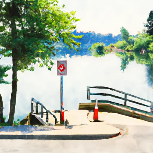
This boat ramp services Lake Stevens, a 1,000-acre freshwater lake located in Snohomish County, Washington. The lake is popular for fishing, boating, and other water-based activities.
According to the Washington State Parks and Recreation Commission, all types of watercraft are permitted on Lake Stevens, including powerboats, sailboats, kayaks, canoes, and stand-up paddleboards. However, it is important to note that there are specific regulations and requirements for different types of watercraft, such as the need for a Washington State Boater Education Card for certain motorized vessels.
Overall, the 123rd Drive Northeast 1709 boat ramp in Lake Stevens provides easy access to the lake for boaters and water enthusiasts of all kinds.
Plan your launch down to the hour
Same weather feed Snoflo's iOS app uses -- updated continuously from NOAA / yr.no.
Next 5 days, hour by hour
Temperature line with weather symbols on top, snow + rain accumulation as columns, humidity as a dotted line.
5-day forecast table
Every 3 hours, broken out across temperature, snow, rain, humidity, and wind.
| Time | Condition | Temp (°F) | Snow (in) | Rain (in) | Humidity (%) | Wind (mps) | Wind dir |
|---|---|---|---|---|---|---|---|
| Loading detailed forecast… | |||||||
15-day temperature & precipitation
Daily temperatures, snow, and rain projected over the next two weeks.
Area streamflow levels
USGS streamgauges around 123rd Drive Northeast 1709, Lake Stevens -- the same readings that determine whether your launch is safe and your boat is the right craft.
| Streamgauge | Discharge | View |
|---|---|---|
| Pilchuck River Near Snohomish | 66 cfs | → |
| Mission Creek Near Tulalip | 2 cfs | → |
| Tulalip Creek Near Tulalip | 7 cfs | → |
| East Branch Tulalip Creek Nr Mouth Nr Tulalip | 2 cfs | → |
| Tulalip Creek Above East Branch Near Tulalip | 4 cfs | → |
| Snohomish River Near Monroe | 1,580 cfs | → |
Plan a longer trip
The closest paddle runs, fishing spots, and other boat launches so you can extend a day on the water.
River runs
- Headwaters In Ne1/4 Of Sec 14, T29n, R10e To Confluence With Canyon Creek
- Canyon Creek To Confluence With North Fork Stillaguamish River
- Headwaters In Sw1/4 Of Sec 7, T31n, R9e To Boulder River Wilderness Boundary
- Boulder River Wilderness Boundary To Confluence With Stillaguamish River
- Confluence Of Tye And Foss Rivers To Gold Bar
- Confluence With Troublesome Creek To Confluence With South Fork Skykomish River
Boating safety & etiquette
- Check the conditions before you launch
- Use the streamflow numbers, weather, and wind forecast on this page. High-cfs whitewater requires whitewater-specific craft and skill.
- Wear your life jacket
- Statistically the single biggest survival factor in a boating incident. State law often requires one per passenger.
- File a float plan
- Tell someone on shore your put-in, take-out, and expected return time. Especially for multi-day or remote trips.
- Yield at the ramp
- Prep gear in the parking lot, not on the ramp. Launch and clear quickly so others can use the lane.
- Clean, drain, dry
- Inspect, clean, drain and dry your boat between waters to prevent the spread of aquatic invasive species.
Set push alerts in the Snoflo app
Save 123rd Drive Northeast 1709, Lake Stevens as a favorite, set a discharge threshold or a wind/precipitation alert, and the iOS app will push the moment conditions cross.
About 123rd Drive Northeast 1709, Lake Stevens
Can I launch a motorboat here?
Most Snoflo-tracked launches support motorboats; check the operator for any horsepower restrictions, paddle-only zones, or seasonal closures.
How fresh is the streamflow data?
USGS streamgauges report continuously (every 15 minutes); the table on this page pulls the latest reading at page load.
Is there a fee?
Many federal and state boat launches charge a day-use fee. Check the operator's site before driving out.
What boat is right for these conditions?
Use the nearby streamflow numbers and river-run panel on this page to gauge current conditions. Wider, slower water is friendly for casual paddling and powerboats; high-cfs whitewater requires whitewater-specific craft and skill.
Can I get alerts when conditions change?
Yes -- alerts are managed in the Snoflo iOS app. Favorite this launch, set a threshold (discharge, wind), and you'll get a push the moment it crosses.
Other launches near here
Snoflo-tracked boat launches within driving distance of 123rd Drive Northeast 1709, Lake Stevens.