Mcdougall Drive 136, Mossyrock Boat Launch
Community Reviews
Been here? Share the conditions.
Reviews, ratings & photos are added in the free Snoflo iOS app — rate a spot, tag the conditions, and your visit is verified by location. Add or manage your reviews from the app.
Mcdougall Drive 136, Mossyrock
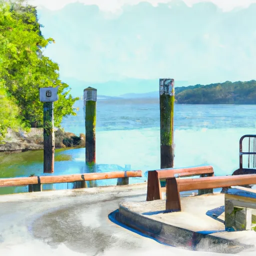
According to the latest information available, the Washington Department of Fish and Wildlife manages the boat ramp and charges a daily launch fee for its use. The ramp is open year-round, but water levels may vary depending on seasonal conditions.
Mayfield Lake is a popular recreational destination for boating, fishing, and swimming. The lake has a surface area of approximately 2,200 acres and is located in Lewis County, Washington. The lake is stocked annually with various species of fish, including rainbow and brown trout, kokanee, and bass.
In summary, McDougall Drive 136 boat ramp is a concrete ramp that provides access to Mayfield Lake, located in Mossyrock, Washington. It is suitable for launching small to medium-sized watercraft, and the ramp is managed by the Washington Department of Fish and Wildlife. Mayfield Lake is a popular recreational destination for boating, fishing, and swimming, and is home to several species of fish.
Plan your launch down to the hour
Same weather feed Snoflo's iOS app uses -- updated continuously from NOAA / yr.no.
Next 5 days, hour by hour
Temperature line with weather symbols on top, snow + rain accumulation as columns, humidity as a dotted line.
5-day forecast table
Every 3 hours, broken out across temperature, snow, rain, humidity, and wind.
| Time | Condition | Temp (°F) | Snow (in) | Rain (in) | Humidity (%) | Wind (mps) | Wind dir |
|---|---|---|---|---|---|---|---|
| Loading detailed forecast… | |||||||
15-day temperature & precipitation
Daily temperatures, snow, and rain projected over the next two weeks.
Area streamflow levels
USGS streamgauges around Mcdougall Drive 136, Mossyrock -- the same readings that determine whether your launch is safe and your boat is the right craft.
| Streamgauge | Discharge | View |
|---|---|---|
| Tilton River Ab Bear Canyon Creek Near Cinebar | 145 cfs | → |
| Cowlitz River Below Mayfield Dam | 2,300 cfs | → |
| Nf Toutle River Below Srs Near Kid Valley | 203 cfs | → |
| South Fork Newaukum River Near Onalaska | 182 cfs | → |
| Cowlitz River Near Kosmos | 1,970 cfs | → |
| South Fork Toutle River At Toutle | 868 cfs | → |
Plan a longer trip
The closest paddle runs, fishing spots, and other boat launches so you can extend a day on the water.
River runs
- Mount St. Helens National Volcanic Monument Boundary To Mount St. Helens National Volcanic Boundary In Sw 1/4 Of Sec 32, T11n, R5e
- Headwaters In Sw1/4 Sec 28, T9n, R5e To Mount St. Helens National Volcanic Monument Boundary
- Goat Rocks Wilderness Bounday To Cowlitz Falls Ferc Project Boundary In Ne1/4 Of Nw1/4 Of Sec 4, T11n, R6e
- Mount St. Helens National Volcanic Monument Boundary To To Point River Reenters Mshnvm In Se 1/4 Of Sec 11, T10n, R5e
- Headwaters In Se1/4 Of Sec 31, T10n, R6e To Mount St. Helens National Volcanic Monument Boundary
- Nw1/4 Of Sec 21, T11n, R8e To Confluence With Cispus River
Boating safety & etiquette
- Check the conditions before you launch
- Use the streamflow numbers, weather, and wind forecast on this page. High-cfs whitewater requires whitewater-specific craft and skill.
- Wear your life jacket
- Statistically the single biggest survival factor in a boating incident. State law often requires one per passenger.
- File a float plan
- Tell someone on shore your put-in, take-out, and expected return time. Especially for multi-day or remote trips.
- Yield at the ramp
- Prep gear in the parking lot, not on the ramp. Launch and clear quickly so others can use the lane.
- Clean, drain, dry
- Inspect, clean, drain and dry your boat between waters to prevent the spread of aquatic invasive species.
Set push alerts in the Snoflo app
Save Mcdougall Drive 136, Mossyrock as a favorite, set a discharge threshold or a wind/precipitation alert, and the iOS app will push the moment conditions cross.
About Mcdougall Drive 136, Mossyrock
Can I launch a motorboat here?
Most Snoflo-tracked launches support motorboats; check the operator for any horsepower restrictions, paddle-only zones, or seasonal closures.
How fresh is the streamflow data?
USGS streamgauges report continuously (every 15 minutes); the table on this page pulls the latest reading at page load.
Is there a fee?
Many federal and state boat launches charge a day-use fee. Check the operator's site before driving out.
What boat is right for these conditions?
Use the nearby streamflow numbers and river-run panel on this page to gauge current conditions. Wider, slower water is friendly for casual paddling and powerboats; high-cfs whitewater requires whitewater-specific craft and skill.
Can I get alerts when conditions change?
Yes -- alerts are managed in the Snoflo iOS app. Favorite this launch, set a threshold (discharge, wind), and you'll get a push the moment it crosses.
Other launches near here
Snoflo-tracked boat launches within driving distance of Mcdougall Drive 136, Mossyrock.