Snyder Boat Launch Boat Launch
Community Reviews
Been here? Share the conditions.
Reviews, ratings & photos are added in the free Snoflo iOS app — rate a spot, tag the conditions, and your visit is verified by location. Add or manage your reviews from the app.
Snyder Boat Launch
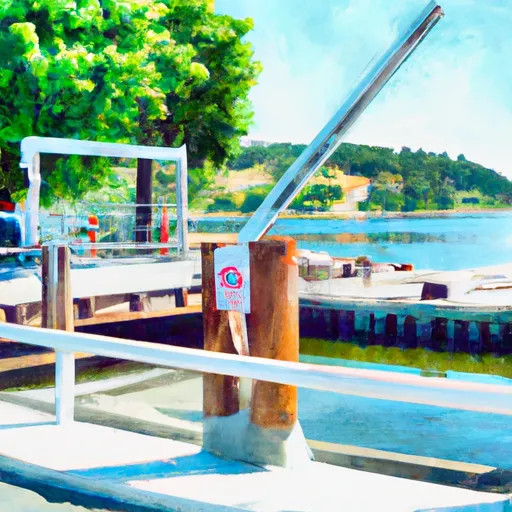
According to the latest information available, Snyder Boat Launch is a concrete boat ramp located in Franklin County, Washington. It is situated along the Columbia River, which is a major waterway in the region. The coordinates of the ramp are latitude: 46.31417084 and longitude: -119.26027679.
As per the available data, Snyder Boat Launch is a two-lane boat ramp that is approximately 30 feet wide. It has a gentle slope and is suitable for launching small to medium-sized watercraft. The ramp is also equipped with a dock for loading and unloading boats.
The Columbia River is a large and diverse body of water, offering opportunities for recreational boating, fishing, and other water-based activities. The river is home to a wide variety of fish species, including salmon, steelhead, and sturgeon. Boaters may also encounter other watercraft, such as jet skis, pontoons, and kayaks, on the river.
In terms of regulations, boaters are required to have a valid Washington State Boater Education Card to operate a motorized boat on the Columbia River. Additionally, all watercraft must be properly registered and equipped with appropriate safety equipment, such as life jackets and fire extinguishers.
Overall, Snyder Boat Launch provides access to a popular and scenic waterway in Washington, and is suitable for launching a variety of watercraft for recreational use.
Plan your launch down to the hour
Same weather feed Snoflo's iOS app uses -- updated continuously from NOAA / yr.no.
Next 5 days, hour by hour
Temperature line with weather symbols on top, snow + rain accumulation as columns, humidity as a dotted line.
5-day forecast table
Every 3 hours, broken out across temperature, snow, rain, humidity, and wind.
| Time | Condition | Temp (°F) | Snow (in) | Rain (in) | Humidity (%) | Wind (mps) | Wind dir |
|---|---|---|---|---|---|---|---|
| Loading detailed forecast… | |||||||
15-day temperature & precipitation
Daily temperatures, snow, and rain projected over the next two weeks.
Area streamflow levels
USGS streamgauges around Snyder Boat Launch -- the same readings that determine whether your launch is safe and your boat is the right craft.
| Streamgauge | Discharge | View |
|---|---|---|
| Yakima River At Kiona | 844 cfs | → |
| Umatilla River Near Umatilla | 67 cfs | → |
Plan a longer trip
The closest paddle runs, fishing spots, and other boat launches so you can extend a day on the water.
Boating safety & etiquette
- Check the conditions before you launch
- Use the streamflow numbers, weather, and wind forecast on this page. High-cfs whitewater requires whitewater-specific craft and skill.
- Wear your life jacket
- Statistically the single biggest survival factor in a boating incident. State law often requires one per passenger.
- File a float plan
- Tell someone on shore your put-in, take-out, and expected return time. Especially for multi-day or remote trips.
- Yield at the ramp
- Prep gear in the parking lot, not on the ramp. Launch and clear quickly so others can use the lane.
- Clean, drain, dry
- Inspect, clean, drain and dry your boat between waters to prevent the spread of aquatic invasive species.
Set push alerts in the Snoflo app
Save Snyder Boat Launch as a favorite, set a discharge threshold or a wind/precipitation alert, and the iOS app will push the moment conditions cross.
About Snyder Boat Launch
Can I launch a motorboat here?
Most Snoflo-tracked launches support motorboats; check the operator for any horsepower restrictions, paddle-only zones, or seasonal closures.
How fresh is the streamflow data?
USGS streamgauges report continuously (every 15 minutes); the table on this page pulls the latest reading at page load.
Is there a fee?
Many federal and state boat launches charge a day-use fee. Check the operator's site before driving out.
What boat is right for these conditions?
Use the nearby streamflow numbers and river-run panel on this page to gauge current conditions. Wider, slower water is friendly for casual paddling and powerboats; high-cfs whitewater requires whitewater-specific craft and skill.
Can I get alerts when conditions change?
Yes -- alerts are managed in the Snoflo iOS app. Favorite this launch, set a threshold (discharge, wind), and you'll get a push the moment it crosses.
Other launches near here
Snoflo-tracked boat launches within driving distance of Snyder Boat Launch.