Panther Lake Road Snohomish County Boat Launch
Community Reviews
Been here? Share the conditions.
Reviews, ratings & photos are added in the free Snoflo iOS app — rate a spot, tag the conditions, and your visit is verified by location. Add or manage your reviews from the app.
Panther Lake Road Snohomish County
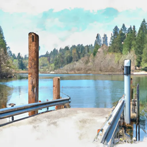
According to the latest information available, the Panther Lake Road Boat Ramp is open year-round and is suitable for motorized boats, canoes, kayaks, and other non-motorized watercraft. However, there are restrictions regarding the use of motorized boats on the lake. Only boats with electric motors or gas-powered engines that produce less than 10 horsepower are allowed on the lake. Propane-powered motors are also permitted.
In addition to the boat ramp, the Panther Lake Road site also provides ample parking for vehicles and boat trailers. There are also restrooms, picnic tables, and a small dock available for use by visitors.
Overall, the Panther Lake Road Boat Ramp is a convenient and well-maintained facility that provides easy access to a beautiful lake for fishing, boating, and other water activities. Its location in Snohomish County makes it easily accessible to residents and visitors alike.
Plan your launch down to the hour
Same weather feed Snoflo's iOS app uses -- updated continuously from NOAA / yr.no.
Next 5 days, hour by hour
Temperature line with weather symbols on top, snow + rain accumulation as columns, humidity as a dotted line.
5-day forecast table
Every 3 hours, broken out across temperature, snow, rain, humidity, and wind.
| Time | Condition | Temp (°F) | Snow (in) | Rain (in) | Humidity (%) | Wind (mps) | Wind dir |
|---|---|---|---|---|---|---|---|
| Loading detailed forecast… | |||||||
15-day temperature & precipitation
Daily temperatures, snow, and rain projected over the next two weeks.
Area streamflow levels
USGS streamgauges around Panther Lake Road Snohomish County -- the same readings that determine whether your launch is safe and your boat is the right craft.
| Streamgauge | Discharge | View |
|---|---|---|
| Pilchuck River Near Snohomish | 83 cfs | → |
| Snohomish River Near Monroe | 2,040 cfs | → |
| Sultan River Below Powerplant Near Sultan | 310 cfs | → |
| Sultan River Below Diversion Dam Near Sultan | 108 cfs | → |
| Mission Creek Near Tulalip | 1 cfs | → |
| Tulalip Creek Near Tulalip | 7 cfs | → |
Plan a longer trip
The closest paddle runs, fishing spots, and other boat launches so you can extend a day on the water.
River runs
- Headwaters In Ne1/4 Of Sec 14, T29n, R10e To Confluence With Canyon Creek
- Canyon Creek To Confluence With North Fork Stillaguamish River
- Headwaters In Sw1/4 Of Sec 7, T31n, R9e To Boulder River Wilderness Boundary
- Confluence With Troublesome Creek To Confluence With South Fork Skykomish River
- Confluence Of Tye And Foss Rivers To Gold Bar
- Boulder River Wilderness Boundary To Confluence With Stillaguamish River
Boating safety & etiquette
- Check the conditions before you launch
- Use the streamflow numbers, weather, and wind forecast on this page. High-cfs whitewater requires whitewater-specific craft and skill.
- Wear your life jacket
- Statistically the single biggest survival factor in a boating incident. State law often requires one per passenger.
- File a float plan
- Tell someone on shore your put-in, take-out, and expected return time. Especially for multi-day or remote trips.
- Yield at the ramp
- Prep gear in the parking lot, not on the ramp. Launch and clear quickly so others can use the lane.
- Clean, drain, dry
- Inspect, clean, drain and dry your boat between waters to prevent the spread of aquatic invasive species.
Set push alerts in the Snoflo app
Save Panther Lake Road Snohomish County as a favorite, set a discharge threshold or a wind/precipitation alert, and the iOS app will push the moment conditions cross.
About Panther Lake Road Snohomish County
Can I launch a motorboat here?
Most Snoflo-tracked launches support motorboats; check the operator for any horsepower restrictions, paddle-only zones, or seasonal closures.
How fresh is the streamflow data?
USGS streamgauges report continuously (every 15 minutes); the table on this page pulls the latest reading at page load.
Is there a fee?
Many federal and state boat launches charge a day-use fee. Check the operator's site before driving out.
What boat is right for these conditions?
Use the nearby streamflow numbers and river-run panel on this page to gauge current conditions. Wider, slower water is friendly for casual paddling and powerboats; high-cfs whitewater requires whitewater-specific craft and skill.
Can I get alerts when conditions change?
Yes -- alerts are managed in the Snoflo iOS app. Favorite this launch, set a threshold (discharge, wind), and you'll get a push the moment it crosses.
Other launches near here
Snoflo-tracked boat launches within driving distance of Panther Lake Road Snohomish County.