Burnt Corral Campground And Day Use Area campground
Community Reviews
Been here? Share the conditions.
Reviews, ratings & photos are added in the free Snoflo iOS app — rate a spot, tag the conditions, and your visit is verified by location. Add or manage your reviews from the app.
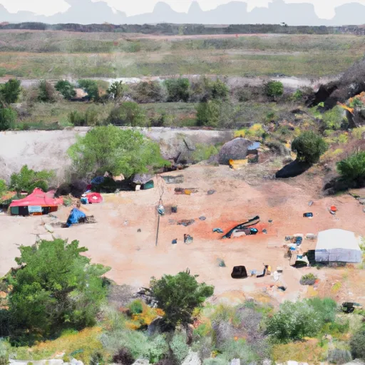
Burnt Corral Campground And Day Use Area
Reservations are accepted at Burnt Corral Campground, allowing visitors to secure their spot in advance. This is particularly beneficial during peak seasons when the campground tends to fill up quickly. It is recommended to make a reservation to ensure availability, especially if planning to visit during holidays or weekends.
The best time to visit Burnt Corral Campground is during the spring and fall months when the weather is mild and pleasant. Summers can be extremely hot, so it is advised to avoid visiting during this season. Additionally, campers should be aware of the potential for flash floods in the area, especially during the monsoon season. It is essential to stay informed about weather conditions and be cautious while exploring the camping area.
In conclusion, Burnt Corral Campground And Day Use Area in Arizona offers a range of amenities, accepts reservations, and is best visited during the spring and fall. Campers should be cautious about potential flash floods during the monsoon season. Overall, this campground is a great choice for those seeking a peaceful and beautiful camping experience in Arizona.
What's on-site at Burnt Corral Campground And Day Use Area
Key facilities Snoflo tracks for this campground. Confirm with the operator before booking -- amenities can change seasonally.
Plan your trip down to the hour
Same weather feed Snoflo's iOS app uses -- updated continuously from NOAA / yr.no.
Next 5 days, hour by hour
Temperature line with weather symbols on top, snow + rain accumulation as columns, humidity as a dotted line.
5-day forecast table
Every 3 hours, broken out across temperature, snow, rain, humidity, and wind. Each cell is colour-coded relative to the column min/max so trends jump out at a glance.
| Time | Condition | Temp (°F) | Snow (in) | Rain (in) | Humidity (%) | Wind (mps) | Wind dir |
|---|---|---|---|---|---|---|---|
| Loading detailed forecast… | |||||||
15-day temperature & precipitation
Daily temperatures, snow, and rain projected over the next two weeks. Hover any point for the full breakdown.
Other campgrounds in the area
Snoflo-tracked campsites within driving distance of Burnt Corral Campground And Day Use Area, with reservations status.
| Campground | Reservations | Toilets | View |
|---|---|---|---|
| Burnt Corral | ✗ | ✓ | → |
| Lower Burnt Corral Dispersed | ✗ | ✗ | → |
| Upper Burnt Corral | ✗ | ✗ | → |
| Upper Burnt Corral Dispersed | ✗ | ✗ | → |
| Davis Wash Dispersed | ✗ | ✗ | → |
Nearby streamflow
USGS streamgauges within reach of Burnt Corral Campground And Day Use Area -- pulled live from the National Water Information System.
| Streamgauge | Discharge | View |
|---|---|---|
| Pinto Creek Near Miami | · | → |
| Salt River Near Roosevelt | 88 cfs | → |
| Pinal Creek At Inspiration Dam | 0 cfs | → |
| Pinto Cr Blw Haunted Canyon Nr Miami | · | → |
| South Fork Parker Creek Near Roosevelt | · | → |
| Sycamore Creek Near Fort Mcdowell | · | → |
Nearby snow depths
NRCS SNOTEL stations within reach of Burnt Corral Campground And Day Use Area -- relevant when planning a shoulder-season or alpine trip.
| SNOTEL station | Snowpack | 24h Snowfall | View |
|---|---|---|---|
| Workman Creek | 0.0 in | 0.0 in | → |
| Fountain Hills 1.2 Nne | 0.0 in | 0.0 in | → |
Plan a longer trip
The closest parks, lakes, boat launches, and paddle runs so a camping night can grow into a full weekend.
Parks
- Tonto National Monument
- Wilderness Salome
- Wilderness Four Peaks
- Wilderness Salt River Canyon
- Superstition Wilderness Water Sources, Plo 5368
- Lost Dutchman State Park
Boat launches
- Service Road 183 Maricopa County
- Apache Lake - 3
- Apache Lake Maricopa County
- Apache Lake - 1
- Roosevelt Lake - 4
- Roosevelt Lake - 5
Fishing spots
- Theodore Roosevelt Lake
- Cherry Creek
- Bartlett Reservoir
- Queen Creek
- South Fork Deadman Creek
- Deadman Creek
Points of interest
- Upper Cliff Dwelling
- Lower Cliff Dwelling
- Black Rock
- Circlestone
- Peephole And Little Arch
- Kvit-Fm (Apache Junction)
Paddle runs
- Southwest Boundary Of Salt River Canyon Wilderness To State Highway 288 Bridge
- Rock Springs To Confluence With Cottonwood Wash
- Boundary Of The Primary Jurisdiction Below Stewart Mountain Dam To Salt River Indian Reservation Boundary
- Lower Salt
- West Boundary Of Fort Apache Indian Reservation To Southwest Boundary Of Salt River Canyon Wilderness
- Salome Wilderness Boundary To Confluence With Salome Creek
Camping essentials & Leave No Trace
- Pack it in, pack it out
- Take all trash, food scraps, and gear back with you to keep campsites clean and protect wildlife.
- Respect wildlife
- Observe animals from a distance, store food securely, and never feed wildlife to maintain natural behavior and safety.
- Know before you go
- Check weather, fire restrictions, trail conditions, and permit requirements to ensure a safe and well-planned trip.
- Minimize campfire impact
- Use established fire rings, keep fires small, fully extinguish them, or opt for a camp stove when fires are restricted.
- Leave what you find
- Preserve natural and cultural features by avoiding removal of plants, rocks, artifacts, or other elements of the environment.
Set push alerts in the Snoflo app
Save Burnt Corral Campground And Day Use Area as a favorite, set a custom threshold (precipitation, snowpack, freezing temperatures), and the iOS app will push the moment conditions cross.
About Burnt Corral Campground And Day Use Area
Can I make reservations at Burnt Corral Campground And Day Use Area?
Yes -- this campground accepts reservations. Snoflo recommends booking early for peak season; check the operator (Recreation.gov / state park system / private operator) for the booking window and cancellation policy.
How fresh is the weather data on this page?
The hourly forecast updates throughout the day from the NOAA / yr.no public feeds. Streamflow data is pulled live from USGS streamgauges and snowpack from the NRCS SNOTEL network.
What's the best time of year to visit?
Use the 15-day temperature & precipitation outlook on this page to plan -- pick a window with comfortable temperatures and low precipitation. For longer trips, the 5-day hourly meteogram shows snow + rain accumulation hour-by-hour.
How do I get to Burnt Corral Campground And Day Use Area?
Tap Directions in the hero above to open driving directions in Google Maps, or Open in map to center the Snoflo interactive map on the campground.
Can I get alerts when conditions change?
Yes -- alerts are managed through the Snoflo iOS app. Favorite this campground, set a threshold (temperature, snowpack, precipitation), and you'll get a push the moment it crosses.
Other campgrounds near here
Snoflo-tracked campgrounds within driving distance of Burnt Corral Campground And Day Use Area.