Rock Crossing Campground campground
Community Reviews
Been here? Share the conditions.
Reviews, ratings & photos are added in the free Snoflo iOS app — rate a spot, tag the conditions, and your visit is verified by location. Add or manage your reviews from the app.
Rock Crossing Campground
Reservations are accepted at Rock Crossing Campground, allowing campers to secure their spot in advance. This is particularly recommended during peak seasons when the campground tends to fill up quickly. The best time of year to visit is in the spring or fall when the weather is pleasant, and the campground is less crowded. It is important to note that during the summer months, temperatures can reach extreme highs, so it is advisable to plan accordingly and bring plenty of water and sun protection.
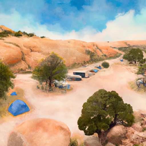
The camping area at Rock Crossing Campground offers several points of interest for nature enthusiasts. The nearby Tonto National Forest provides opportunities for hiking and exploring scenic trails. The campground is also close to the picturesque Sycamore Creek, offering a refreshing spot for swimming and fishing. However, campers should be cautious of flash floods in the area during the monsoon season, which typically occurs from late June to September. It is crucial to stay informed about weather conditions and be prepared for sudden changes.
In conclusion, Rock Crossing Campground in Arizona offers a beautiful camping experience with amenities such as restrooms, picnic tables, and fire rings. Reservations are accepted, and it is advisable to visit during the spring or fall to enjoy pleasant weather and avoid crowds. The nearby Tonto National Forest and Sycamore Creek provide opportunities for outdoor activities, but campers should remain cautious of flash floods during the monsoon season.
What's on-site at Rock Crossing Campground
Key facilities Snoflo tracks for this campground. Confirm with the operator before booking -- amenities can change seasonally.
Plan your trip down to the hour
Same weather feed Snoflo's iOS app uses -- updated continuously from NOAA / yr.no.
Next 5 days, hour by hour
Temperature line with weather symbols on top, snow + rain accumulation as columns, humidity as a dotted line.
5-day forecast table
Every 3 hours, broken out across temperature, snow, rain, humidity, and wind. Each cell is colour-coded relative to the column min/max so trends jump out at a glance.
| Time | Condition | Temp (°F) | Snow (in) | Rain (in) | Humidity (%) | Wind (mps) | Wind dir |
|---|---|---|---|---|---|---|---|
| Loading detailed forecast… | |||||||
15-day temperature & precipitation
Daily temperatures, snow, and rain projected over the next two weeks. Hover any point for the full breakdown.
Other campgrounds in the area
Snoflo-tracked campsites within driving distance of Rock Crossing Campground, with reservations status.
| Campground | Reservations | Toilets | View |
|---|---|---|---|
| Rock Crossing | ✗ | ✓ | → |
| Blue Ridge | ✗ | ✓ | → |
| Blue Ridge Campground | ✗ | ✗ | → |
| Moqui Group Campground | ✗ | ✗ | → |
| Clints Well | ✗ | ✓ | → |
Nearby streamflow
USGS streamgauges within reach of Rock Crossing Campground -- pulled live from the National Water Information System.
| Streamgauge | Discharge | View |
|---|---|---|
| East Verde R Div From East Clear Cr Nr Pine | 1 cfs | → |
| Wet Beaver Creek Near Rimrock | 8 cfs | → |
| West Clear Creek Near Camp Verde | 17 cfs | → |
| Chevelon Fork Below Wildcat Canyon | · | → |
| East Verde River Near Childs | · | → |
| Verde River Near Camp Verde | 34 cfs | → |
Nearby snow depths
NRCS SNOTEL stations within reach of Rock Crossing Campground -- relevant when planning a shoulder-season or alpine trip.
| SNOTEL station | Snowpack | 24h Snowfall | View |
|---|---|---|---|
| Baker Butte Smt | 0.0 in | 0.0 in | → |
| Nohrsc Baker Butte Smt | 0.0 in | 0.0 in | → |
| Baker Butte | 1.0 in | 0.0 in | → |
| Nohrsc Happy Jack | 0.0 in | 0.0 in | → |
| Happy Jack | 0.0 in | 0.0 in | → |
| Promontory | 0.0 in | 0.0 in | → |
Plan a longer trip
The closest parks, lakes, boat launches, and paddle runs so a camping night can grow into a full weekend.
Parks
- Wilderness West Clear Creek
- Wilderness Fossil Springs
- Wilderness Wet Beaver
- Sitgreaves National Forest
- Montezuma Well
- Wilderness Munds Mountain
Boat launches
Fishing spots
Points of interest
- General Springs Cabin
- Pine-Strawberry Museum
- Apache Maid Cabin
- Strawberry Schoolhouse
- Rim Lakes Vista Observation Site
- Woods Canyon Vista Observation Site
Paddle runs
- Crossing Of Forest Road 96 To Coconino National Forest Boundary
- Headwaters In Sec 14, T13n, R9e To Clear Creek Wilderness Boundary
- Below Flow Structure In Sec 16, T12n,R11e To Confluence With Clear Creek
- Below The Dam At Knoll Lake To Confluence With East Clear Creek
- 1/4 Mile Below Wiggins Crossing To Confluence With Clear Creek
- Headwaters In Sec 16, T15n, R8e To Wet Beaver Creek Wilderness Boundary
Camping essentials & Leave No Trace
- Pack it in, pack it out
- Take all trash, food scraps, and gear back with you to keep campsites clean and protect wildlife.
- Respect wildlife
- Observe animals from a distance, store food securely, and never feed wildlife to maintain natural behavior and safety.
- Know before you go
- Check weather, fire restrictions, trail conditions, and permit requirements to ensure a safe and well-planned trip.
- Minimize campfire impact
- Use established fire rings, keep fires small, fully extinguish them, or opt for a camp stove when fires are restricted.
- Leave what you find
- Preserve natural and cultural features by avoiding removal of plants, rocks, artifacts, or other elements of the environment.
Set push alerts in the Snoflo app
Save Rock Crossing Campground as a favorite, set a custom threshold (precipitation, snowpack, freezing temperatures), and the iOS app will push the moment conditions cross.
About Rock Crossing Campground
Can I make reservations at Rock Crossing Campground?
This campground does not appear to accept reservations -- it's typically first-come, first-served. Arrive early on summer weekends.
How fresh is the weather data on this page?
The hourly forecast updates throughout the day from the NOAA / yr.no public feeds. Streamflow data is pulled live from USGS streamgauges and snowpack from the NRCS SNOTEL network.
What's the best time of year to visit?
Use the 15-day temperature & precipitation outlook on this page to plan -- pick a window with comfortable temperatures and low precipitation. For longer trips, the 5-day hourly meteogram shows snow + rain accumulation hour-by-hour.
How do I get to Rock Crossing Campground?
Tap Directions in the hero above to open driving directions in Google Maps, or Open in map to center the Snoflo interactive map on the campground.
Can I get alerts when conditions change?
Yes -- alerts are managed through the Snoflo iOS app. Favorite this campground, set a threshold (temperature, snowpack, precipitation), and you'll get a push the moment it crosses.
Other campgrounds near here
Snoflo-tracked campgrounds within driving distance of Rock Crossing Campground.