Benton City - Fry Area Campground
Community Reviews
Been here? Share the conditions.
Reviews, ratings & photos are added in the free Snoflo iOS app — rate a spot, tag the conditions, and your visit is verified by location. Add or manage your reviews from the app.
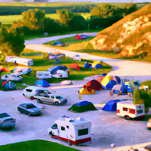
Benton City - Fry Area
Reservations are not accepted at Benton City - Fry Area camping area, and campsites are available on a first-come, first-served basis. Therefore, it is recommended to arrive early, especially during peak seasons, to secure a spot. As for the best time of year to visit, the camping area is typically open from April through October. The prime time for camping is during the warmer months, from May to September, when the weather is more favorable for outdoor activities.
While visiting Benton City - Fry Area camping area, campers can enjoy various outdoor activities such as hiking, fishing, and wildlife viewing. The camping area is surrounded by natural beauty, providing opportunities for exploration and relaxation. However, it is essential to be cautious of ticks and mosquitoes, especially during the summer months, and take appropriate measures to prevent insect bites. Additionally, campers should be aware of local wildlife and follow guidelines for food storage to avoid encounters with animals. By considering these factors and planning accordingly, campers can have an enjoyable and safe experience at Benton City - Fry Area camping area in Iowa.
What's on-site at Benton City - Fry Area
Key facilities Snoflo tracks for this campground. Confirm with the operator before booking -- amenities can change seasonally.
Plan your trip down to the hour
Same weather feed Snoflo's iOS app uses -- updated continuously from NOAA / yr.no.
Next 5 days, hour by hour
Temperature line with weather symbols on top, snow + rain accumulation as columns, humidity as a dotted line.
5-day forecast table
Every 3 hours, broken out across temperature, snow, rain, humidity, and wind. Each cell is colour-coded relative to the column min/max so trends jump out at a glance.
| Time | Condition | Temp (°F) | Snow (in) | Rain (in) | Humidity (%) | Wind (mps) | Wind dir |
|---|---|---|---|---|---|---|---|
| Loading detailed forecast… | |||||||
15-day temperature & precipitation
Daily temperatures, snow, and rain projected over the next two weeks. Hover any point for the full breakdown.
Other campgrounds in the area
Snoflo-tracked campsites within driving distance of Benton City - Fry Area, with reservations status.
| Campground | Reservations | Toilets | View |
|---|---|---|---|
| Wildcat Bluff County Park | ✗ | ✗ | → |
| Hoefle - Dulin Area County Park | ✗ | ✓ | → |
| Pleasant Creek State Park Campground | ✗ | ✗ | → |
| Milroy Access | ✗ | ✗ | → |
| Pleasant Creek State Rec Area | ✓ | ✗ | → |
Nearby streamflow
USGS streamgauges within reach of Benton City - Fry Area -- pulled live from the National Water Information System.
| Streamgauge | Discharge | View |
|---|---|---|
| Cedar River At Cedar Rapids | 7,670 cfs | → |
| Wolf Creek Near Dysart | 244 cfs | → |
| Wapsipinicon River At Independence | 704 cfs | → |
| Salt Creek Near Elberon | 149 cfs | → |
| Iowa River At Marengo | 1,660 cfs | → |
| Iowa River Near Belle Plaine | 1,630 cfs | → |
Nearby snow depths
NRCS SNOTEL stations within reach of Benton City - Fry Area -- relevant when planning a shoulder-season or alpine trip.
| SNOTEL station | Snowpack | 24h Snowfall | View |
|---|---|---|---|
| Fairfax 4.0 Nw | 0.0 in | 0.0 in | → |
| Cedar Rapids 2.5 Wsw | 0.0 in | 0.0 in | → |
| Cedar Rapids No 1 | 0.0 in | 0.0 in | → |
| Belle Plaine | 0.0 in | 0.0 in | → |
| Waterloo 1.9 Sse | 0.0 in | 0.0 in | → |
| Anamosa 3 Ssw | 0.0 in | 0.0 in | → |
Plan a longer trip
The closest parks, lakes, boat launches, and paddle runs so a camping night can grow into a full weekend.
Parks
- Pleasant Ridge Cemetery
- Fross Park
- Minne Estema Park
- Wickiup Hill County Park
- Palo Marsh County Park
- Mount Auburn Bridge Park
Camping essentials & Leave No Trace
- Pack it in, pack it out
- Take all trash, food scraps, and gear back with you to keep campsites clean and protect wildlife.
- Respect wildlife
- Observe animals from a distance, store food securely, and never feed wildlife to maintain natural behavior and safety.
- Know before you go
- Check weather, fire restrictions, trail conditions, and permit requirements to ensure a safe and well-planned trip.
- Minimize campfire impact
- Use established fire rings, keep fires small, fully extinguish them, or opt for a camp stove when fires are restricted.
- Leave what you find
- Preserve natural and cultural features by avoiding removal of plants, rocks, artifacts, or other elements of the environment.
Set push alerts in the Snoflo app
Save Benton City - Fry Area as a favorite, set a custom threshold (precipitation, snowpack, freezing temperatures), and the iOS app will push the moment conditions cross.
About Benton City - Fry Area
Can I make reservations at Benton City - Fry Area?
This campground does not appear to accept reservations -- it's typically first-come, first-served. Arrive early on summer weekends.
How fresh is the weather data on this page?
The hourly forecast updates throughout the day from the NOAA / yr.no public feeds. Streamflow data is pulled live from USGS streamgauges and snowpack from the NRCS SNOTEL network.
What's the best time of year to visit?
Use the 15-day temperature & precipitation outlook on this page to plan -- pick a window with comfortable temperatures and low precipitation. For longer trips, the 5-day hourly meteogram shows snow + rain accumulation hour-by-hour.
How do I get to Benton City - Fry Area?
Tap Directions in the hero above to open driving directions in Google Maps, or Open in map to center the Snoflo interactive map on the campground.
Can I get alerts when conditions change?
Yes -- alerts are managed through the Snoflo iOS app. Favorite this campground, set a threshold (temperature, snowpack, precipitation), and you'll get a push the moment it crosses.
Other campgrounds near here
Snoflo-tracked campgrounds within driving distance of Benton City - Fry Area.