Brush Creek fishing
As of July 15, 2026, the nearest streamgauge to Brush Creek — Turkey River Above French Hollow Cr At Elkader — reports 1,200 cfs. Source: USGS gauge data, refreshed throughout the day.
Community Reviews
Been here? Share the conditions.
Reviews, ratings & photos are added in the free Snoflo iOS app — rate a spot, tag the conditions, and your visit is verified by location. Add or manage your reviews from the app.
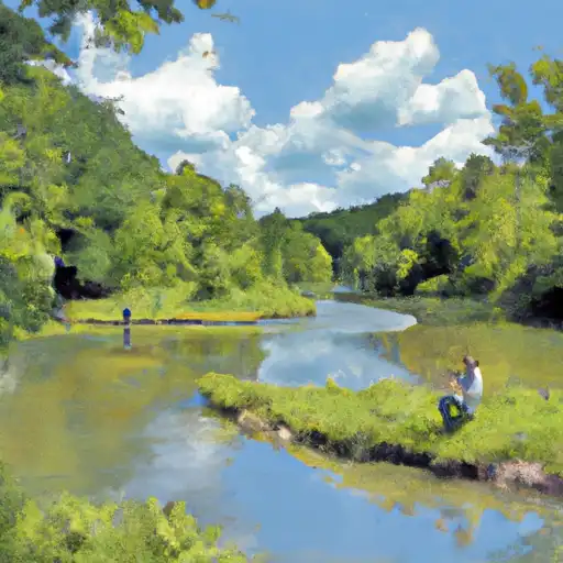
Brush Creek
What's biting at Brush Creek
Species commonly reported here -- tap any card for techniques, target seasons, and other waters where it's been caught.
Plan your trip down to the hour
Same weather feed Snoflo's iOS app uses -- updated continuously from NOAA / yr.no.
Next 5 days, hour by hour
Temperature line with weather symbols on top, snow + rain accumulation as columns, humidity as a dotted line.
5-day forecast table
Every 3 hours, broken out across temperature, snow, rain, humidity, and wind. Each cell is colour-coded relative to the column min/max so trends jump out at a glance.
| Time | Condition | Temp (°F) | Snow (in) | Rain (in) | Humidity (%) | Wind (mps) | Wind dir |
|---|---|---|---|---|---|---|---|
| Loading detailed forecast… | |||||||
15-day temperature & precipitation
Daily temperatures, snow, and rain projected over the next two weeks. Hover any point for the full breakdown.
Nearby streamflow
USGS streamgauges within reach of Brush Creek -- updated continuously from the National Water Information System.
| Streamgauge | Discharge | View |
|---|---|---|
| Turkey River Above French Hollow Cr At Elkader | 1,200 cfs | → |
| Volga River At Littleport | 307 cfs | → |
| Turkey River Near Eldorado | 688 cfs | → |
| Turkey River At Garber | 1,780 cfs | → |
| Wapsipinicon River At Independence | 2,170 cfs | → |
| Maquoketa River At Manchester | 340 cfs | → |
Plan a longer trip
The closest campgrounds, parks, boat launches, and reservoirs so a fishing run can grow into a weekend.
Campgrounds
- Volga River State Recreation Area
- Volga River State Rec Area
- Klocks Island Park
- Klocks Island City Park Campground
- Joy Springs County Park
- Lakeview Campground
Parks
- Brushy Creek Canyon State Preserve
- Volga River State Recreation Area
- Klacks Island Park
- Joy Springs County Park
- Twin Bridges County Park
- Echo Valley State Park
Reservoirs
Boat launches
- Agate Road 10568, Clayton County
- County Highway B64 Fayette County
- Canoe Road Fayette County
- West Lake Trail Delaware County
- Turkey River Water Trail Elkader
- River Street Clermont
Points of interest
- Wilder Memorial Museum
- Richardson-Jakway House
- Hub City Heritage Railway Museum
- Oelwein Area Historical Society Museum
- Fayette County Historical Museum;Fayette County Historical Library
- Red Barn Model Railroad Museum
Paddle runs
- Western Boundary Of Effigy Mounds National Monument To Boundary Of Effigy Mounds National Monument
- The "Lower" Dam, Near The Confluence Of Coon Creek To Lane's Bridge
- The Town Of Bluffton To The "Lower" Dam, Near The Confluence Of Coon Creek
- The Big Green River To The River's Mouth At The Mississippi River
- The Minnesota-Iowa State Border To Ends Near The Town Of Bluffton, Iowa
Angling safety & ethics
- Know the regulations
- Check local fishing rules, seasons, size limits, and license requirements to ensure legal and sustainable angling.
- Handle fish responsibly
- Use wet hands, minimize air exposure, and release fish gently to improve survival rates when practicing catch-and-release.
- Choose the right gear
- Match your rod, line, and tackle to the species and conditions to increase success and reduce unnecessary harm to fish.
- Respect the waterway
- Avoid disturbing habitat, prevent bank erosion, and keep a safe distance from spawning areas to protect ecosystems.
- Keep it clean
- Pack out all line, hooks, bait containers, and trash. Discarded gear can injure wildlife and degrade waterways.
Set push alerts in the Snoflo app
Save Brush Creek as a favorite, set a custom threshold (water temperature, streamflow, snowpack), and the iOS app will push the moment conditions cross.
About Brush Creek
What fish species are found at Brush Creek?
Snoflo tracks the species commonly reported at Brush Creek -- see the Fish Species panel above for the live list with images and links to per-species pages.
How fresh is the weather data on this page?
The hourly forecast updates throughout the day from the NOAA / yr.no public feeds. Streamflow data comes live from USGS streamgauges, also refreshed continuously.
Can I get alerts when conditions change?
Yes -- alerts are managed through the Snoflo iOS app. Favorite this area, set a threshold (water temperature, streamflow, snowpack), and you'll get a push the moment it crosses.
Do I need a fishing license?
Yes. Check your state agency's regulations for license requirements, seasons, size limits, and any waterbody-specific rules before fishing Brush Creek.
How do I get to Brush Creek?
Tap Open in map in the hero above to center the Snoflo interactive map on this area, or grab the coordinates from the location facts panel.
Other angling spots near here
Snoflo-tracked fishing areas within driving distance of Brush Creek.