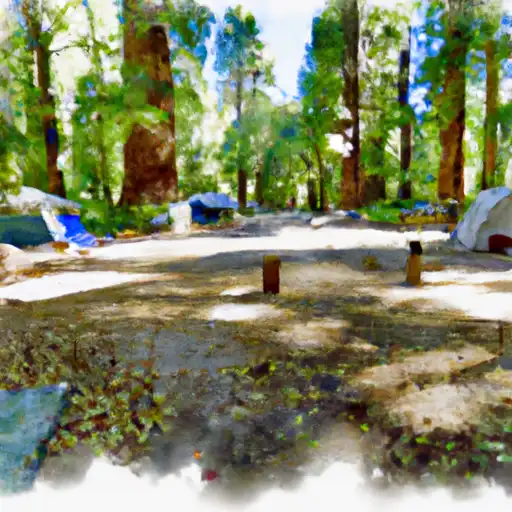
Calaveras Big Trees State Park campground
Community Reviews
Been here? Share the conditions.
Reviews, ratings & photos are added in the free Snoflo iOS app — rate a spot, tag the conditions, and your visit is verified by location. Add or manage your reviews from the app.
Calaveras Big Trees State Park
What's on-site at Calaveras Big Trees State Park
Key facilities Snoflo tracks for this campground. Confirm with the operator before booking -- amenities can change seasonally.
Plan your trip down to the hour
Same weather feed Snoflo's iOS app uses -- updated continuously from NOAA / yr.no.
Next 5 days, hour by hour
Temperature line with weather symbols on top, snow + rain accumulation as columns, humidity as a dotted line.
5-day forecast table
Every 3 hours, broken out across temperature, snow, rain, humidity, and wind. Each cell is colour-coded relative to the column min/max so trends jump out at a glance.
| Time | Condition | Temp (°F) | Snow (in) | Rain (in) | Humidity (%) | Wind (mps) | Wind dir |
|---|---|---|---|---|---|---|---|
| Loading detailed forecast… | |||||||
15-day temperature & precipitation
Daily temperatures, snow, and rain projected over the next two weeks. Hover any point for the full breakdown.
Other campgrounds in the area
Snoflo-tracked campsites within driving distance of Calaveras Big Trees State Park, with reservations status.
| Campground | Reservations | Toilets | View |
|---|---|---|---|
| Stanislaus View | ✗ | ✗ | → |
| Lone Snag | ✗ | ✗ | → |
| Boards Crossing | ✗ | ✓ | → |
| Wakalu Hep Yo (Wild River) Campground | ✓ | ✗ | → |
| Wa Ka Luu Hep Yoo (Wild River) Campground | ✗ | ✗ | → |
Nearby streamflow
USGS streamgauges within reach of Calaveras Big Trees State Park -- pulled live from the National Water Information System.
| Streamgauge | Discharge | View |
|---|---|---|
| Black C Nr Copperopolis Ca | · | → |
| Cherry C Bl Valley Dam Nr Hetch Hetchy Ca | 16 cfs | → |
| Lk Eleanor Div To Cherry Lake Nr Hetch Hetchy Ca | 1 cfs | → |
| Big C Ab Whites Gulch Nr Groveland Ca | · | → |
| Eleanor C Nr Hetch Hetchy Ca | 21 cfs | → |
| Cherry C Bl Dion R Holm Ph | 80 cfs | → |
Nearby snow depths
NRCS SNOTEL stations within reach of Calaveras Big Trees State Park -- relevant when planning a shoulder-season or alpine trip.
| SNOTEL station | Snowpack | 24h Snowfall | View |
|---|---|---|---|
| Black Springs | 0.0 in | 0.0 in | → |
| Bloods Creek | 0.0 in | 0.0 in | → |
| Nohrsc Gianelli Meadow | 168.6 in | 0.0 in | → |
| Nohrsc Elstanislaus Meadow (Goes) | 0.1 in | 0.0 in | → |
| Nohrsc Lower Kibbie | 0.0 in | 0.0 in | → |
| Nohrsc Silver Lake (Goes) | 33.3 in | 0.0 in | → |
Plan a longer trip
The closest parks, lakes, boat launches, and paddle runs so a camping night can grow into a full weekend.
Parks
- Calaveras Big Trees State Park
- Eldorado National Forest
- Wilderness Mokelumne
- Columbia Historic State Park
- Utica Park
- Heaven For Kids Rotary Park
Boat launches
- Beardsley Reservoir
- Pinecrest Lake Resort Marina
- Bear River Lake Resort
- Lake Alpine
- New Melones Lake (Angels Creek)
- New Melones Lake Marina
Fishing spots
- Highland Creek
- Salt Springs Reservoir
- Pinecrest Lake
- Hobart Creek
- Lower Bear River Reservoir
- Bear River Reservoir
Points of interest
- Big Stump
- Campfire Center
- Calaveras Big Trees State Park Visitor Center
- Sierra Nevada Logging Museum
- California Caverns
- Mercer Caverns
Paddle runs
- Calaveras Big Trees State Park Boundary In Sec 24, T5n, R15e To One Mile Downstream Of State Park Boundary In Sec 24, T5n, R15e
- One-Quarter Mile Downstream Of Forest Road 5n75 Bridge Crossing To Calaveras Big Trees State Park Boundary In Sec 24, T5n, R15e
- One Mile Downstream Of State Park Boundary In Sec 24, T5n, R15e To Mckay's Reservoir
- Below Mckay's Reservoir To Confluence With Middle Fork Stanislaus River
- One-Quarter Mile Upstream Of Forest Road 5no2 Bridge Crossing To One-Quarter Mile Downstream Of Forest Road 5n75 Bridge Crossing
- Confluence With Highland Creek To One-Quarter Mile Upstream Forest Road 5no2 Bridge Crossing
Camping essentials & Leave No Trace
- Pack it in, pack it out
- Take all trash, food scraps, and gear back with you to keep campsites clean and protect wildlife.
- Respect wildlife
- Observe animals from a distance, store food securely, and never feed wildlife to maintain natural behavior and safety.
- Know before you go
- Check weather, fire restrictions, trail conditions, and permit requirements to ensure a safe and well-planned trip.
- Minimize campfire impact
- Use established fire rings, keep fires small, fully extinguish them, or opt for a camp stove when fires are restricted.
- Leave what you find
- Preserve natural and cultural features by avoiding removal of plants, rocks, artifacts, or other elements of the environment.
Set push alerts in the Snoflo app
Save Calaveras Big Trees State Park as a favorite, set a custom threshold (precipitation, snowpack, freezing temperatures), and the iOS app will push the moment conditions cross.
About Calaveras Big Trees State Park
Can I make reservations at Calaveras Big Trees State Park?
Yes -- this campground accepts reservations. Snoflo recommends booking early for peak season; check the operator (Recreation.gov / state park system / private operator) for the booking window and cancellation policy.
How fresh is the weather data on this page?
The hourly forecast updates throughout the day from the NOAA / yr.no public feeds. Streamflow data is pulled live from USGS streamgauges and snowpack from the NRCS SNOTEL network.
What's the best time of year to visit?
Use the 15-day temperature & precipitation outlook on this page to plan -- pick a window with comfortable temperatures and low precipitation. For longer trips, the 5-day hourly meteogram shows snow + rain accumulation hour-by-hour.
How do I get to Calaveras Big Trees State Park?
Tap Directions in the hero above to open driving directions in Google Maps, or Open in map to center the Snoflo interactive map on the campground.
Can I get alerts when conditions change?
Yes -- alerts are managed through the Snoflo iOS app. Favorite this campground, set a threshold (temperature, snowpack, precipitation), and you'll get a push the moment it crosses.
Other campgrounds near here
Snoflo-tracked campgrounds within driving distance of Calaveras Big Trees State Park.