Chilao Campground campground
Community Reviews
Been here? Share the conditions.
Reviews, ratings & photos are added in the free Snoflo iOS app — rate a spot, tag the conditions, and your visit is verified by location. Add or manage your reviews from the app.
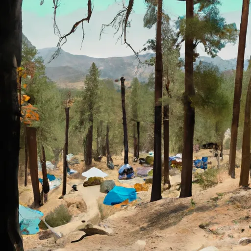
Chilao Campground
Reservations are indeed accepted at Chilao Campground, ensuring you have a guaranteed spot during peak seasons or busy weekends. However, it is important to note that some sites are available on a first-come, first-served basis. To secure a reservation, it is recommended to check the official website or contact the campground directly.
The best time of year to visit Chilao Campground is during the spring and fall seasons, as the weather is generally pleasant with mild temperatures. However, it is essential to be prepared for changing weather conditions, as temperatures can drop significantly during the night. Additionally, visitors should be cautious of potential wildlife encounters, such as rattlesnakes or bears, and must follow proper food storage guidelines to minimize any unwanted interactions. Furthermore, it is advisable to bring insect repellent and be mindful of poison oak in the area.
In summary, Chilao Campground in California's Angeles National Forest offers a comfortable camping experience with amenities such as picnic tables, fire rings, and access to drinking water. Reservations are accepted, but some sites are available on a first-come, first-served basis. Spring and fall are the ideal seasons to visit, and caution should be exercised regarding wildlife encounters and poison oak.
What's on-site at Chilao Campground
Key facilities Snoflo tracks for this campground. Confirm with the operator before booking -- amenities can change seasonally.
Plan your trip down to the hour
Same weather feed Snoflo's iOS app uses -- updated continuously from NOAA / yr.no.
Next 5 days, hour by hour
Temperature line with weather symbols on top, snow + rain accumulation as columns, humidity as a dotted line.
5-day forecast table
Every 3 hours, broken out across temperature, snow, rain, humidity, and wind. Each cell is colour-coded relative to the column min/max so trends jump out at a glance.
| Time | Condition | Temp (°F) | Snow (in) | Rain (in) | Humidity (%) | Wind (mps) | Wind dir |
|---|---|---|---|---|---|---|---|
| Loading detailed forecast… | |||||||
15-day temperature & precipitation
Daily temperatures, snow, and rain projected over the next two weeks. Hover any point for the full breakdown.
Nearby streamflow
USGS streamgauges within reach of Chilao Campground -- pulled live from the National Water Information System.
| Streamgauge | Discharge | View |
|---|---|---|
| Arroyo Seco Nr Pasadena Ca | 1 cfs | → |
| Big Rock C Nr Valyermo Ca | 12 cfs | → |
| San Gabriel R Bl Santa Fe Dam Nr Baldwin Pk Ca | · | → |
| Rio Hondo Ab Whittier Narrows Dam Ca | 1 cfs | → |
| San Gabriel R Ab Whittier Narrows Dam Ca | 28 cfs | → |
| Rio Hondo Bl Whittier Narrows Dam Ca | · | → |
Nearby snow depths
NRCS SNOTEL stations within reach of Chilao Campground -- relevant when planning a shoulder-season or alpine trip.
| SNOTEL station | Snowpack | 24h Snowfall | View |
|---|---|---|---|
| Hesperia 1ene | 0.0 in | 0.0 in | → |
| Lake Arrowhead 1.5 Se | 0.0 in | 0.0 in | → |
Plan a longer trip
The closest parks, lakes, boat launches, and paddle runs so a camping night can grow into a full weekend.
Parks
- Wilderness Pleasant View Ridge
- Wilderness San Gabriel
- Monrovia Canyon Park
- Bailey Canyon Wilderness Park
- Farnsworth Park
- Mount Wilson Trail Park
Boat launches
Fishing spots
- Santa Fe Dam
- Peck Road Park Lake
- Garvey Reservoir
- Legg Lake
- Puddingstone Reservoir
- Puddingstone Lake
Points of interest
- Stony Ridge Observatory
- Mount Wilson Observatory
- Sturtevant Falls
- Camp 16
- Inspiration Point Loop--Lighting Ridge Nature Trl
- Eaton Canyon Waterfall
Paddle runs
- Cooper Canyon- Near State Highway 2 (Sw 1/4, Ne 1/4, Sec 16, T3n, R10w To Confluence With Little Rock Creek
- Gaging Station Below Spillway Of Cogswell Dam (Ne 1/4, Se 1/4, Sec 19, T2n, R10w) To Confluence With Nf San Gabriel River (Sw 1/4.Sw 1/4, Sec 15, T2n, R9w)
- Mainstream - Confluence With South Fork Little Rock Creek To Little Rock Creek Reservoir
- West Fork - Headwaters (Se 1/4, Ne 1/4, Sec 14, T2n, R12w) To Cogswell Reservoir (Ne 1/4, Sw 1/4, Sec 24, T2n, R9w
- Mainstream - Confluence With Cooper Canyon To Confluence Wit South Fork Little Rock Creek
- Mainstream - Headwaters To Confluence With Cooper Canyon
Camping essentials & Leave No Trace
- Pack it in, pack it out
- Take all trash, food scraps, and gear back with you to keep campsites clean and protect wildlife.
- Respect wildlife
- Observe animals from a distance, store food securely, and never feed wildlife to maintain natural behavior and safety.
- Know before you go
- Check weather, fire restrictions, trail conditions, and permit requirements to ensure a safe and well-planned trip.
- Minimize campfire impact
- Use established fire rings, keep fires small, fully extinguish them, or opt for a camp stove when fires are restricted.
- Leave what you find
- Preserve natural and cultural features by avoiding removal of plants, rocks, artifacts, or other elements of the environment.
Set push alerts in the Snoflo app
Save Chilao Campground as a favorite, set a custom threshold (precipitation, snowpack, freezing temperatures), and the iOS app will push the moment conditions cross.
About Chilao Campground
Can I make reservations at Chilao Campground?
Yes -- this campground accepts reservations. Snoflo recommends booking early for peak season; check the operator (Recreation.gov / state park system / private operator) for the booking window and cancellation policy.
How fresh is the weather data on this page?
The hourly forecast updates throughout the day from the NOAA / yr.no public feeds. Streamflow data is pulled live from USGS streamgauges and snowpack from the NRCS SNOTEL network.
What's the best time of year to visit?
Use the 15-day temperature & precipitation outlook on this page to plan -- pick a window with comfortable temperatures and low precipitation. For longer trips, the 5-day hourly meteogram shows snow + rain accumulation hour-by-hour.
How do I get to Chilao Campground?
Tap Directions in the hero above to open driving directions in Google Maps, or Open in map to center the Snoflo interactive map on the campground.
Can I get alerts when conditions change?
Yes -- alerts are managed through the Snoflo iOS app. Favorite this campground, set a threshold (temperature, snowpack, precipitation), and you'll get a push the moment it crosses.
Other campgrounds near here
Snoflo-tracked campgrounds within driving distance of Chilao Campground.