Eucalyptus Park Road, San Dimas Boat Launch
Community Reviews
Been here? Share the conditions.
Reviews, ratings & photos are added in the free Snoflo iOS app — rate a spot, tag the conditions, and your visit is verified by location. Add or manage your reviews from the app.
Eucalyptus Park Road, San Dimas
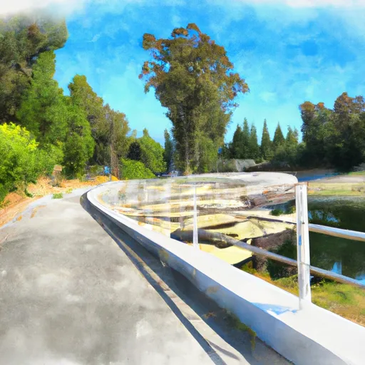
According to the latest information available, the boat ramp at Eucalyptus Park Road is a concrete ramp that is approximately 20 feet wide. The ramp is suitable for launching a variety of watercraft, including motorboats, sailboats, kayaks, and canoes. However, no personal watercraft, such as jet skis, are permitted on the reservoir.
In addition to the boat ramp, Eucalyptus Park Road also features a dock and parking area for vehicles with trailers. The park itself offers other amenities, including picnic areas, playgrounds, and walking trails.
Overall, Eucalyptus Park Road boat ramp provides a convenient and accessible way for visitors to enjoy the recreational opportunities offered by Puddingstone Reservoir.
Plan your launch down to the hour
Same weather feed Snoflo's iOS app uses -- updated continuously from NOAA / yr.no.
Next 5 days, hour by hour
Temperature line with weather symbols on top, snow + rain accumulation as columns, humidity as a dotted line.
5-day forecast table
Every 3 hours, broken out across temperature, snow, rain, humidity, and wind.
| Time | Condition | Temp (°F) | Snow (in) | Rain (in) | Humidity (%) | Wind (mps) | Wind dir |
|---|---|---|---|---|---|---|---|
| Loading detailed forecast… | |||||||
15-day temperature & precipitation
Daily temperatures, snow, and rain projected over the next two weeks.
Area streamflow levels
USGS streamgauges around Eucalyptus Park Road, San Dimas -- the same readings that determine whether your launch is safe and your boat is the right craft.
| Streamgauge | Discharge | View |
|---|---|---|
| San Antonio C A Riverside Dr Nr Chino Ca | 2 cfs | → |
| Chino C A Schaefer Avenue Nr Chino Ca | 1 cfs | → |
| San Gabriel R Bl Santa Fe Dam Nr Baldwin Pk Ca | · | → |
| Carbon C Bl Carbon Cyn Dam Ca | · | → |
| Cucamonga C Nr Mira Loma Ca | 46 cfs | → |
| Fullerton C Bl Fullerton Dam Nr Brea Ca | 1 cfs | → |
Plan a longer trip
The closest paddle runs, fishing spots, and other boat launches so you can extend a day on the water.
River runs
- Laurel Gulch To Confluence With Mineo Canyon (Se 1/4, Sw 1/4, Sec 17, T2n, R8w)
- Gaging Station Below Spillway Of Cogswell Dam (Ne 1/4, Se 1/4, Sec 19, T2n, R10w) To Confluence With Nf San Gabriel River (Sw 1/4.Sw 1/4, Sec 15, T2n, R9w)
- North Fork - Confluence Of Soldier And Coldbrook Creeks (Se1/4,Sw1/4, Sec) 5, T2n,,R9w To Conflluence With West Fork Of San Gabriel (Sw 1/4,Sw1/4, Sec 17, T2n, R8w)
- East Fork - Confluence Of Vincent Gulch And Prairie Fork (Nw 1/4, Sw 1/4 Sec 16 ) To Laurel Gulch (Nw 1/4, Sw 1/4, Sec 17, T2n, R8w)
- Middle Fork - Commanche Campsite To Middle Fork Trailhead
- Cooper Canyon- Near State Highway 2 (Sw 1/4, Ne 1/4, Sec 16, T3n, R10w To Confluence With Little Rock Creek
Boating safety & etiquette
- Check the conditions before you launch
- Use the streamflow numbers, weather, and wind forecast on this page. High-cfs whitewater requires whitewater-specific craft and skill.
- Wear your life jacket
- Statistically the single biggest survival factor in a boating incident. State law often requires one per passenger.
- File a float plan
- Tell someone on shore your put-in, take-out, and expected return time. Especially for multi-day or remote trips.
- Yield at the ramp
- Prep gear in the parking lot, not on the ramp. Launch and clear quickly so others can use the lane.
- Clean, drain, dry
- Inspect, clean, drain and dry your boat between waters to prevent the spread of aquatic invasive species.
Set push alerts in the Snoflo app
Save Eucalyptus Park Road, San Dimas as a favorite, set a discharge threshold or a wind/precipitation alert, and the iOS app will push the moment conditions cross.
About Eucalyptus Park Road, San Dimas
Can I launch a motorboat here?
Most Snoflo-tracked launches support motorboats; check the operator for any horsepower restrictions, paddle-only zones, or seasonal closures.
How fresh is the streamflow data?
USGS streamgauges report continuously (every 15 minutes); the table on this page pulls the latest reading at page load.
Is there a fee?
Many federal and state boat launches charge a day-use fee. Check the operator's site before driving out.
What boat is right for these conditions?
Use the nearby streamflow numbers and river-run panel on this page to gauge current conditions. Wider, slower water is friendly for casual paddling and powerboats; high-cfs whitewater requires whitewater-specific craft and skill.
Can I get alerts when conditions change?
Yes -- alerts are managed in the Snoflo iOS app. Favorite this launch, set a threshold (discharge, wind), and you'll get a push the moment it crosses.
Other launches near here
Snoflo-tracked boat launches within driving distance of Eucalyptus Park Road, San Dimas.