Upper Pines - Yosemite National Park Campground
Community Reviews
Been here? Share the conditions.
Reviews, ratings & photos are added in the free Snoflo iOS app — rate a spot, tag the conditions, and your visit is verified by location. Add or manage your reviews from the app.
Upper Pines - Yosemite National Park
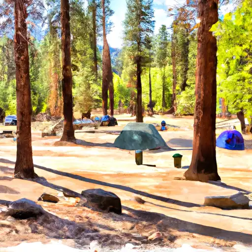
The Upper Pines campground offers many amenities, including restrooms, showers, and a camp store. There are also picnic tables and fire rings at each campsite. The campground is open year-round and reservations are highly recommended as the area can fill up quickly. There are 238 campsites available on a first-come, first-served basis.
One interesting fact about the Upper Pines campground is that it was originally established in 1916 and was one of the first campgrounds in Yosemite National Park.
The best time of year to visit Upper Pines is from May through October when the temperatures are mild and the weather is pleasant. Average temperatures during this time range from the high 60s to the low 80s Fahrenheit. However, it’s important to note that the area can get crowded during peak season, so visitors should plan accordingly.
Overall, if you’re looking for a stunning camping experience with easy access to some of Yosemite’s most famous landmarks, Upper Pines is definitely worth considering.
What's on-site at Upper Pines - Yosemite National Park
Key facilities Snoflo tracks for this campground. Confirm with the operator before booking -- amenities can change seasonally.
Plan your trip down to the hour
Same weather feed Snoflo's iOS app uses -- updated continuously from NOAA / yr.no.
Next 5 days, hour by hour
Temperature line with weather symbols on top, snow + rain accumulation as columns, humidity as a dotted line.
5-day forecast table
Every 3 hours, broken out across temperature, snow, rain, humidity, and wind. Each cell is colour-coded relative to the column min/max so trends jump out at a glance.
| Time | Condition | Temp (°F) | Snow (in) | Rain (in) | Humidity (%) | Wind (mps) | Wind dir |
|---|---|---|---|---|---|---|---|
| Loading detailed forecast… | |||||||
15-day temperature & precipitation
Daily temperatures, snow, and rain projected over the next two weeks. Hover any point for the full breakdown.
Other campgrounds in the area
Snoflo-tracked campsites within driving distance of Upper Pines - Yosemite National Park, with reservations status.
| Campground | Reservations | Toilets | View |
|---|---|---|---|
| Upper Pines | ✗ | ✗ | → |
| Lower Pines | ✗ | ✗ | → |
| North Pines | ✗ | ✗ | → |
| North Pines - Yosemite National Park | ✓ | ✓ | → |
| Lower Pines - Yosemite National Park | ✓ | ✓ | → |
Nearby streamflow
USGS streamgauges within reach of Upper Pines - Yosemite National Park -- pulled live from the National Water Information System.
| Streamgauge | Discharge | View |
|---|---|---|
| Merced R A Happy Isles Bridge Nr Yosemite Ca | 124 cfs | → |
| Merced R A Pohono Bridge Nr Yosemite Ca | 158 cfs | → |
| Tuolumne R A Grand Cyn Of Tuolumne Ab Hetch Hetchy | 161 cfs | → |
| Big C Div Nr Fish Camp Ca | 0 cfs | → |
| Tuolumne R Nr Hetch Hetchy Ca | 113 cfs | → |
| Tuolumne R Ab Early Intake Nr Mather Ca | 117 cfs | → |
Nearby snow depths
NRCS SNOTEL stations within reach of Upper Pines - Yosemite National Park -- relevant when planning a shoulder-season or alpine trip.
| SNOTEL station | Snowpack | 24h Snowfall | View |
|---|---|---|---|
| Tenaya Lake | 0.2 in | 0.0 in | → |
| Nohrsc White Wolf Raws | 1.1 in | 0.0 in | → |
| Nohrsc Tuolumne Meadows | 124.2 in | 0.0 in | → |
| Nohrsc Tioga Pass-Dana Meadows | 30.4 in | 0.0 in | → |
| Nohrsc Green Mtn | 7.8 in | 0.0 in | → |
| Nohrsc Paradise Meadow | 0.0 in | 0.0 in | → |
Plan a longer trip
The closest parks, lakes, boat launches, and paddle runs so a camping night can grow into a full weekend.
Parks
- Yosemite National Park
- Stanislaus National Forest
- Hoover Wilderness
- Wilderness Emigrant
- Mono Lake Tufa State Reserve
- Devils Postpile National Monument
Fishing spots
Points of interest
- Nature Center At Happy Isles
- Glacier Point
- Glacier Point Geology Exhibit
- Sierra Point
- Yosemite Conservation Heritage Center
- Vernal Fall
Paddle runs
- Headwaters Near The Tuolumne And Mariposa County Lines To Western Boundary Of Yosemite National Park
- Headwaters In Sec 8, T3s, R25 E To Hemlock Crossing
- Hemlock Crossing To Confluence With Cora Creek
- Headwaters Tributaries To Research Natural Area Boundary
- Saddlebag Lake Rna Boundary To State Highway 120
Camping essentials & Leave No Trace
- Pack it in, pack it out
- Take all trash, food scraps, and gear back with you to keep campsites clean and protect wildlife.
- Respect wildlife
- Observe animals from a distance, store food securely, and never feed wildlife to maintain natural behavior and safety.
- Know before you go
- Check weather, fire restrictions, trail conditions, and permit requirements to ensure a safe and well-planned trip.
- Minimize campfire impact
- Use established fire rings, keep fires small, fully extinguish them, or opt for a camp stove when fires are restricted.
- Leave what you find
- Preserve natural and cultural features by avoiding removal of plants, rocks, artifacts, or other elements of the environment.
Set push alerts in the Snoflo app
Save Upper Pines - Yosemite National Park as a favorite, set a custom threshold (precipitation, snowpack, freezing temperatures), and the iOS app will push the moment conditions cross.
About Upper Pines - Yosemite National Park
Can I make reservations at Upper Pines - Yosemite National Park?
Yes -- this campground accepts reservations. Snoflo recommends booking early for peak season; check the operator (Recreation.gov / state park system / private operator) for the booking window and cancellation policy.
How fresh is the weather data on this page?
The hourly forecast updates throughout the day from the NOAA / yr.no public feeds. Streamflow data is pulled live from USGS streamgauges and snowpack from the NRCS SNOTEL network.
What's the best time of year to visit?
Use the 15-day temperature & precipitation outlook on this page to plan -- pick a window with comfortable temperatures and low precipitation. For longer trips, the 5-day hourly meteogram shows snow + rain accumulation hour-by-hour.
How do I get to Upper Pines - Yosemite National Park?
Tap Directions in the hero above to open driving directions in Google Maps, or Open in map to center the Snoflo interactive map on the campground.
Can I get alerts when conditions change?
Yes -- alerts are managed through the Snoflo iOS app. Favorite this campground, set a threshold (temperature, snowpack, precipitation), and you'll get a push the moment it crosses.
Other campgrounds near here
Snoflo-tracked campgrounds within driving distance of Upper Pines - Yosemite National Park.