Warner Creek Campground Campground
Community Reviews
Been here? Share the conditions.
Reviews, ratings & photos are added in the free Snoflo iOS app — rate a spot, tag the conditions, and your visit is verified by location. Add or manage your reviews from the app.
Warner Creek Campground
The campground provides access to several nearby points of interest, including hiking trails, fishing spots, and wildlife viewing opportunities. Visitors can take on the nearby Pacific Crest Trail or explore the Modoc National Forest, which is home to a diverse range of flora and fauna.
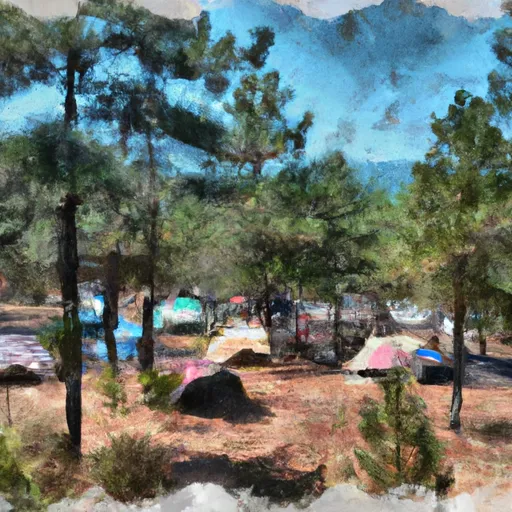
The campground offers several amenities, including drinking water, picnic tables, fire rings, and vault toilets. The campground operates on a first-come, first-served basis, with 14 campsites available for tents or small RVs.
An interesting fact about the Warner Creek Campground is that it is located close to the site of the Modoc War, a conflict between the Native American Modoc people and the United States Army that took place in the late 1800s.
The best time to visit the Warner Creek Campground is between May and October, when temperatures are mild, ranging from 55°F to 85°F during the day and 30°F to 50°F at night. However, visitors should be aware that the campground may close due to snowfall or other weather events.
What's on-site at Warner Creek Campground
Key facilities Snoflo tracks for this campground. Confirm with the operator before booking -- amenities can change seasonally.
Plan your trip down to the hour
Same weather feed Snoflo's iOS app uses -- updated continuously from NOAA / yr.no.
Next 5 days, hour by hour
Temperature line with weather symbols on top, snow + rain accumulation as columns, humidity as a dotted line.
5-day forecast table
Every 3 hours, broken out across temperature, snow, rain, humidity, and wind. Each cell is colour-coded relative to the column min/max so trends jump out at a glance.
| Time | Condition | Temp (°F) | Snow (in) | Rain (in) | Humidity (%) | Wind (mps) | Wind dir |
|---|---|---|---|---|---|---|---|
| Loading detailed forecast… | |||||||
15-day temperature & precipitation
Daily temperatures, snow, and rain projected over the next two weeks. Hover any point for the full breakdown.
Other campgrounds in the area
Snoflo-tracked campsites within driving distance of Warner Creek Campground, with reservations status.
| Campground | Reservations | Toilets | View |
|---|---|---|---|
| Warner Creek | ✗ | ✓ | → |
| High Bridge | ✗ | ✓ | → |
| High Bridge Campground | ✗ | ✗ | → |
| Domingo Springs | ✗ | ✓ | → |
| Domingo Springs Campground | ✗ | ✗ | → |
Nearby streamflow
USGS streamgauges within reach of Warner Creek Campground -- pulled live from the National Water Information System.
| Streamgauge | Discharge | View |
|---|---|---|
| Hat C Nr Hat Creek Ca | 118 cfs | → |
| Spanish C Ab Blackhawk C At Keddie Ca | 27 cfs | → |
| Spanish C A Quincy Ca | 15 cfs | → |
| Deer C Nr Vina Ca | 102 cfs | → |
| Mill C Nr Los Molinos Ca | 131 cfs | → |
| Battle C Bl Coleman Fish Hatchery Nr Cottonwood Ca | 223 cfs | → |
Nearby snow depths
NRCS SNOTEL stations within reach of Warner Creek Campground -- relevant when planning a shoulder-season or alpine trip.
| SNOTEL station | Snowpack | 24h Snowfall | View |
|---|---|---|---|
| Nohrsc Harkness Flat Near Chester 8nnw | 0.0 in | 0.0 in | → |
| Blacks Mountain #1 | 0.0 in | 0.0 in | → |
| Susanville 3.2 Ssw | 0.0 in | 0.0 in | → |
Plan a longer trip
The closest parks, lakes, boat launches, and paddle runs so a camping night can grow into a full weekend.
Parks
- Wilderness Caribou
- Chester Park
- Wilderness Lassen Volcanic
- Lassen Volcanic National Park
- Cedar Drive
- Wilderness Thousand Lakes
Boat launches
- Northshore Campground
- Knotty Pine Resort & Marina
- Big Cove Resort
- Almanor Lakeside Resort
- North Of Plattville
- Lake Almanor Country Club Recreation Area 1
Fishing spots
Points of interest
- Terminal Geyser
- Boiling Springs Lake
- St. Bernard Lodge
- Devil's Kitchen
- Bumpass Hell
- Almanor Overlook
Paddle runs
- Lassen Np Boundary To Just Below Highway 36 Crossing
- Just Below Highway 36 Crossing To One-Half Mile Downstream From Hole-In-The-Ground
- One-Half Mile Downstream From Hole-In-The-Ground To Sec Line Between 29/20 T28n, R3e, Below Big Bend
- Elam Creek Campground To Deer Creek-Highway 32 Junction
- Deer Creek-Highway 32 Junction To Sec 26, T27n, R3e, West Of Deer Creek Crossing
- Nf Boundary To Confluence With Yellow Creek
Camping essentials & Leave No Trace
- Pack it in, pack it out
- Take all trash, food scraps, and gear back with you to keep campsites clean and protect wildlife.
- Respect wildlife
- Observe animals from a distance, store food securely, and never feed wildlife to maintain natural behavior and safety.
- Know before you go
- Check weather, fire restrictions, trail conditions, and permit requirements to ensure a safe and well-planned trip.
- Minimize campfire impact
- Use established fire rings, keep fires small, fully extinguish them, or opt for a camp stove when fires are restricted.
- Leave what you find
- Preserve natural and cultural features by avoiding removal of plants, rocks, artifacts, or other elements of the environment.
Set push alerts in the Snoflo app
Save Warner Creek Campground as a favorite, set a custom threshold (precipitation, snowpack, freezing temperatures), and the iOS app will push the moment conditions cross.
About Warner Creek Campground
Can I make reservations at Warner Creek Campground?
This campground does not appear to accept reservations -- it's typically first-come, first-served. Arrive early on summer weekends.
How fresh is the weather data on this page?
The hourly forecast updates throughout the day from the NOAA / yr.no public feeds. Streamflow data is pulled live from USGS streamgauges and snowpack from the NRCS SNOTEL network.
What's the best time of year to visit?
Use the 15-day temperature & precipitation outlook on this page to plan -- pick a window with comfortable temperatures and low precipitation. For longer trips, the 5-day hourly meteogram shows snow + rain accumulation hour-by-hour.
How do I get to Warner Creek Campground?
Tap Directions in the hero above to open driving directions in Google Maps, or Open in map to center the Snoflo interactive map on the campground.
Can I get alerts when conditions change?
Yes -- alerts are managed through the Snoflo iOS app. Favorite this campground, set a threshold (temperature, snowpack, precipitation), and you'll get a push the moment it crosses.
Other campgrounds near here
Snoflo-tracked campgrounds within driving distance of Warner Creek Campground.