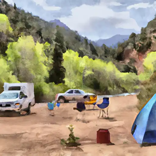
Sig Creek campground
Community Reviews
Been here? Share the conditions.
Reviews, ratings & photos are added in the free Snoflo iOS app — rate a spot, tag the conditions, and your visit is verified by location. Add or manage your reviews from the app.
Sig Creek
Reservations are accepted at Sig Creek camping area, ensuring that campers can secure a spot in advance. This is particularly recommended during peak seasons when the campground tends to fill up quickly. It is advisable to check the availability and make reservations well in advance to avoid disappointment.
The best time of year to visit the Sig Creek camping area is during the summer months, from June to August, when the weather is generally pleasant and conducive to outdoor activities. However, it is important to note that the campground is located at a relatively high elevation, so temperatures can drop significantly during the night, even in summer. Therefore, it is recommended to bring appropriate clothing and gear to stay warm.
While exploring the Sig Creek camping area, visitors should be cautious of wildlife encounters, as this region is known for its diverse wildlife population. Campers should store food securely to prevent attracting animals, and it is advised to keep a safe distance if encountering any wildlife. Additionally, it is important to be mindful of fire safety and follow all campground rules and regulations to ensure a safe and enjoyable camping experience.
What's on-site at Sig Creek
Key facilities Snoflo tracks for this campground. Confirm with the operator before booking -- amenities can change seasonally.
Plan your trip down to the hour
Same weather feed Snoflo's iOS app uses -- updated continuously from NOAA / yr.no.
Next 5 days, hour by hour
Temperature line with weather symbols on top, snow + rain accumulation as columns, humidity as a dotted line.
5-day forecast table
Every 3 hours, broken out across temperature, snow, rain, humidity, and wind. Each cell is colour-coded relative to the column min/max so trends jump out at a glance.
| Time | Condition | Temp (°F) | Snow (in) | Rain (in) | Humidity (%) | Wind (mps) | Wind dir |
|---|---|---|---|---|---|---|---|
| Loading detailed forecast… | |||||||
15-day temperature & precipitation
Daily temperatures, snow, and rain projected over the next two weeks. Hover any point for the full breakdown.
Other campgrounds in the area
Snoflo-tracked campsites within driving distance of Sig Creek, with reservations status.
| Campground | Reservations | Toilets | View |
|---|---|---|---|
| Sig Creek Campground | ✗ | ✗ | → |
| Purgatory | ✗ | ✓ | → |
| Haviland Lake Campground | ✗ | ✗ | → |
| Haviland Lake | ✓ | ✓ | → |
| Chris Park Group Campground | ✓ | ✗ | → |
Nearby streamflow
USGS streamgauges within reach of Sig Creek -- pulled live from the National Water Information System.
| Streamgauge | Discharge | View |
|---|---|---|
| Animas River Above Tacoma | 165 cfs | → |
| Dolores River Below Rico | 18 cfs | → |
| Animas River Below Silverton | 108 cfs | → |
| Mineral Creek At Silverton | 34 cfs | → |
| South Fork San Miguel River Near Ophir | 31 cfs | → |
| Animas River At Silverton | 37 cfs | → |
Nearby snow depths
NRCS SNOTEL stations within reach of Sig Creek -- relevant when planning a shoulder-season or alpine trip.
| SNOTEL station | Snowpack | 24h Snowfall | View |
|---|---|---|---|
| Cascade | 0.0 in | 0.0 in | → |
| Cascade #2 | 0.0 in | 0.0 in | → |
| Cascade #2 | 0.0 in | 0.0 in | → |
| Scotch Creek | 0.0 in | 0.0 in | → |
| Scotch Creek | 0.0 in | 0.0 in | → |
| Spud Mountain | 0.0 in | 0.0 in | → |
Plan a longer trip
The closest parks, lakes, boat launches, and paddle runs so a camping night can grow into a full weekend.
Parks
- Uncompahgre National Forest
- Wilderness Hermosa Creek
- Wilderness Lizard Head
- Telluride Town Park
- Judy Long Memorial Park
- Memorial Park Phase One
Boat launches
Fishing spots
Camping essentials & Leave No Trace
- Pack it in, pack it out
- Take all trash, food scraps, and gear back with you to keep campsites clean and protect wildlife.
- Respect wildlife
- Observe animals from a distance, store food securely, and never feed wildlife to maintain natural behavior and safety.
- Know before you go
- Check weather, fire restrictions, trail conditions, and permit requirements to ensure a safe and well-planned trip.
- Minimize campfire impact
- Use established fire rings, keep fires small, fully extinguish them, or opt for a camp stove when fires are restricted.
- Leave what you find
- Preserve natural and cultural features by avoiding removal of plants, rocks, artifacts, or other elements of the environment.
Set push alerts in the Snoflo app
Save Sig Creek as a favorite, set a custom threshold (precipitation, snowpack, freezing temperatures), and the iOS app will push the moment conditions cross.
About Sig Creek
Can I make reservations at Sig Creek?
This campground does not appear to accept reservations -- it's typically first-come, first-served. Arrive early on summer weekends.
How fresh is the weather data on this page?
The hourly forecast updates throughout the day from the NOAA / yr.no public feeds. Streamflow data is pulled live from USGS streamgauges and snowpack from the NRCS SNOTEL network.
What's the best time of year to visit?
Use the 15-day temperature & precipitation outlook on this page to plan -- pick a window with comfortable temperatures and low precipitation. For longer trips, the 5-day hourly meteogram shows snow + rain accumulation hour-by-hour.
How do I get to Sig Creek?
Tap Directions in the hero above to open driving directions in Google Maps, or Open in map to center the Snoflo interactive map on the campground.
Can I get alerts when conditions change?
Yes -- alerts are managed through the Snoflo iOS app. Favorite this campground, set a threshold (temperature, snowpack, precipitation), and you'll get a push the moment it crosses.
Other campgrounds near here
Snoflo-tracked campgrounds within driving distance of Sig Creek.