Supply Basin Campground Campground
Community Reviews
Been here? Share the conditions.
Reviews, ratings & photos are added in the free Snoflo iOS app — rate a spot, tag the conditions, and your visit is verified by location. Add or manage your reviews from the app.
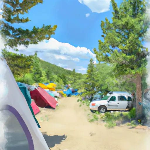
Supply Basin Campground
Reservations are not accepted at Supply Basin Campground, so it operates on a first-come, first-served basis. It is recommended to arrive early, especially during the peak season, to secure a spot. The campground is open from late spring to early fall, offering campers ample time to enjoy the beautiful surroundings.
The best time to visit Supply Basin Campground is during the summer months when the weather is pleasant for outdoor activities. The nearby reservoir provides opportunities for fishing, boating, and swimming, adding to the appeal of the area. However, caution should be exercised while camping, as this is bear country. Campers are advised to properly store and dispose of food to avoid attracting bears. Following safety guidelines and being mindful of wildlife will ensure a safe and enjoyable camping experience at Supply Basin Campground.
What's on-site at Supply Basin Campground
Key facilities Snoflo tracks for this campground. Confirm with the operator before booking -- amenities can change seasonally.
Plan your trip down to the hour
Same weather feed Snoflo's iOS app uses -- updated continuously from NOAA / yr.no.
Next 5 days, hour by hour
Temperature line with weather symbols on top, snow + rain accumulation as columns, humidity as a dotted line.
5-day forecast table
Every 3 hours, broken out across temperature, snow, rain, humidity, and wind. Each cell is colour-coded relative to the column min/max so trends jump out at a glance.
| Time | Condition | Temp (°F) | Snow (in) | Rain (in) | Humidity (%) | Wind (mps) | Wind dir |
|---|---|---|---|---|---|---|---|
| Loading detailed forecast… | |||||||
15-day temperature & precipitation
Daily temperatures, snow, and rain projected over the next two weeks. Hover any point for the full breakdown.
Other campgrounds in the area
Snoflo-tracked campsites within driving distance of Supply Basin Campground, with reservations status.
| Campground | Reservations | Toilets | View |
|---|---|---|---|
| Supply Basin | ✗ | ✓ | → |
| Deep Lake | ✗ | ✓ | → |
| White Owl | ✗ | ✓ | → |
| Deep Lake Campground | ✓ | ✗ | → |
| Coffee Pot Spring | ✗ | ✓ | → |
Nearby streamflow
USGS streamgauges within reach of Supply Basin Campground -- pulled live from the National Water Information System.
| Streamgauge | Discharge | View |
|---|---|---|
| Colorado River Below Glenwood Springs | 1,730 cfs | → |
| Roaring Fork River At Glenwood Springs | 391 cfs | → |
| Colorado River Near Dotsero | 1,290 cfs | → |
| Eagle River Below Gypsum | 114 cfs | → |
| White River Below North Elk Creek Near Buford | 217 cfs | → |
| Roaring Fork River Near Emma | 227 cfs | → |
Nearby snow depths
NRCS SNOTEL stations within reach of Supply Basin Campground -- relevant when planning a shoulder-season or alpine trip.
| SNOTEL station | Snowpack | 24h Snowfall | View |
|---|---|---|---|
| Bison Lake | 1.0 in | 0.0 in | → |
| Bison Lake | 1.0 in | 0.0 in | → |
| Glenwood Springs 7.0 Nw | 0.0 in | 0.0 in | → |
| Glenwood Springs .64 S | 0.0 in | 0.0 in | → |
| Nohrsc Burro Mountain | 3.0 in | 0.0 in | → |
| Burro Mountain | 3.0 in | 0.0 in | → |
Plan a longer trip
The closest parks, lakes, boat launches, and paddle runs so a camping night can grow into a full weekend.
Parks
- Wilderness Flat Tops
- Sister Lucy Downey Park
- Two Rivers Park
- A E Axtell Park
- Hyland Park
- Routt National Forest
Boat launches
- Lyon's Gulch Boat Ramp
- Grizzly Creek Garfield County
- I 70 Garfield County
- South Canyon Boat Ramp
- Cottonwood Island Boat Ramp
- Dotsero Landing Boat Ramp
Fishing spots
- Deep Lake Fishing/Picnic Area Fishing Site
- Meadow Creek Lake
- Meadow Lake Picnic Area
- Trappers Lake
- Lake Of The Woods
- Harvey Gap Reservoir
Camping essentials & Leave No Trace
- Pack it in, pack it out
- Take all trash, food scraps, and gear back with you to keep campsites clean and protect wildlife.
- Respect wildlife
- Observe animals from a distance, store food securely, and never feed wildlife to maintain natural behavior and safety.
- Know before you go
- Check weather, fire restrictions, trail conditions, and permit requirements to ensure a safe and well-planned trip.
- Minimize campfire impact
- Use established fire rings, keep fires small, fully extinguish them, or opt for a camp stove when fires are restricted.
- Leave what you find
- Preserve natural and cultural features by avoiding removal of plants, rocks, artifacts, or other elements of the environment.
Set push alerts in the Snoflo app
Save Supply Basin Campground as a favorite, set a custom threshold (precipitation, snowpack, freezing temperatures), and the iOS app will push the moment conditions cross.
About Supply Basin Campground
Can I make reservations at Supply Basin Campground?
This campground does not appear to accept reservations -- it's typically first-come, first-served. Arrive early on summer weekends.
How fresh is the weather data on this page?
The hourly forecast updates throughout the day from the NOAA / yr.no public feeds. Streamflow data is pulled live from USGS streamgauges and snowpack from the NRCS SNOTEL network.
What's the best time of year to visit?
Use the 15-day temperature & precipitation outlook on this page to plan -- pick a window with comfortable temperatures and low precipitation. For longer trips, the 5-day hourly meteogram shows snow + rain accumulation hour-by-hour.
How do I get to Supply Basin Campground?
Tap Directions in the hero above to open driving directions in Google Maps, or Open in map to center the Snoflo interactive map on the campground.
Can I get alerts when conditions change?
Yes -- alerts are managed through the Snoflo iOS app. Favorite this campground, set a threshold (temperature, snowpack, precipitation), and you'll get a push the moment it crosses.
Other campgrounds near here
Snoflo-tracked campgrounds within driving distance of Supply Basin Campground.