Black Rock State Park campground
Community Reviews
Been here? Share the conditions.
Reviews, ratings & photos are added in the free Snoflo iOS app — rate a spot, tag the conditions, and your visit is verified by location. Add or manage your reviews from the app.
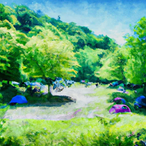
Black Rock State Park
Reservations are accepted at Black Rock State Park, allowing visitors to secure their preferred camping spot in advance. This ensures a hassle-free experience, especially during peak seasons when the campground tends to be busier. It is recommended to make reservations early, particularly for weekends or holidays, to guarantee availability.
The best time to visit Black Rock State Park is during the warmer months, from late spring to early fall. The park offers stunning foliage in the autumn, making it a popular destination for nature lovers. However, it is important to note that the campground's peak season is from Memorial Day to Labor Day, so it may be more crowded during this time.
While camping at Black Rock State Park, it is important to be aware of certain considerations. The park is known for its black bear population, so campers should take precautions to properly store food and dispose of trash to avoid attracting bears. Additionally, ticks are prevalent in the area, so wearing appropriate clothing and using insect repellent is advised. Overall, Black Rock State Park offers a wonderful camping experience with its beautiful surroundings and convenient amenities, making it an excellent choice for outdoor enthusiasts in Connecticut.
What's on-site at Black Rock State Park
Key facilities Snoflo tracks for this campground. Confirm with the operator before booking -- amenities can change seasonally.
Plan your trip down to the hour
Same weather feed Snoflo's iOS app uses -- updated continuously from NOAA / yr.no.
Next 5 days, hour by hour
Temperature line with weather symbols on top, snow + rain accumulation as columns, humidity as a dotted line.
5-day forecast table
Every 3 hours, broken out across temperature, snow, rain, humidity, and wind. Each cell is colour-coded relative to the column min/max so trends jump out at a glance.
| Time | Condition | Temp (°F) | Snow (in) | Rain (in) | Humidity (%) | Wind (mps) | Wind dir |
|---|---|---|---|---|---|---|---|
| Loading detailed forecast… | |||||||
15-day temperature & precipitation
Daily temperatures, snow, and rain projected over the next two weeks. Hover any point for the full breakdown.
Other campgrounds in the area
Snoflo-tracked campsites within driving distance of Black Rock State Park, with reservations status.
| Campground | Reservations | Toilets | View |
|---|---|---|---|
| Point Folly - White Memorial | ✗ | ✗ | → |
| Windmill Hill - White Memorial | ✗ | ✗ | → |
| Cozy Hill Campground | ✗ | ✗ | → |
| Sr1 | ✗ | ✗ | → |
| Sr2 | ✗ | ✗ | → |
Nearby streamflow
USGS streamgauges within reach of Black Rock State Park -- pulled live from the National Water Information System.
| Streamgauge | Discharge | View |
|---|---|---|
| Naugatuck River At Thomaston | 27 cfs | → |
| Nonewaug River At Minortown | 5 cfs | → |
| Weekeepeemee River At Hotchkissville | 6 cfs | → |
| Shepaug River At Peters Dam At Woodville | 20 cfs | → |
| Quinnipiac River At Southington | 10 cfs | → |
| Burlington Brook Near Burlington | 1 cfs | → |
Nearby snow depths
NRCS SNOTEL stations within reach of Black Rock State Park -- relevant when planning a shoulder-season or alpine trip.
| SNOTEL station | Snowpack | 24h Snowfall | View |
|---|---|---|---|
| Litchfield 2.3 Nne | 0.0 in | 0.0 in | → |
| Naugatuck 1.7 Nne | 0.0 in | 0.0 in | → |
| Farmington 4.9 Wsw | 0.0 in | 0.0 in | → |
| New Hartford Center 3.2 Sw | 0.0 in | 0.0 in | → |
| Bakersville | 0.0 in | 0.0 in | → |
| Southington 3.0 E | 0.0 in | 0.0 in | → |
Plan a longer trip
The closest parks, lakes, boat launches, and paddle runs so a camping night can grow into a full weekend.
Parks
- Black Rock State Park
- Plymouth Green
- Humaston Brook State Park
- Deland Field
- Mattatuck State Forest
- Aldorizo Park
Boat launches
- Lake Plymouth Boulevard 191, Plymouth
- Bantam Lake
- Stillwater Pond
- Dog Pond
- Farmington River Trail Collinsville
- Mohawk Pond
Fishing spots
- Lower Fulton Park Pond
- Great Brook Reservoir
- Lake Quassapaug
- Seymour Reservoir Number 4
- Papermill Pond
- Reservoir Number 2
Points of interest
- Rock House
- Waterbury Road
- Watertown History Museum
- Skilton Road
- Terryville Waterwheel
- James Morris Museum And Aline Brothier Morris Reading Room
Paddle runs
- Begins Downstream Of The Borough Of Bantam, At Stoddard Road Bridge To The Confluence With The Shepaug River
- Pond Downstream Of Shepaug Reservoir Dam, Marked By Service Road Bridge To Ends In Backwaters Of Lake Lillinonah, Near Roxbury Falls
- Begins Below The Tailrace Of The Lower Collinsville Dam To The Route 187 Bridge
- The Confluence With The Nepaug River To A Point 0.2 Miles Below The Lower Collinsville Dam Tailrace
- New Hartford/Canton Town Line To The Confluence With The Nepaug River
- Kent Bridge To Boardman Bridge
Camping essentials & Leave No Trace
- Pack it in, pack it out
- Take all trash, food scraps, and gear back with you to keep campsites clean and protect wildlife.
- Respect wildlife
- Observe animals from a distance, store food securely, and never feed wildlife to maintain natural behavior and safety.
- Know before you go
- Check weather, fire restrictions, trail conditions, and permit requirements to ensure a safe and well-planned trip.
- Minimize campfire impact
- Use established fire rings, keep fires small, fully extinguish them, or opt for a camp stove when fires are restricted.
- Leave what you find
- Preserve natural and cultural features by avoiding removal of plants, rocks, artifacts, or other elements of the environment.
Set push alerts in the Snoflo app
Save Black Rock State Park as a favorite, set a custom threshold (precipitation, snowpack, freezing temperatures), and the iOS app will push the moment conditions cross.
About Black Rock State Park
Can I make reservations at Black Rock State Park?
Yes -- this campground accepts reservations. Snoflo recommends booking early for peak season; check the operator (Recreation.gov / state park system / private operator) for the booking window and cancellation policy.
How fresh is the weather data on this page?
The hourly forecast updates throughout the day from the NOAA / yr.no public feeds. Streamflow data is pulled live from USGS streamgauges and snowpack from the NRCS SNOTEL network.
What's the best time of year to visit?
Use the 15-day temperature & precipitation outlook on this page to plan -- pick a window with comfortable temperatures and low precipitation. For longer trips, the 5-day hourly meteogram shows snow + rain accumulation hour-by-hour.
How do I get to Black Rock State Park?
Tap Directions in the hero above to open driving directions in Google Maps, or Open in map to center the Snoflo interactive map on the campground.
Can I get alerts when conditions change?
Yes -- alerts are managed through the Snoflo iOS app. Favorite this campground, set a threshold (temperature, snowpack, precipitation), and you'll get a push the moment it crosses.
Other campgrounds near here
Snoflo-tracked campgrounds within driving distance of Black Rock State Park.