Bee Island Campground
Community Reviews
Been here? Share the conditions.
Reviews, ratings & photos are added in the free Snoflo iOS app — rate a spot, tag the conditions, and your visit is verified by location. Add or manage your reviews from the app.
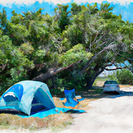
Bee Island
Reservations are accepted at Bee Island camping area, allowing campers to secure their spot in advance. It is advisable to make reservations, particularly during peak seasons, to ensure availability. The best time of year to visit this camping area is generally during the spring and fall, when the weather is pleasant, and the campground is less crowded.
While at Bee Island camping area, campers should be cautious of wildlife, including snakes and insects commonly found in Florida. It is important to be mindful of surroundings and practice proper safety measures to avoid any potential encounters. Additionally, campers should familiarize themselves with the campground's rules and regulations to ensure a respectful and enjoyable experience for all visitors.
What's on-site at Bee Island
Key facilities Snoflo tracks for this campground. Confirm with the operator before booking -- amenities can change seasonally.
Plan your trip down to the hour
Same weather feed Snoflo's iOS app uses -- updated continuously from NOAA / yr.no.
Next 5 days, hour by hour
Temperature line with weather symbols on top, snow + rain accumulation as columns, humidity as a dotted line.
5-day forecast table
Every 3 hours, broken out across temperature, snow, rain, humidity, and wind. Each cell is colour-coded relative to the column min/max so trends jump out at a glance.
| Time | Condition | Temp (°F) | Snow (in) | Rain (in) | Humidity (%) | Wind (mps) | Wind dir |
|---|---|---|---|---|---|---|---|
| Loading detailed forecast… | |||||||
15-day temperature & precipitation
Daily temperatures, snow, and rain projected over the next two weeks. Hover any point for the full breakdown.
Other campgrounds in the area
Snoflo-tracked campsites within driving distance of Bee Island, with reservations status.
| Campground | Reservations | Toilets | View |
|---|---|---|---|
| Mossy Hammock | ✗ | ✗ | → |
| Honore Campsite | ✗ | ✗ | → |
| Panther Point | ✗ | ✗ | → |
| Op36 | ✗ | ✗ | → |
| Op35 | ✗ | ✗ | → |
Nearby streamflow
USGS streamgauges within reach of Bee Island -- pulled live from the National Water Information System.
| Streamgauge | Discharge | View |
|---|---|---|
| Myakka River Near Sarasota Fl | 43 cfs | → |
| Howard Creek Near Sarasota Fl | 44 cfs | → |
| Myakka River At Control Near Laurel Fl | 27 cfs | → |
| Big Slough Canal Near Myakka City Fl | 5 cfs | → |
| Myakka River At Myakka City Fl | 177 cfs | → |
| Big Slough At Tropicaire Blvd Near North Port Fl | 8 cfs | → |
Plan a longer trip
The closest parks, lakes, boat launches, and paddle runs so a camping night can grow into a full weekend.
Parks
- Myakka River State Park
- T. Mabry Carlton, Jr. Memorial Reserve
- Myakkahatchee Park
- Little Salt Springs Park
- Maxfield Park
- Country Club East Park
Boat launches
- Myakka State Park Road, Sarasota
- Snook Haven Park
- Tamiami Trail Venice
- World Championship Drive Sarasota County
- Dallas White Park
- Loreto Boat Ramp
Fishing spots
- Lake Myakka
- Upper Myakka Lake
- Lake Manatee
- Ward Lake (Bill Evers Reservoir)
- Manasota Lemon Bay Fishing Dock
- Industrial Lake
Points of interest
- Crowley Museum And Nature Center
- Warm Mineral Springs
- Venice Rail Depot
- Blackburn Point Bridge
- Sarasota Art Museum
- Museum Of Botany & The Arts
Paddle runs
- County Road 780 Bridge To State Road 72 Bridge
- Begins Downstream Of The State Road 72 Bridge To The Southern Boundary Of Myakka River State Park
- The Southern Boundary Of The Myakka River State Park To Ends Approximately At River Mile 23 Where Riverfront Residential Development Begins
- Approximately At River Mile 23 Where Riverfront Residential Development Begins To The Vicinity Of Snook Haven Fish Camp At Approximately River Mile 18
- Approximately River Mile 18 To A Point Just Upriver Of The Us 41 Highway Crossing
- A Point Just Upriver Of The Us 41 Highway Crossing To The Sarasota/Charlotte County Line
Camping essentials & Leave No Trace
- Pack it in, pack it out
- Take all trash, food scraps, and gear back with you to keep campsites clean and protect wildlife.
- Respect wildlife
- Observe animals from a distance, store food securely, and never feed wildlife to maintain natural behavior and safety.
- Know before you go
- Check weather, fire restrictions, trail conditions, and permit requirements to ensure a safe and well-planned trip.
- Minimize campfire impact
- Use established fire rings, keep fires small, fully extinguish them, or opt for a camp stove when fires are restricted.
- Leave what you find
- Preserve natural and cultural features by avoiding removal of plants, rocks, artifacts, or other elements of the environment.
Set push alerts in the Snoflo app
Save Bee Island as a favorite, set a custom threshold (precipitation, snowpack, freezing temperatures), and the iOS app will push the moment conditions cross.
About Bee Island
Can I make reservations at Bee Island?
This campground does not appear to accept reservations -- it's typically first-come, first-served. Arrive early on summer weekends.
How fresh is the weather data on this page?
The hourly forecast updates throughout the day from the NOAA / yr.no public feeds. Streamflow data is pulled live from USGS streamgauges and snowpack from the NRCS SNOTEL network.
What's the best time of year to visit?
Use the 15-day temperature & precipitation outlook on this page to plan -- pick a window with comfortable temperatures and low precipitation. For longer trips, the 5-day hourly meteogram shows snow + rain accumulation hour-by-hour.
How do I get to Bee Island?
Tap Directions in the hero above to open driving directions in Google Maps, or Open in map to center the Snoflo interactive map on the campground.
Can I get alerts when conditions change?
Yes -- alerts are managed through the Snoflo iOS app. Favorite this campground, set a threshold (temperature, snowpack, precipitation), and you'll get a push the moment it crosses.
Other campgrounds near here
Snoflo-tracked campgrounds within driving distance of Bee Island.