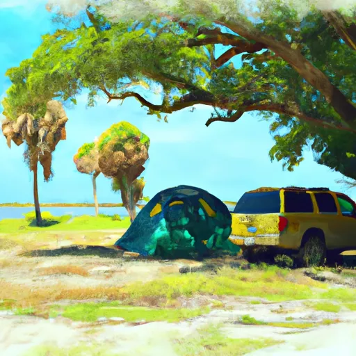
Fort Desoto County Park Campground
Community Reviews
Been here? Share the conditions.
Reviews, ratings & photos are added in the free Snoflo iOS app — rate a spot, tag the conditions, and your visit is verified by location. Add or manage your reviews from the app.
Fort Desoto County Park
What's on-site at Fort Desoto County Park
Key facilities Snoflo tracks for this campground. Confirm with the operator before booking -- amenities can change seasonally.
Plan your trip down to the hour
Same weather feed Snoflo's iOS app uses -- updated continuously from NOAA / yr.no.
Next 5 days, hour by hour
Temperature line with weather symbols on top, snow + rain accumulation as columns, humidity as a dotted line.
5-day forecast table
Every 3 hours, broken out across temperature, snow, rain, humidity, and wind. Each cell is colour-coded relative to the column min/max so trends jump out at a glance.
| Time | Condition | Temp (°F) | Snow (in) | Rain (in) | Humidity (%) | Wind (mps) | Wind dir |
|---|---|---|---|---|---|---|---|
| Loading detailed forecast… | |||||||
15-day temperature & precipitation
Daily temperatures, snow, and rain projected over the next two weeks. Hover any point for the full breakdown.
Other campgrounds in the area
Snoflo-tracked campsites within driving distance of Fort Desoto County Park, with reservations status.
| Campground | Reservations | Toilets | View |
|---|---|---|---|
| Holiday Cove Rv Resort | ✗ | ✗ | → |
| E G Simmons County Park | ✗ | ✗ | → |
| Encore Vacation Village | ✗ | ✗ | → |
| Camper's Cove | ✗ | ✗ | → |
| Coons Creek Military - Macdill Afb | ✓ | ✗ | → |
Nearby streamflow
USGS streamgauges within reach of Fort Desoto County Park -- pulled live from the National Water Information System.
| Streamgauge | Discharge | View |
|---|---|---|
| Frog Creek Near Rubonia Fl | 4 cfs | → |
| Frog Creek At Buffalo Road Near Rubonia Fl | 4 cfs | → |
| Saint Joe Creek At Pinellas Park Fl | 8 cfs | → |
| Pinebrook Cn At Bryan Dairy Rd At Pinellas Park Fl | 0 cfs | → |
| Walker Creek Near Sarasota Fl | 3 cfs | → |
| Roosevelt Canal At Str 23-8 Nr Pinellas Park Fl | 3 cfs | → |
Plan a longer trip
The closest parks, lakes, boat launches, and paddle runs so a camping night can grow into a full weekend.
Parks
- Fort De Soto Park
- Egmont Key State Park
- National Wildlife Refuge Egmont Key
- Pinellas National Wildlife Refuge
- Passage Key National Wildlife Refuge
- Hurley Park
Boat launches
- Fort Desoto Park Boat Ramp
- Cabrillo Avenue 3204-3216, Saint Pete Beach
- 63rd St Memorial Park
- O'Neill's Marina
- Dorm Drive, Saint Petersburg
- Maximo Park
Fishing spots
- Industrial Lake
- Ward Lake (Bill Evers Reservoir)
- Clearwater Bay
- Lake Manatee
- Cypress Lake
- Carlton Lake
Points of interest
- Egmont Key Light
- Battery Mellon
- Battery Howard
- Battery Mcintosh
- Battery Burchsted
- Sunshine Skyway Bridge
Paddle runs
- County Road 780 Bridge To State Road 72 Bridge
- Begins Downstream Of The State Road 72 Bridge To The Southern Boundary Of Myakka River State Park
- The Southern Boundary Of The Myakka River State Park To Ends Approximately At River Mile 23 Where Riverfront Residential Development Begins
- Approximately At River Mile 23 Where Riverfront Residential Development Begins To The Vicinity Of Snook Haven Fish Camp At Approximately River Mile 18
- Approximately River Mile 18 To A Point Just Upriver Of The Us 41 Highway Crossing
Camping essentials & Leave No Trace
- Pack it in, pack it out
- Take all trash, food scraps, and gear back with you to keep campsites clean and protect wildlife.
- Respect wildlife
- Observe animals from a distance, store food securely, and never feed wildlife to maintain natural behavior and safety.
- Know before you go
- Check weather, fire restrictions, trail conditions, and permit requirements to ensure a safe and well-planned trip.
- Minimize campfire impact
- Use established fire rings, keep fires small, fully extinguish them, or opt for a camp stove when fires are restricted.
- Leave what you find
- Preserve natural and cultural features by avoiding removal of plants, rocks, artifacts, or other elements of the environment.
Set push alerts in the Snoflo app
Save Fort Desoto County Park as a favorite, set a custom threshold (precipitation, snowpack, freezing temperatures), and the iOS app will push the moment conditions cross.
About Fort Desoto County Park
Can I make reservations at Fort Desoto County Park?
This campground does not appear to accept reservations -- it's typically first-come, first-served. Arrive early on summer weekends.
How fresh is the weather data on this page?
The hourly forecast updates throughout the day from the NOAA / yr.no public feeds. Streamflow data is pulled live from USGS streamgauges and snowpack from the NRCS SNOTEL network.
What's the best time of year to visit?
Use the 15-day temperature & precipitation outlook on this page to plan -- pick a window with comfortable temperatures and low precipitation. For longer trips, the 5-day hourly meteogram shows snow + rain accumulation hour-by-hour.
How do I get to Fort Desoto County Park?
Tap Directions in the hero above to open driving directions in Google Maps, or Open in map to center the Snoflo interactive map on the campground.
Can I get alerts when conditions change?
Yes -- alerts are managed through the Snoflo iOS app. Favorite this campground, set a threshold (temperature, snowpack, precipitation), and you'll get a push the moment it crosses.
Other campgrounds near here
Snoflo-tracked campgrounds within driving distance of Fort Desoto County Park.