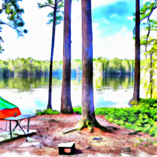
High Bluff Landing - Lake Talquin State Forest Campground
Community Reviews
Been here? Share the conditions.
Reviews, ratings & photos are added in the free Snoflo iOS app — rate a spot, tag the conditions, and your visit is verified by location. Add or manage your reviews from the app.
High Bluff Landing - Lake Talquin State Forest
Reservation policies for High Bluff Landing are quite accommodating, as they accept both walk-ins and advanced reservations. However, it is advisable to make reservations, especially during peak seasons, to secure a spot at this popular campground. As for the best time to visit, the weather in Florida is generally favorable for camping year-round. However, the months of October through April offer more pleasant temperatures, making it an ideal time to enjoy outdoor activities and explore the beautiful surroundings.
While staying at High Bluff Landing, campers can look forward to various activities. The campground is situated near Lake Talquin, providing opportunities for fishing, boating, and wildlife viewing. Nature enthusiasts will appreciate the abundance of hiking trails, allowing them to immerse themselves in the diverse flora and fauna of the state forest. It is important to be cautious of wildlife encounters, including raccoons and snakes, and to adhere to proper food storage practices. Overall, High Bluff Landing in Lake Talquin State Forest offers a serene and well-equipped camping experience for nature lovers and outdoor enthusiasts.
What's on-site at High Bluff Landing - Lake Talquin State Forest
Key facilities Snoflo tracks for this campground. Confirm with the operator before booking -- amenities can change seasonally.
Plan your trip down to the hour
Same weather feed Snoflo's iOS app uses -- updated continuously from NOAA / yr.no.
Next 5 days, hour by hour
Temperature line with weather symbols on top, snow + rain accumulation as columns, humidity as a dotted line.
5-day forecast table
Every 3 hours, broken out across temperature, snow, rain, humidity, and wind. Each cell is colour-coded relative to the column min/max so trends jump out at a glance.
| Time | Condition | Temp (°F) | Snow (in) | Rain (in) | Humidity (%) | Wind (mps) | Wind dir |
|---|---|---|---|---|---|---|---|
| Loading detailed forecast… | |||||||
15-day temperature & precipitation
Daily temperatures, snow, and rain projected over the next two weeks. Hover any point for the full breakdown.
Other campgrounds in the area
Snoflo-tracked campsites within driving distance of High Bluff Landing - Lake Talquin State Forest, with reservations status.
| Campground | Reservations | Toilets | View |
|---|---|---|---|
| High Bluff Campground | ✗ | ✗ | → |
| Coe Landing | ✗ | ✗ | → |
| Williams Landing | ✗ | ✗ | → |
| Hall Landing | ✗ | ✓ | → |
| Lakeside Rv Travel Park | ✗ | ✗ | → |
Nearby streamflow
USGS streamgauges within reach of High Bluff Landing - Lake Talquin State Forest -- pulled live from the National Water Information System.
| Streamgauge | Discharge | View |
|---|---|---|
| Little River Nr Midway | 56 cfs | → |
| Little River Nr Quincy | 97 cfs | → |
| Ochlockonee River Nr Havana | 309 cfs | → |
| Ochlockonee River Nr Bloxham | 412 cfs | → |
| Ochlockonee River Nr Concord | 228 cfs | → |
| Little Attapulgus Creek At Attapulgus | 4 cfs | → |
Nearby snow depths
NRCS SNOTEL stations within reach of High Bluff Landing - Lake Talquin State Forest -- relevant when planning a shoulder-season or alpine trip.
| SNOTEL station | Snowpack | 24h Snowfall | View |
|---|---|---|---|
| Havana 4.2 Sw | 0.0 in | 0.0 in | → |
| Havana 5.5 Ne | 0.0 in | 0.0 in | → |
| Marianna 7 Ne | 6.0 in | 4.0 in | → |
| Thomasville 5.1 Ese | 0.0 in | 0.0 in | → |
| Pelham 10.8 W | 0.0 in | 0.0 in | → |
| Marianna 0.8 Nne | 0.0 in | 0.0 in | → |
Plan a longer trip
The closest parks, lakes, boat launches, and paddle runs so a camping night can grow into a full weekend.
Parks
- Fort Braden Community Park
- Joe Budd Wildlife Management Area
- Talquin Wildlife Management Area
- Lake Talquin State Recreation Area
- Lake Talquin State Park
- Bear Creek Educational Forest
Boat launches
- High Bluff Landing Road, Midway
- Coes Landing
- Williams Landing
- Vause Landing
- Gadsden County
- Lake Talquin Lodge
Fishing spots
Points of interest
- Talon Range
- Clear Lake Wilderness Study Area
- Tallahassee Museum
- Calynne & Lou Hill Gallery
- The French Studio
- Salvage Art
Paddle runs
- 2 Miles Below Dam On Lake Talquin To Ochlockonee Bay
- Headwaters To Concrete Bridge (Burnt Bridge) On Fh 13 (Where River Enters Bradwell Ray Wilderness)
- Bradwell Bay Wilderness (Northern Boundary) To Bradwell Bay Wilderness Boundary At Trice Bridge On Fr 329
- Tirce Creek Bridge (Monkey Creek) To Forest Service Property Boundary In Sec 13
- Forest Service Property Bounday To St. Marks Wildlife Refuge Boundary
- Segment B--Sh 65 To Carr Bridge On Fh 13
Camping essentials & Leave No Trace
- Pack it in, pack it out
- Take all trash, food scraps, and gear back with you to keep campsites clean and protect wildlife.
- Respect wildlife
- Observe animals from a distance, store food securely, and never feed wildlife to maintain natural behavior and safety.
- Know before you go
- Check weather, fire restrictions, trail conditions, and permit requirements to ensure a safe and well-planned trip.
- Minimize campfire impact
- Use established fire rings, keep fires small, fully extinguish them, or opt for a camp stove when fires are restricted.
- Leave what you find
- Preserve natural and cultural features by avoiding removal of plants, rocks, artifacts, or other elements of the environment.
Set push alerts in the Snoflo app
Save High Bluff Landing - Lake Talquin State Forest as a favorite, set a custom threshold (precipitation, snowpack, freezing temperatures), and the iOS app will push the moment conditions cross.
About High Bluff Landing - Lake Talquin State Forest
Can I make reservations at High Bluff Landing - Lake Talquin State Forest?
This campground does not appear to accept reservations -- it's typically first-come, first-served. Arrive early on summer weekends.
How fresh is the weather data on this page?
The hourly forecast updates throughout the day from the NOAA / yr.no public feeds. Streamflow data is pulled live from USGS streamgauges and snowpack from the NRCS SNOTEL network.
What's the best time of year to visit?
Use the 15-day temperature & precipitation outlook on this page to plan -- pick a window with comfortable temperatures and low precipitation. For longer trips, the 5-day hourly meteogram shows snow + rain accumulation hour-by-hour.
How do I get to High Bluff Landing - Lake Talquin State Forest?
Tap Directions in the hero above to open driving directions in Google Maps, or Open in map to center the Snoflo interactive map on the campground.
Can I get alerts when conditions change?
Yes -- alerts are managed through the Snoflo iOS app. Favorite this campground, set a threshold (temperature, snowpack, precipitation), and you'll get a push the moment it crosses.
Other campgrounds near here
Snoflo-tracked campgrounds within driving distance of High Bluff Landing - Lake Talquin State Forest.