Salt Springs Campground
Community Reviews
Been here? Share the conditions.
Reviews, ratings & photos are added in the free Snoflo iOS app — rate a spot, tag the conditions, and your visit is verified by location. Add or manage your reviews from the app.
Salt Springs
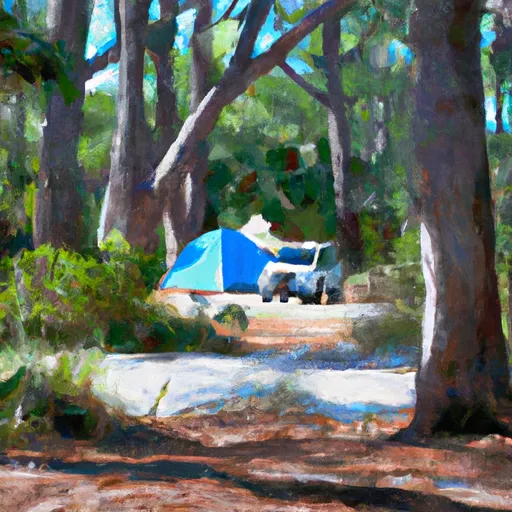
Reservations are accepted at Salt Springs camping area, allowing visitors to secure their preferred site in advance. It is advisable to make a reservation, especially during peak seasons, to ensure availability. The campground offers a peaceful and serene atmosphere surrounded by nature, making it a perfect retreat for outdoor enthusiasts.
The best time to visit Salt Springs camping area is during the cooler months of the year, typically from October to March, when temperatures are milder and more comfortable for outdoor activities. During this time, you can enjoy hiking, fishing, and swimming in the crystal-clear springs. It is essential to take precautions against mosquitoes and other bugs, as they can be quite prevalent in the area. Additionally, be cautious of wildlife, particularly alligators, as they are known to inhabit the springs.
In conclusion, Salt Springs camping area in Florida is a fantastic destination for campers seeking a tranquil retreat amidst nature. With its amenities, reservation options, and optimal visiting time, it provides a delightful camping experience. However, it is crucial to be mindful of bugs and wildlife to ensure a safe and enjoyable stay.
What's on-site at Salt Springs
Key facilities Snoflo tracks for this campground. Confirm with the operator before booking -- amenities can change seasonally.
Plan your trip down to the hour
Same weather feed Snoflo's iOS app uses -- updated continuously from NOAA / yr.no.
Next 5 days, hour by hour
Temperature line with weather symbols on top, snow + rain accumulation as columns, humidity as a dotted line.
5-day forecast table
Every 3 hours, broken out across temperature, snow, rain, humidity, and wind. Each cell is colour-coded relative to the column min/max so trends jump out at a glance.
| Time | Condition | Temp (°F) | Snow (in) | Rain (in) | Humidity (%) | Wind (mps) | Wind dir |
|---|---|---|---|---|---|---|---|
| Loading detailed forecast… | |||||||
15-day temperature & precipitation
Daily temperatures, snow, and rain projected over the next two weeks. Hover any point for the full breakdown.
Other campgrounds in the area
Snoflo-tracked campsites within driving distance of Salt Springs, with reservations status.
| Campground | Reservations | Toilets | View |
|---|---|---|---|
| Shanty Pond Recreation Area | ✗ | ✗ | → |
| Hopkins Prairie | ✗ | ✗ | → |
| Lake Delancy East Campground | ✗ | ✗ | → |
| Lake Delancy | ✗ | ✗ | → |
| Hopkins Prairie Campground | ✓ | ✗ | → |
Nearby streamflow
USGS streamgauges within reach of Salt Springs -- pulled live from the National Water Information System.
| Streamgauge | Discharge | View |
|---|---|---|
| Ocklawaha River At Eureka | 442 cfs | → |
| Ocklawaha R At Rodman Dam Nr Orange Springs | 632 cfs | → |
| Dunns Creek Near Satsuma | 596 cfs | → |
| Orange Creek At Orange Springs | 3 cfs | → |
| St. Johns R At Buffalo Bluff Nr Satsuma | 5,660 cfs | → |
| St. Johns River At Astor | 2,140 cfs | → |
Nearby snow depths
NRCS SNOTEL stations within reach of Salt Springs -- relevant when planning a shoulder-season or alpine trip.
| SNOTEL station | Snowpack | 24h Snowfall | View |
|---|---|---|---|
| Hastings 4ne | 0.0 in | 0.0 in | → |
| St. Augustine 3.4 Sw | 0.0 in | 0.0 in | → |
Plan a longer trip
The closest parks, lakes, boat launches, and paddle runs so a camping night can grow into a full weekend.
Parks
- Wilderness Little Lake George
- Welaka State Forest
- Caravelle Ranch Wildlife Management Area
- Gores Landing Unit Ocklawaha River Wildlife Management Area
- Dunns Creek State Park
- Wilderness Juniper Prairie
Boat launches
- Bear Swamp Trail Salt Springs
- Salt Springs Run Marina And Landing
- Northeast 140th Street 20740, Fort Mccoy
- Drayton Island Ferry Public Boat Ramp
- Northeast 306th Court Marion County
- Johnson Field - Oklawaha River At State Road 19
Fishing spots
Points of interest
- Little Lake George Wilderness
- Juniper Prairie Wilderness
- Astor Bridge
- Billie Bay Wilderness
- Orange Creek Restoration Area
- Gem City Cottage Llc.
Paddle runs
- Segment A--Mouth Of Spring On Ocala Nf (At Juniper Springs Wilderness) To Bridge On Sh 19 (At Wilderness Boundary)
- Segment B--Bridge On Sh 19 To Confluence With Lake George
- Segment A--Mouth Of Spring On Ocala Nf To Alexander Springs Wilderness Boundary
- Segment B--Alexander Springs Wilderness Boundary To Confluence With St. Johns River
Camping essentials & Leave No Trace
- Pack it in, pack it out
- Take all trash, food scraps, and gear back with you to keep campsites clean and protect wildlife.
- Respect wildlife
- Observe animals from a distance, store food securely, and never feed wildlife to maintain natural behavior and safety.
- Know before you go
- Check weather, fire restrictions, trail conditions, and permit requirements to ensure a safe and well-planned trip.
- Minimize campfire impact
- Use established fire rings, keep fires small, fully extinguish them, or opt for a camp stove when fires are restricted.
- Leave what you find
- Preserve natural and cultural features by avoiding removal of plants, rocks, artifacts, or other elements of the environment.
Set push alerts in the Snoflo app
Save Salt Springs as a favorite, set a custom threshold (precipitation, snowpack, freezing temperatures), and the iOS app will push the moment conditions cross.
About Salt Springs
Can I make reservations at Salt Springs?
Yes -- this campground accepts reservations. Snoflo recommends booking early for peak season; check the operator (Recreation.gov / state park system / private operator) for the booking window and cancellation policy.
How fresh is the weather data on this page?
The hourly forecast updates throughout the day from the NOAA / yr.no public feeds. Streamflow data is pulled live from USGS streamgauges and snowpack from the NRCS SNOTEL network.
What's the best time of year to visit?
Use the 15-day temperature & precipitation outlook on this page to plan -- pick a window with comfortable temperatures and low precipitation. For longer trips, the 5-day hourly meteogram shows snow + rain accumulation hour-by-hour.
How do I get to Salt Springs?
Tap Directions in the hero above to open driving directions in Google Maps, or Open in map to center the Snoflo interactive map on the campground.
Can I get alerts when conditions change?
Yes -- alerts are managed through the Snoflo iOS app. Favorite this campground, set a threshold (temperature, snowpack, precipitation), and you'll get a push the moment it crosses.
Other campgrounds near here
Snoflo-tracked campgrounds within driving distance of Salt Springs.