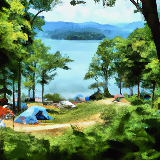
Lake Yonah County Park campground
Community Reviews
Been here? Share the conditions.
Reviews, ratings & photos are added in the free Snoflo iOS app — rate a spot, tag the conditions, and your visit is verified by location. Add or manage your reviews from the app.
Lake Yonah County Park
Reservations are accepted at Lake Yonah County Park, allowing campers to secure their preferred campsites in advance. This ensures a stress-free and organized camping trip. It is advisable to make reservations well in advance, especially during peak seasons, as the campground tends to fill up quickly.
The best time to visit Lake Yonah County Park campground is during the spring and fall months when the weather is mild and comfortable for outdoor activities. The beautiful lake offers opportunities for fishing, boating, and swimming, making it an ideal destination for water enthusiasts. Campers can also explore the surrounding trails for hiking and biking.
While camping at Lake Yonah County Park, it is essential to be cautious of wildlife encounters, including snakes and insects. It is advisable to keep a safe distance from wildlife and take necessary precautions to prevent any unwanted encounters. Additionally, campers should be mindful of campfire safety and adhere to all rules and regulations within the campground to ensure a safe and enjoyable camping experience at Lake Yonah County Park.
What's on-site at Lake Yonah County Park
Key facilities Snoflo tracks for this campground. Confirm with the operator before booking -- amenities can change seasonally.
Plan your trip down to the hour
Same weather feed Snoflo's iOS app uses -- updated continuously from NOAA / yr.no.
Next 5 days, hour by hour
Temperature line with weather symbols on top, snow + rain accumulation as columns, humidity as a dotted line.
5-day forecast table
Every 3 hours, broken out across temperature, snow, rain, humidity, and wind. Each cell is colour-coded relative to the column min/max so trends jump out at a glance.
| Time | Condition | Temp (°F) | Snow (in) | Rain (in) | Humidity (%) | Wind (mps) | Wind dir |
|---|---|---|---|---|---|---|---|
| Loading detailed forecast… | |||||||
15-day temperature & precipitation
Daily temperatures, snow, and rain projected over the next two weeks. Hover any point for the full breakdown.
Other campgrounds in the area
Snoflo-tracked campsites within driving distance of Lake Yonah County Park, with reservations status.
| Campground | Reservations | Toilets | View |
|---|---|---|---|
| Backcountry Campsite #1 | ✗ | ✗ | → |
| Backcountry Campsite #3 | ✗ | ✗ | → |
| Backcountry Campsite #2 | ✗ | ✗ | → |
| Tallulah Gorge State Park | ✓ | ✗ | → |
| Toccoa Falls College Rv Park | ✗ | ✓ | → |
Nearby streamflow
USGS streamgauges within reach of Lake Yonah County Park -- pulled live from the National Water Information System.
| Streamgauge | Discharge | View |
|---|---|---|
| Tallulah River Ab Powerhouse | 36 cfs | → |
| Chattooga River Near Clayton | 301 cfs | → |
| Tallulah River Near Clayton | 78 cfs | → |
| Chattahoochee River Near Leaf | 294 cfs | → |
| Chattahoochee River Near Cornelia | 573 cfs | → |
| Chattahoochee River At Helen | 85 cfs | → |
Nearby snow depths
NRCS SNOTEL stations within reach of Lake Yonah County Park -- relevant when planning a shoulder-season or alpine trip.
| SNOTEL station | Snowpack | 24h Snowfall | View |
|---|---|---|---|
| Germany Valley | 0.0 in | 0.0 in | → |
| Dillard 0.7 Nnw | 0.0 in | 0.0 in | → |
| Sautee 3.5 Sw | 0.0 in | 0.0 in | → |
| Carnesville 7.3 Sw | 0.0 in | 0.0 in | → |
| Dahlonega | 0.0 in | 0.0 in | → |
| Anderson | 0.0 in | 0.0 in | → |
Plan a longer trip
The closest parks, lakes, boat launches, and paddle runs so a camping night can grow into a full weekend.
Parks
- Sumter National Forest
- Tallulah Gorge State Park
- National Wild And Scenic River Chattooga, North Carolina, South Carolina And Georgia
- Henderson Falls Park
- Black Rock Mountain State Park
- Moccasin Creek State Park
Boat launches
Fishing spots
Points of interest
- Brasstown Falls
- Opossum Creek Falls
- Currahee Military Museum
- Camp Toccoa
- Riley Moore Falls
- Habersham County Fairgrounds
Paddle runs
- Confluence Of Brasstown Creek And Little Brasstown Creek Just South Of Brasstown Falls Road (Fs 751) To Confluence Of Mill Branch, Brasstown Creek And Boatwright Creek Near Boatwright Road (Fs 753)
- Confluence Of Cedar Creek To 1/4 Mile Below The Nf Boundary And Fh 110, Cobbs Bridge Road
- South Of Cedar Creek Rifle Range To Confluence With Chauga River
- 1/4 Mile Below Fs 745 And Cassidy Bridge Hunt Camp To Confluence Of Cedar Creek
- Crpssing Of Land Bridge Road, Sc 196 To 1/4 Mile Below Fs 745 And Cassidy Bridge Hunt Camp
- Earl's Ford To Route 76 (Section 3)
Camping essentials & Leave No Trace
- Pack it in, pack it out
- Take all trash, food scraps, and gear back with you to keep campsites clean and protect wildlife.
- Respect wildlife
- Observe animals from a distance, store food securely, and never feed wildlife to maintain natural behavior and safety.
- Know before you go
- Check weather, fire restrictions, trail conditions, and permit requirements to ensure a safe and well-planned trip.
- Minimize campfire impact
- Use established fire rings, keep fires small, fully extinguish them, or opt for a camp stove when fires are restricted.
- Leave what you find
- Preserve natural and cultural features by avoiding removal of plants, rocks, artifacts, or other elements of the environment.
Set push alerts in the Snoflo app
Save Lake Yonah County Park as a favorite, set a custom threshold (precipitation, snowpack, freezing temperatures), and the iOS app will push the moment conditions cross.
About Lake Yonah County Park
Can I make reservations at Lake Yonah County Park?
This campground does not appear to accept reservations -- it's typically first-come, first-served. Arrive early on summer weekends.
How fresh is the weather data on this page?
The hourly forecast updates throughout the day from the NOAA / yr.no public feeds. Streamflow data is pulled live from USGS streamgauges and snowpack from the NRCS SNOTEL network.
What's the best time of year to visit?
Use the 15-day temperature & precipitation outlook on this page to plan -- pick a window with comfortable temperatures and low precipitation. For longer trips, the 5-day hourly meteogram shows snow + rain accumulation hour-by-hour.
How do I get to Lake Yonah County Park?
Tap Directions in the hero above to open driving directions in Google Maps, or Open in map to center the Snoflo interactive map on the campground.
Can I get alerts when conditions change?
Yes -- alerts are managed through the Snoflo iOS app. Favorite this campground, set a threshold (temperature, snowpack, precipitation), and you'll get a push the moment it crosses.
Other campgrounds near here
Snoflo-tracked campgrounds within driving distance of Lake Yonah County Park.